Photography: My Shot – Beautiful Hillside in Sintra, Portugal


Whether I am traveling to foreign countries or hiking the national parks, one of my major goals is to capture the experience through my photography. Of course weather is not controllable and under adverse weather conditions, photography can be challenging.

When traveling with a tour group another “tricky” variable is how much time will be allotted at a given site and what areas will be available to view before needing to get back to the group.

In the picture below, I was with a group touring the National Palace in Sintra, Portugal. It is just a short ride from Lisbon via bus. The town is historic with very narrow streets and many pretty houses.

While we were touring the various rooms of the Palace, windows were open to allow air to circulate through the building. One procedure I have developed as a photography enthusiast is to look for pictures within pictures. When I looked through a palace window, I saw the scene pictured below.

Although the sky was cloudy and the light was not great, I thought it was remarkably picturesque. The details and colors of the buildings juxtaposed against the lush foliage certainly caught my eye. While my movement was limited because of the narrow window I thought the composition was also worthy.

I hope you concur that this is an interesting picture taken on a cloudy day.


**********

Metadata

File Name: 0000350 Picturesque view of the mountainside of Sintra Portugal 2622r.jpg
Capture time: 9:17 AM
Capture date: May 10, 2018
Exposure: 1/125 sec @ f/9.0
Focal Length: 55mm
ISO: 100
Camera: Nikon D3300
Lens: 18.0 – 55.12mm f/3.5-5.6
Edited in Lightroom

Jerez, Spain – Horses and Sherry

Departing Seville, Spain with a population of 700,000 we boarded our Motor Coach and headed for Jerez de la Frontera with a population of 213,000 (estimates via the Internet). This was an interesting change as we travled through the smaller Spanish towns and saw more of the countryside.

Our first adventure in Jerez was a stop at the Royal Andalusian School of Equestrian Art. We were greeted by a guide who explained the history and goals of the academy. This is a very exclusive school and gaining acceptance is quite competitive. Our group was taken inside a display area where horse carriages were stored and available for inspection.

One horse was tethered nearby for us to admire. Unfortunately, photography was restricted in many areas which proved disappointing. I was hoping to gather a couple of snapshots of horses being trained in the indoor stadium, but this was not permitted.

The guide begrudgingly allowed a few quick photographs of the tack room.


Pictures of the rein training outdoors were allowed.


The saving grace of this stop were the beautiful buildings and grounds. As we were waiting to walk toward the arena, an upward glance revealed an interesting and somewhat surprising sight.


Storks nest in many of the high towers, ridges and chimneys afforded them in and around town. As a matter of fact, we found that storks are an object of pride in Spain (and Portugal) and are encouraged to nest. At one time most of the birds migrated to Africa during the winter months and returned for the warmer seasons, but nowadays less and less of the birds migrate.


It appears that the availability of higher quality water in the wetlands combined with availability of “junk food” has become attractive to the White Storks that now become year-round residents.

You can find more information about the storks in Spain and Portugal HERE and HERE.

I must say that the exhibition hall and arena at the school was quite attractive.


The administration building and headquarters was equally impressive with its old-style elegance.


The area outside the administration building had a very picturesque fountain that added to the splendor of the estate.


After our stop at the Equestrian School, we walked to The House of Sandeman Jerez – producers of fine sherries and port. The traditional Andalusian garb includes a cape and large-brimmed black hat ala Zoro.


I wasn’t too interested in the distillation and preparation of sherry since red wines are about as much as I have on occasion. Our guide, however, did an excellent job of explaining the processes involved and the nuances between the various sherries produced. Of more interest to me was the history and building itself.


Yes indeed, there were barrels upon barrels of sherry being aged as we walked through the distillery (if that is the correct term).


I didn’t understand it all, but the markings on the outside of the the wooden barrels contained important production codes. Naturally, there was a “tasting” with chips and small sandwiches.


These stops did not make my top ten list although I found them somewhat interesting primarily for the few photographic opportunities available.

The Sandeman Sherry Bodega has an excellent website with amusing videos and information. If you enjoy sherry, I think you will appreciate this LINK – click on “OUR STORIES.”

 
Next stop…Gibraltar!


**********


***************
Continue reading about our trip to Portugal and Spain.


Read more Hiking and Exploration posts HERE


**********


All original content on this blog is copyrighted by Jeffrey B. Ross with ALL Rights Reserved. While reference links back to JBRish.com are appreciated and encouraged, please acquire approval for any reproduction of original content from this website.

©Jeffrey B. Ross 2014 – 2019 – JBRish.com


Photography: My Shot — Cabins in the Snow


We were staying at the John Muir Lodge while hiking in Kings Canyon, California and among the redwoods. We checked the temperatures prior to making these arrangements, but there was an unusual cold snap and we were greeted by a late spring snow.

Although we live in Phoenix, AZ where it rarely snows or sleets, we carry an ice scraper because we often visit Flagstaff where it does snow; quite a bit. We were one of the few who were prepared for this eventuality.

This picture is more reminiscent of a winter scene than that of late spring and with the weather patterns across the United States changing, I thought I would share it!


**********

Metadata

File Name: kings_cnyn_1651.NEF
Capture time: 8:04 AM
Capture date: Jun 12, 2018
Exposure: 1/160 sec @ f/6.3
Focal Length: 22mm
ISO: 100
Camera: Nikon D3300
Lens: 18.0 – 55.0mm f/3.5-5.6
Edited in Lightroom

**********

See more photography posts HERE and visit Jeff’s Instagram site HERE


**********


All original content on this blog is copyrighted by Jeffrey B. Ross with ALL Rights Reserved. While reference links back to JBRish.com are appreciated and encouraged, please acquire approval for any reproduction of original content from this website.

©Jeffrey B. Ross 2014 – 2018 – JBRish.com


Portugal – Alfama District, Lisbon Part 1

Breaking away from our routine of traveling to national parks in the United States, we decided to journey overseas with a noted tour company to see a part of the world in which we have been interested for a long time. So off it was to Portugal and Spain.


Map of Portugal with Lisbon noted

Map Via

We arrived in Lisbon relatively early in the day. After we checked in at our hotel, we were anxious to get out and about to visit some of the sights we researched. High on the list was the Alfama district in Lisbon.

One of Alfama’s distinctions is that it is the oldest neighborhood in Lisbon. It is located along the Tejo river and is very picturesque. The concierge at the hotel explained that we needed to take a taxi to the tram stop and then take the number 28 to Alfama.


Tram #28 headed to Alfama

The #28 tram’s route traverses the city’s center thus making it a very busy mode of transportation as tourists use this to arrive at many of Lisbon’s popular attractions. It is less expensive than a tour bus, but there is no guide to point out the sights. We had to be careful as there were two different #28 trams. We determined we needed the one with the destination noted as Prazeres.

You can read more about it HERE

This popular tram usually operates from 7AM until 11PM daily. Check out the current schedules to be sure.

NOTE – Pickpockets often frequent this tram so be careful and keep your valuables close. We had no problems at all (besides the usual language barrier).

Little did we understand that the tram was going to drop us off quite a distance from the main section of Alfama and that we also needed to board a small van to take us to Alfama’s central location; no extra charge. Streets are so narrow in places that cars cannot navigate them. Bicycles and smaller motorized transports are plentiful on these narrow side streets.

As we were walking to board the jitney, we passed a trash can that was quite unique. We didn’t realize that this was customary in Portugal and Spain. Trash/recycle receptacles are sometimes painted and serve as a work of contemporary art. The city sponsors some to the container art. Apparently a number of other European cities have adopted this colorful method of camouflaging these streetside bins.


Art covered trash=recycle bins

We managed to find our way to the small van and disembarked near the Miradouro das Portas do Sol (Viewpoint of the Doors of the Sun) which is a large terraced area with an elevated point of view looking over Alfama. The first thing visitors are going to notice is the famous red roofs. This is Alfama’s trademark!


Landmark red roofs of Alfama seen from Miradouro das Portas do Sol

In the picture above, the river is barely visible, but some of the prominent buildings can be clearly seen. The large building in the upper left (with the two towers) is the Church or Monastery of São Vicente de Fora which Wikipedia translates as “Monastery of St. Vincent .” Just off to the the right of the Monastery is the dome of the National Pantheon.

Saint Vincent is Lisbon’s patron saint and a statue to honor him stands as a sentinel at the Portas del Sol close to where most visitors will arrive at one point or another during their explorations. There are several vendors and street merchants at this location trying to capitalize on the crowds that often gather in this area.


Statue of Lisbon's patron saint, Saint Vincent

Here is another photograph of Alfama taken from the Miradouro de Santa Luzia which is another great viewing area. The Tejo river is located along the horizon. More central with a single tower visible is the iglesia de Santo Estevao (Church of St. Stephen).


Another view of the port of Alfama seen from Miradouro de Santa Luzia

As we began to make our way through the old streets of Alfama on the way to the Thieve’s Market, we passed by ancient structures. Here is a crossover near the Campo de Santa Clara (market square).


crossover near the Campo de Santa Clara (market square)

The Thieves Market is similar to flea markets around the world. It is only open on Tuesday and Saturdays in the square near the Panteão Nacional and São Vicente de Fora dating back to the late 1880’s.


Vendors at the Thieves Market in Alfama

There was a large variety of goods for sale including books, crafts and other typical flea market wares.


Wheelbarrow with dishes for sale


***************
Continue reading about our trip to Portugal and Spain.


Read more Hiking and Exploration posts HERE


All original content on this blog is copyrighted by Jeffrey B. Ross with ALL Rights Reserved. While reference links back to JBRish.com are appreciated and encouraged, please acquire approval for any reproduction of original content from this website.

©Jeffrey B. Ross – 2018 – JBRish.com


Adventures in Oregon: State Parks: Umpqua to Shore Acres


XXXXXXXX

As anticipated when traveling along a nation’s coastline, one is likely to find a number of lighthouses. Although technology has rendered them less important than in the past, the lure of the sea and the mystique that accompanies them gives lighthouses a certain panache.

I am as much of a sucker for this type of thing as the next person and was therefore anxious to see the lighthouse at Umpqua Lighthouse State Park.


XXXXXXXX

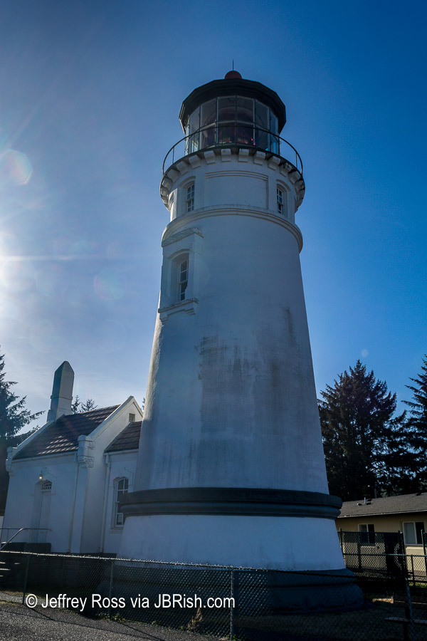
This was one stop, however that was somewhat disappointing because the lighthouse was not open to the public. It was fenced in and surrounded by houses. While it had all of the requisite characteristics of other lighthouses…


XXXXXXXX

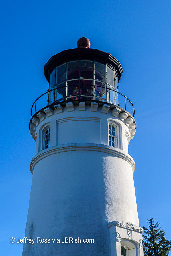
it was not as picturesque or architecturally engaging as others we had seen.

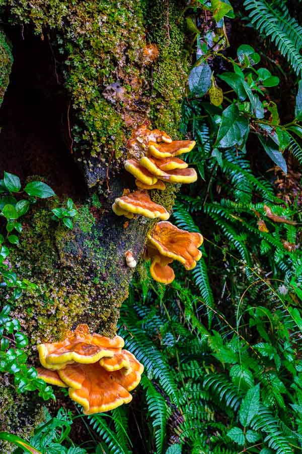
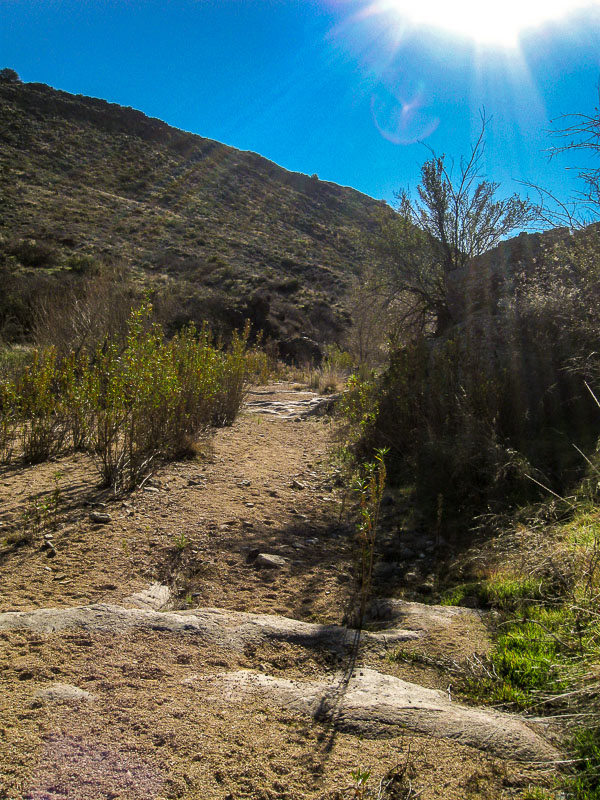
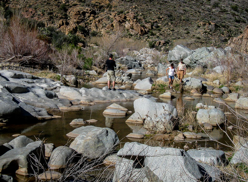
The Umpqua Lighthouse State Park had much more to offer than the lighthouse as we pulled into one of the main parking lots near the beach and put on our explorer’s garb. I have always liked beach combing because of some of the treasures Davy Jones tosses our way.

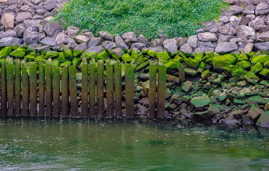
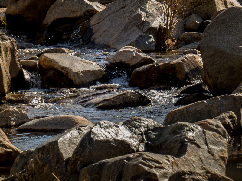
There was a series of jetties and one in particular seemed interesting because of this…


XXXXXXXX

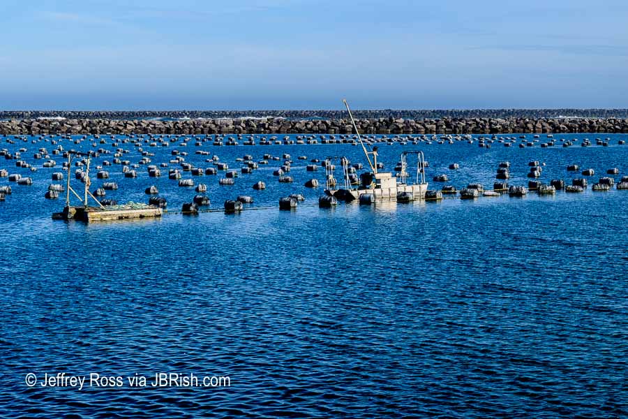
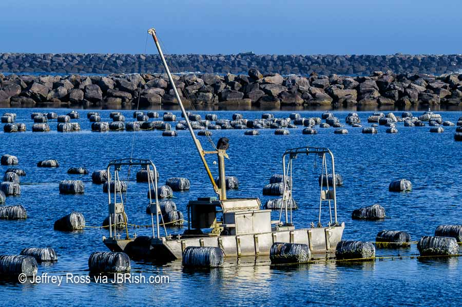
We could not discern exactly what this boat was doing in the water. It was surrounded by barrels and there was a floating platform about twenty five yards behind. The craft seemed functional, but did not give the impression it was used for seafaring adventures very often. Here’s a closer look:


XXXXXXXX

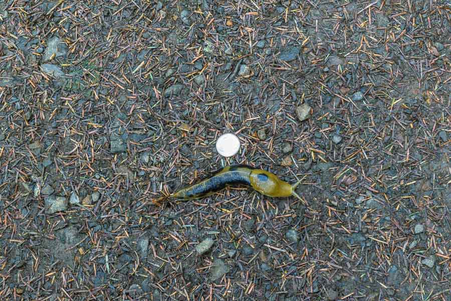
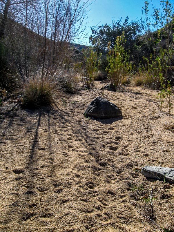
As we walked along, we appreciated that we were not the only living creatures on the beach. This set of bird tracks went zig-zaging up the rocks toward the water creating an interesting pattern.


XXXXXXXX

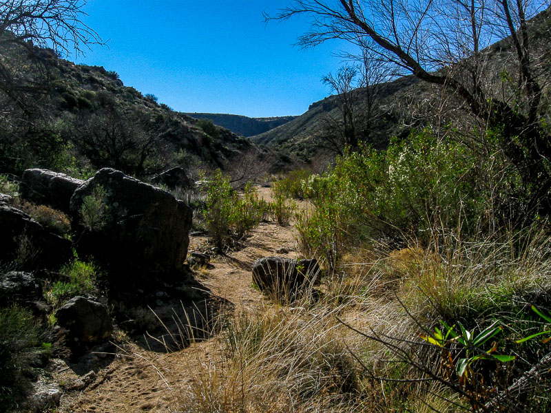
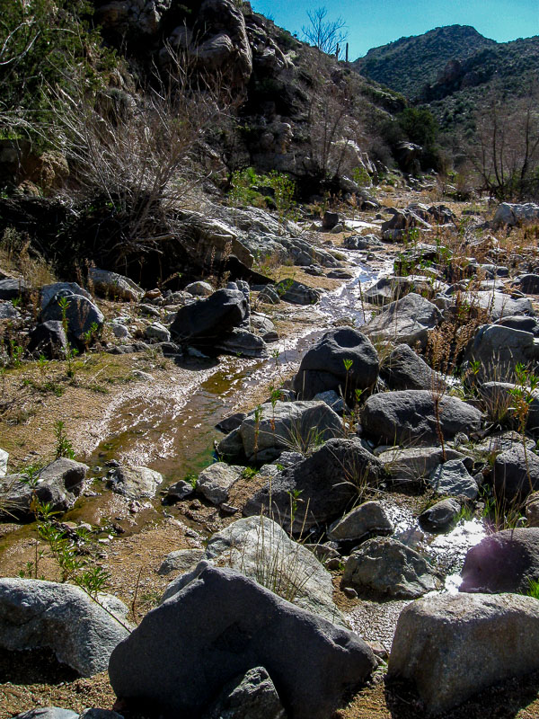
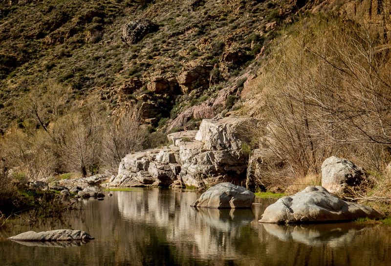
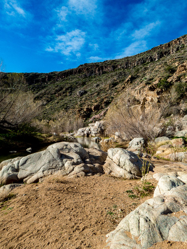
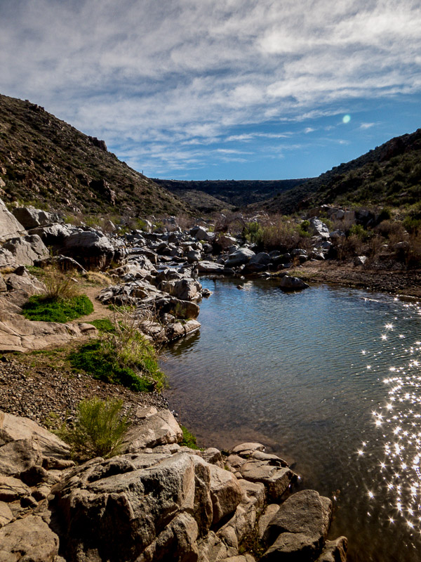
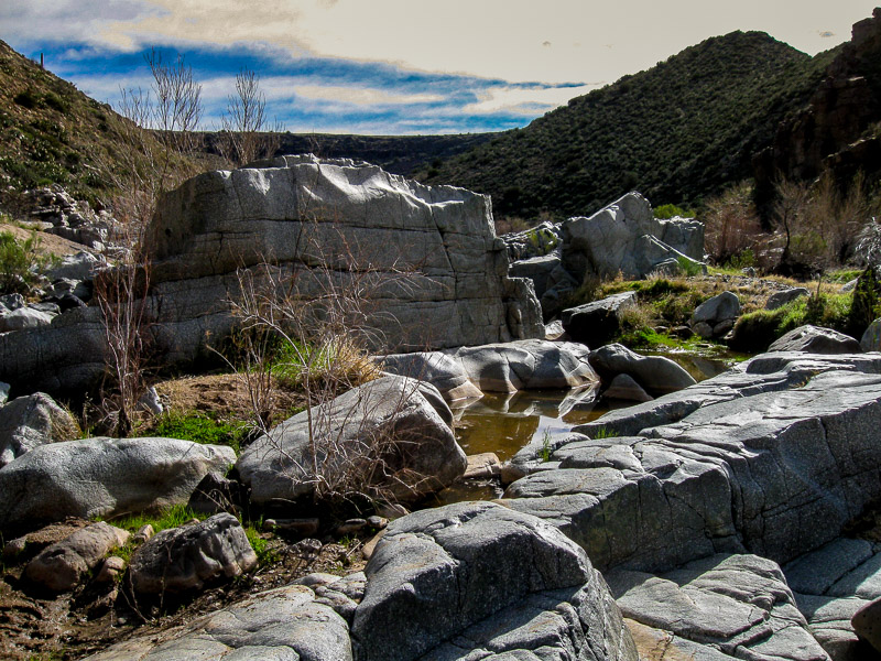
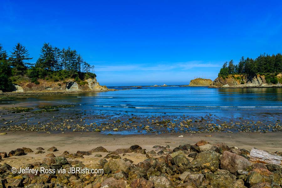
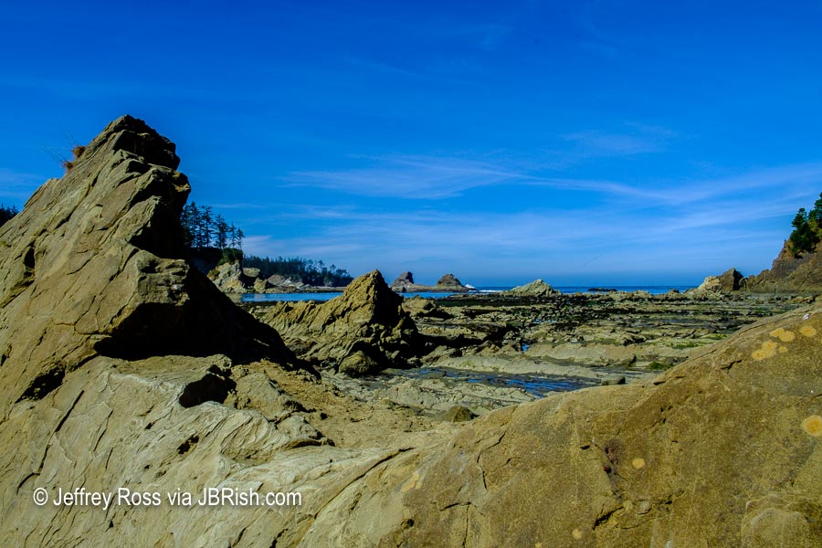
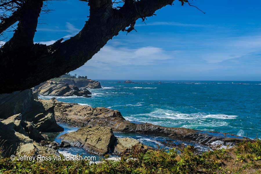
With much to do this day, we did not linger before heading farther down the road. Sunset Bay State Park was a worthy stop. The tide was low and the colors of the water, surrounding rocks and trees were picture-pretty.


XXXXXXXX


XXXXXXXX

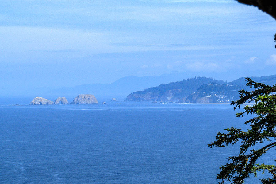
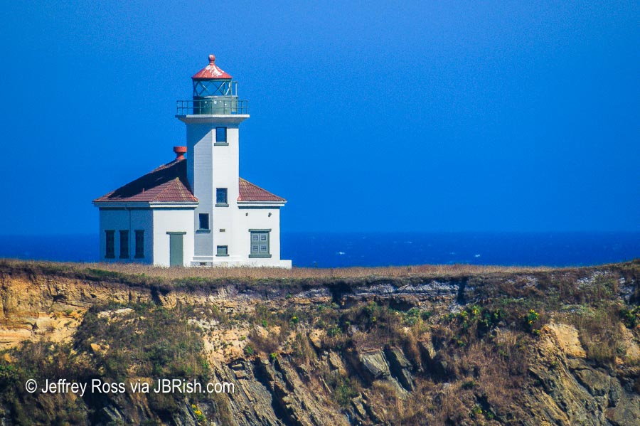
We read about yet another lighhouse at Cape Arago near Charleston and were once again tempted to stop and capture some photographs. These were all from a distance as we could not get close to the building.


XXXXXXXX


XXXXXXXX


XXXXXXXX

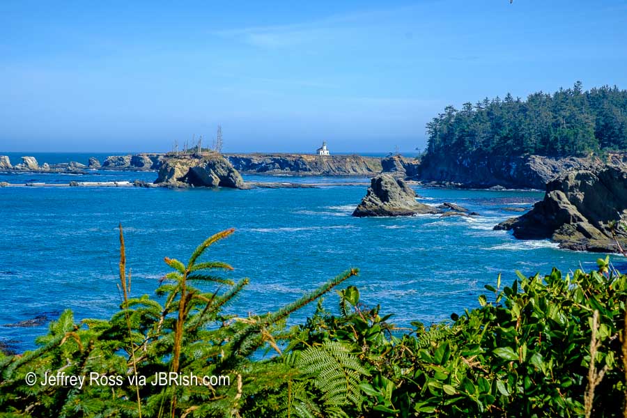
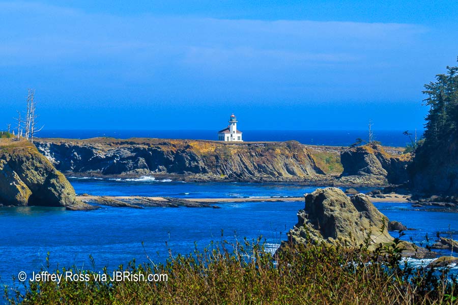
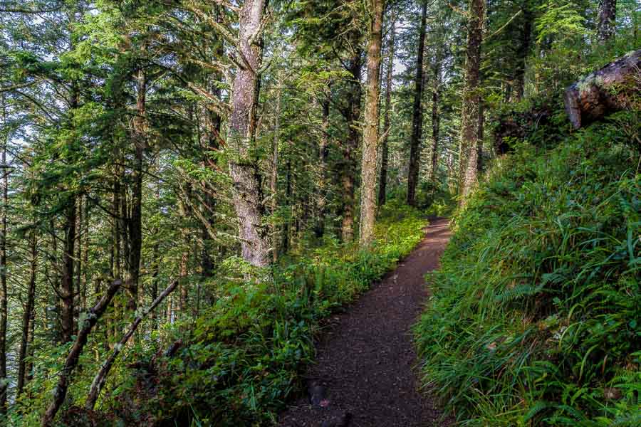
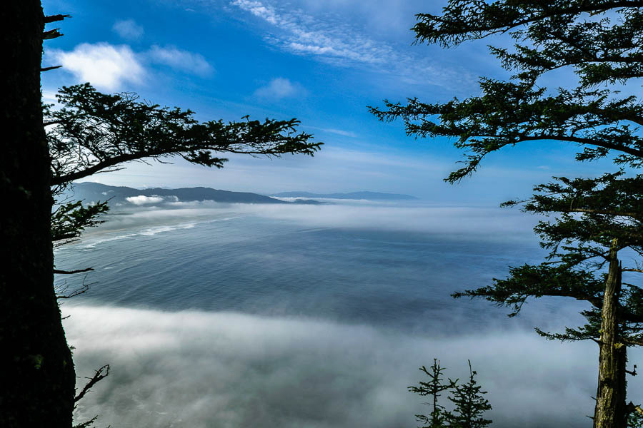
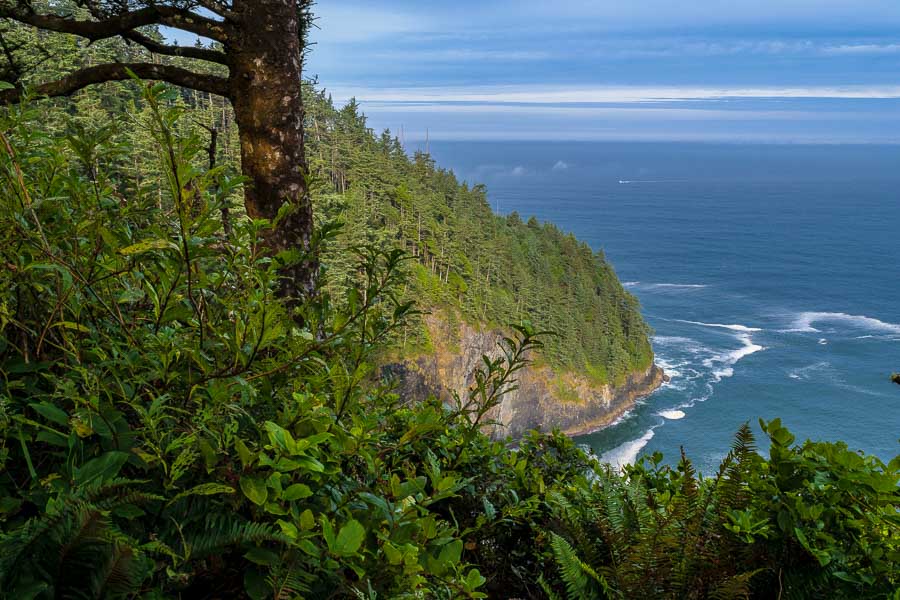
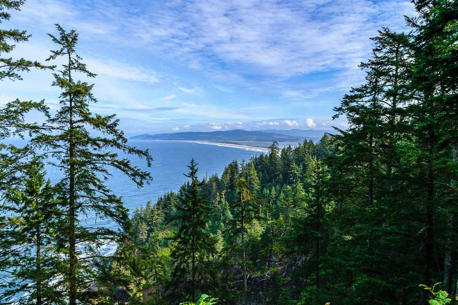
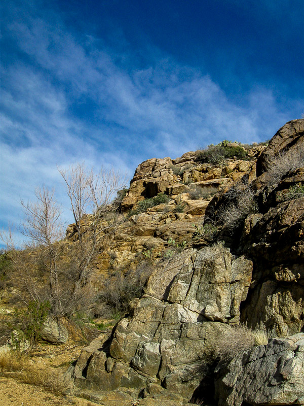
This was a beautiful day. The sky was blue with wispy clouds and a soft breeze. After a number of days of mist and rain, the sun was most welcome. The seaside offered wonderful views of the Pacific Ocean.


XXXXXXXX

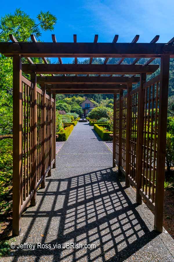
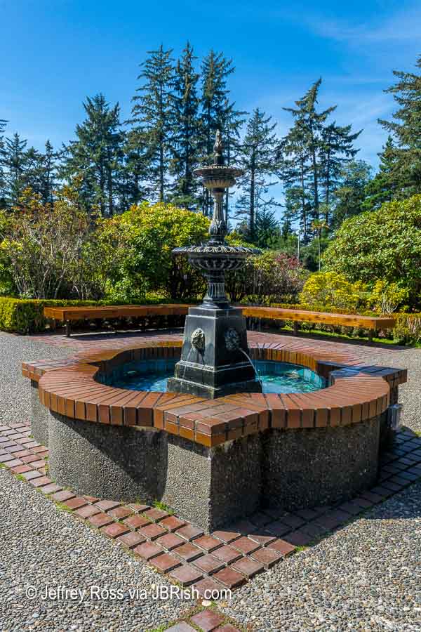
Anyone who spends a bit of time reading posts on JBRish.com, knows that I like gardening and I enjoy flowers. If you also appreciate plants, gardens and beautifully arranged formal garden settings, I would encourage you to stop and spend time at Shore Acres State Park garden near Coos Bay, OR.


XXXXXXXX


XXXXXXXX


XXXXXXXX

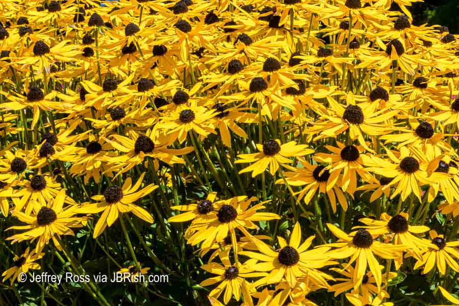
This display of Rudbeckias, which we grew in New Jersey, was thick and dazzling.


XXXXXXXX

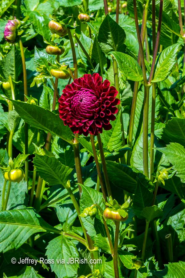
Dahlias have always been one of my favorite flowers because of the intricate petal patterns and nearly unlimited variety in size, color and shape.


XXXXXXXX

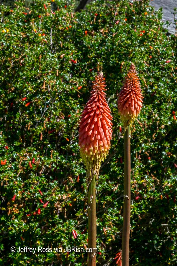
The Hot Poker Plant (Tritoma) was one I have never grown, but these specimens were very colorful placed along the nearby hedge.


XXXXXXXX

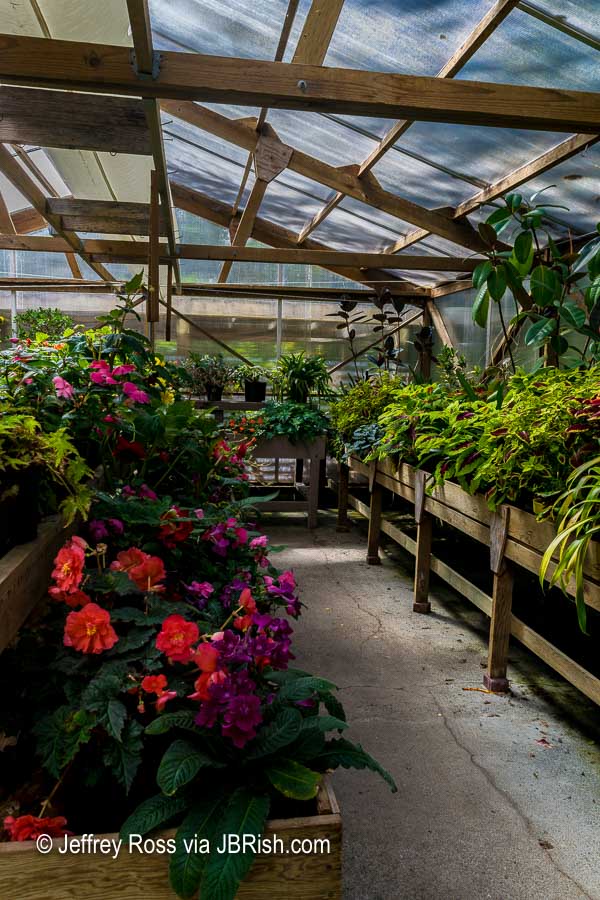
There were a few greenhouses that had open doors and we took advantage of the “invite” and stepped inside. There were baskets of Impatiens, Angel Wing Begonias, Tuberous Begonias, Streptocarpus, Gloxinias and more.


XXXXXXXX


XXXXXXXX

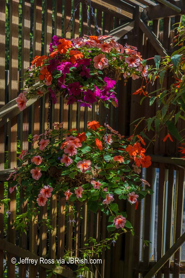
Visitors couldn’t ask for a more exquisite setting. There were an abundance of plants in a manicured and beautifully hardscaped botanical venue.


**********

Read previous posts about our adventures hiking and exploring in Oregon:

Exploring Astoria, Oregon – Part 1

Exploring Astoria, Oregon – Part 2

Exploring Astoria, Oregon – Part 3

Adventures in Oregon: Warrenton to Seaside

Adventures in Oregon: Hiking at Indian Beach

Adventures in Oregon: Views from Ecola Point

Adventures in Oregon: Movin’ On Down the Road

Adventures in Oregon: Garibaldi’s Graces and Pier

Adventures in Oregon: Tillamook – Cape Meares Lighthouse

Adventures in Oregon: Pacific City, Neskowin & Lincoln City

Adventures in Oregon: Cascade Head and Hart’s Cove in Lincoln City

Adventures in Oregon: Cape Foulweather & Drift Creek Falls

Adventures in Oregon: Newport to Yachats

Adventures in Oregon: Heceta Head & Sand Dunes


Read more Hiking and Exploration posts HERE


**********


All original content on this blog is copyrighted by Jeffrey B. Ross with ALL Rights Reserved. While reference links back to JBRish.com are appreciated and encouraged, please acquire approval for any reproduction of original content from this website.

©Jeffrey B. Ross – 2018 – JBRish.com


Adventures in Oregon: Adventures in Oregon: Cape Lookout, South Trail

It had been raining the day before and we had previously had our share of grey, misty days so we were excited to find the clouds lifting and the sun breaking through.

The majesty represented by a beautiful tree and a well-populated forest always resonated with my spirit and the South Trail on Cape Lookout did not disappoint in this respect.

The trail begins very modestly.


A trail through the woods
The South Trail of Cape Lookout Begins

Soon the coast appears to add interest to the hike. The fog was still rather low, but was beginning to lift.


Fog was lifting as we began our hike.
The fog was lifting to reveal more of the ocean

As we moved further inland, the forest began to reveal some of its interesting sights. The ferns growing in the nooks and crannies of the tree limbs are known as basket ferns. This area is close enough to the shore to provide ample moisture for these plants to thrive.


Ferns growing in the crooks of tree limbs
Ferns growing in the crooks of tree limbs known as basket ferns

As the trail meandered through forest and intermittently along the coastline, we were treated to vistas of the ocean and shore.


Coastline vista
The trail reveals vistas of the coast

This was a picturesque cove that we stopped to admire both coming and going!


A picturesque cove
A picturesque cove shows can be seen through a break in the tree line

The path was very muddy in places because of the recent rains.


A muddy path
The path was muddy from overnight rains

On the return trip, we began to encounter more hikers. Luckily we started early enough to have the trail to ourselves during most of the hike to the cape. In season, I would anticipate larger crowds.

This (below) was one of my favorite stops along the trail. The colorful browns and greens and the mist-laden atmosphere was very captivating.


A serene landscape along the trail

Here is another shot of the coast showing one of the panoramic views from the trail.


A panoramic view of the coast

Not actually a flower, this Chicken of the Woods wild mushroom (Laetiporus sulphureus), was as nice as many wildflowers.


beautiful wild mushroom
Nature’s art seen in a beautiful wild mushroom

As we neared the parking area, we came across yet another Banana slug. They grow them big in this wooded area as the quarter coin next to it demonstrates!


Large Banana slug
Large Banana slug

While some may feel that the South Trail of Cape Lookout does not have a remarkable payoff at the end, it is a nice vantage point for whale watching and looking at the ocean. Keep in mind that getting there is more than half the fun!


**********

Read previous posts about our adventures hiking and exploring in Oregon:

Exploring Astoria, Oregon – Part 1

Exploring Astoria, Oregon – Part 2

Exploring Astoria, Oregon – Part 3

Adventures in Oregon: Warrenton to Seaside

Adventures in Oregon: Hiking at Indian Beach

Adventures in Oregon: Views from Ecola Point

Adventures in Oregon: Movin’ On Down the Road

Adventures in Oregon: Garibaldi’s Graces and Pier

Adventures in Oregon: Tillamook – Cape Meares Lighthouse


Read more Hiking and Exploration posts HERE


**********


All original content on this blog is copyrighted by Jeffrey B. Ross with ALL Rights Reserved. While reference links back to JBRish.com are appreciated and encouraged, please acquire approval for any reproduction of original content from this website.

©Jeffrey B. Ross – 2018 – JBRish.com


Cape Meares, lighthouse, ocean, pacific, beach, scenery, history, landscape, pacific ocean

Exploring Astoria, Oregon – Part 2

As I mentioned in my previous post (see link below), we found much to do during our August, 2017 visit to Astoria, OR. We continued to explore the town and the nearby riverfront. The morning was very hazy/foggy; some of it caused by the abundant wildfires in surrounding areas.

Walking by the river, there were many scenes I found picture-worthy such as this shot of the sun poking out behind the crows nest of a small ship.


Waterfront ship's crows nest with sun

We were interested in a paddle wheeler, the American Empress, that was moored at a nearby dock. We headed toward the ship and met two passengers along the way. They explained that the steamship was sidelined because of the wildfires and was “stuck” in Astoria until the air quality and wildfires improved enough for them to head upriver.


Paddleboat Steamship anchored in Astoria

Even the moss covered pylons against the mossy green and grey of the rocks led to a few colorful snaps.


Moss covered rocks and pilons create a colorful scene

We often enjoy speaking with the agents at the local visitor’s center and I need to brag about the Astoria staff and facility. They had many varied and interesting resources and we enjoyed learning about some of the local favorites uncovered through our questioning of the agents. The bus below was parked outside and little did I know it was the living quarters of someone and not an attraction; sorry!


Fanciful bus outside the visitor's center

Even with the fog, the aura of the waterfront was alluring and picturesque.


The fog created an eeerie waterfront mood

We read about the Astoria Column and the staff at the visitor’s center encouraged us to visit. There is a small parking fee of $5 that covers a year of parking. The car ride was uphill and the road to the tower was curvy. The column was constructed 600 feet above sea level on Coxcomb Hill. It is 125 feet high and those electing to ascend it will need to climb 164 steps.

Once in the parking area, you can look around and notice some of the sights Astoria has to offer. The view below shows the Megler Bridge partially covered by fog.


walking up the hill to the Astoria Column

You can see a person walking to the tower. If you don’t need to park, the visit is free!

Below is another view from the parking area.


Another view from the Astoria Column's parking area

Leaving the car, we hiked up the small hill to the base of the tower that commemorates the major events in Astoria history.


A closeup of the lower portion of the Astoria Column

It took a while to ascend the tower’s steps, but it really wasn’t too difficult (IMO).


Asotria Column circular stairway

The bird’s-eye view afforded by the column’s vantage point was very interesting.


Bird's-eye view from the top of the Astorial Column

There was a young man doing his morning exercises on the grounds and he ran up the tower and handed small, wooden gliders to the visitors so they could be tossed into the wind. He explained that he will later go around to collect them.


Small model gliders flung from the top of the Astoria Column

I enjoyed this view (below) of the tower against the cloudy blue-grey sky.


Partial closeup view of the top of the Astoria Column

I can recommend a visit to the tower if you are in the area. There is a small gift shop and I am sure when the skies are bluer and brighter, the views will be even better.


Moody sky and visitor at the Astoria Column

Here is a short paragraph from the Astoria Column Website Organization’s webpage:

“Standing above the city–600 feet above sea level to be exact–the Astoria Column unleashes an unrivaled view of Young’s Bay, the Coast Range, the mighty Columbia River, and in the distance—the Pacific Ocean. Its light shines each night as a silent testament to the pride, fortitude, and resolve of the people who settled the Pacific Northwest, and to those who live here today.”

This was just a small portion of our day exploring Astoria. JBRish.com will soon have more stories about Astoria and other adventures in Oregon.


**********

Read previous posts about our adventures hiking and exploring in Oregon:


Read more Hiking and Exploration posts HERE


**********


All original content on this blog is copyrighted by Jeffrey B. Ross with ALL Rights Reserved. While reference links back to JBRish.com are appreciated and encouraged, please acquire approval for any reproduction of original content from this website.

©Jeffrey B. Ross – 2017 – JBRish.com


Lembert Dome Trail Beauty- Year of Yosemite (YOY) – Day 251

Lembert Dome Trail's beauty

Another stream in the woods

As we continued our hike back to the parking area, we came across a number of scenes like that above. There appears to be so much beauty to enjoy that even this rather common Yosemite sight of a meandering stream, reveals wonderful colors of green, brown and gray amid the bubbling waters.

Who could encounter such a place with dappled sunlight, gurgling water and not be happy to be among the mountains?

 
Do you have a question about our visit to Yosemite? Ask it in the comment section.


JBRish.com originally published this post
*All photographs Copyright by Jeffrey B. Ross with all rights reserved.

 
See previous Year of Yosemite (YOY) posts HERE. If you want to read the introduction to the YOY series, CLICK HERE.

***********************************

Meta Data – Day 251 YOY – Year of Yosemite

File Name: 0247.NEF
Capture time: 4:27:24 PM
Capture date: June 7, 2016
Exposure: 1/15 sec @ f/16
Focal Length: 55mm
ISO 110
Nikon D3300


A Hike in the Agua Fria National Monument – Valentine’s Day

This may not sound like a very romantic Valentine’s Day, but for my wife and me, it was exactly the type of day we like. We took a hike in the Agua Fria National Monument in Arizona near Cordes Lakes just 40 miles or so North of Phoenix.

Agua Fria Nat'l Monumnet Sign

The area is a diverse riparian habitat which has been described as a “perennial river” meaning that there is water flowing in the area nearly all year long even though it is a semi-desert grassland.

This is what the trail looks like at the start. It hadn’t rained in a number of days so the river bed was dry and rocky.

Beginning of the Sandy Trail

As you can see many other people have been on this trail which follows the river bed and can be quite wet at times so be prepared. There are higher trails alongside most of the riverbed that can offer some drier terrain along parts of the hike if needed.

Many footprints in the sand

This was a perfect day for hiking. The weather was cool and the sky was clear and beautiful.

Boulders and vegetation appear in the river bed

This is a noted birding environment and while we saw some cardinals and a phainopepla, this curve-billed thrasher was the only picture I was able to take of the avian denizens on this day. While this isn’t the most flattering side of the bird, it does show how it got its name.

Profile of a cruve-billed thrasher

Along this stretch the stream was more pronounced.

The stream begins to run more abundantly

After hiking a bit in an easterly direction, the stream bed opens up to a river area which is more north and south in orientation. The boulders and hills form a picturesque setting even when the foliage of the landscape is not full.

picturesque area where the river is quite substantial as well as the boulder fields

Canyon walls and boulders along the banks

The nearby cliffs create a canyon wall on one side.

Cliffs around the the river bed

Detail of cliffs

On the cliff pictured above, we found this artifact which was probably used to support a cable or pipe of some sort.

An artifact of sorts for able or pipe

After continuing past this point we had to scramble across the boulder fields to continue to seek the path which would appear from amid the rocks at intervals.

More river and boulders of the Agua Fria

One challenge was finding a way to cross the river. People would seek their own “stepping stone” path hoping to make it to the other side.

Crossing the Agua Fria via boulders

While crossing the rocky terrain there would be fast running areas where the rocks would create eddys or small waterfalls.

waterfalls and eddys

Some of the literature notes that on warm summer days, pools will form where people can take a dip in the shallow water held by the circles of rocks.

Pools form amid the boulders

There was a group of hikers making their way into the canyon on this pleasant hiking day.

hiking group along the trail

Other visitors took time to sit and enjoy the tranquil setting.

Woman resting on a large section or rocks

Generally speaking, saguaro cactus do not grow in this area primarily because of the elevation, but this somewhat protected environment was well-enough suited for some to grow on the south-facing hillside.

Saguaros along the top of the cliff; unusual for this area

A number of rocks had curious patterns which I am sure geologists would be able to explain and perhaps find even more interesting than I did.

Darker gray pattern cover the rock

Butteflies were making their first forays into the field and here we see a slightly tattered Mourning Cloak (Nymphalis antiopa) upside down most likely looking for a place to lay some eggs.

Mourning Cloak Butterfly

Here is another picture with the wings slightly closed, but in a more appropriate and customary orientation.

Mourning Cloak Butterfly

The unusually warm days were probably responsible for this Ashen Milkvetch (Astragalus Tephrodes) to put forth its floral display. I like the detailed leaf formation of this particular plant.

Ashen Milkvetch plant with interesting leaf pattern

It was time to head home after a super hike!

Click HERE for more information about the Agua Fria


JBRish.com originally published this post

 
See more JBRish hiking posts here HERE