Adventures in Oregon: Hiking at Indian Beach

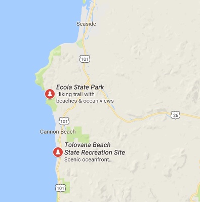
After our exploration of Warrenton and Seaside our next stop was Ecola State Park located between Seaside and Cannon Beach, OR.


Map showing Ecola State Park

As you will note from the following series of photographs our day at Ecola State Park’s Indian Beach started off with clouds and rain.


Surfers along the stormy beach
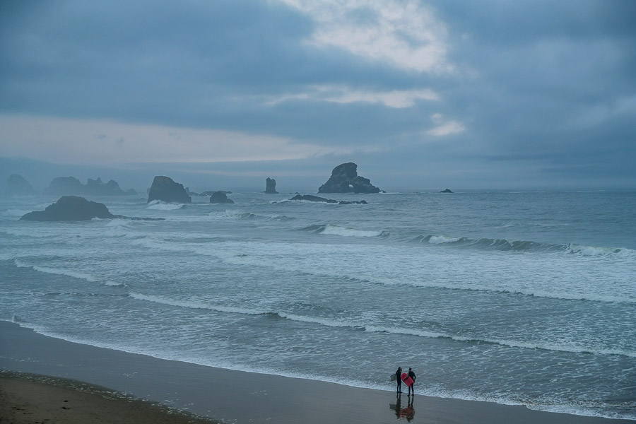
Surfers welcomed the waves created by the storm

The rain didn’t bother the surfers who were sure to get wet anyway, but hiking in the rain can create some challenges. We were not to be deterred however.

Other adventurers also wanted to experience the more dour mood the ocean would offer this morning.


We were not the only people intrigued by the rumbling waves
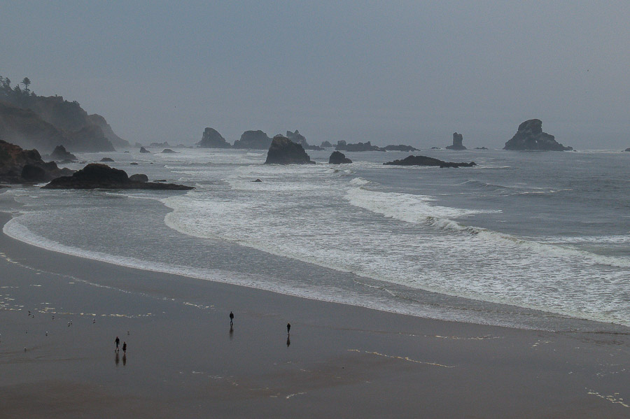
A number of beach lovers were attracted to the stormy shore

And there was enough wind and surf to accomodate those seeking the more somber beach experience.


Dark, craggy rock formations just offshore
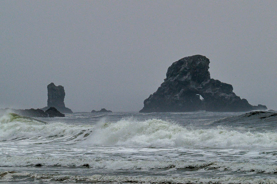
The grey day gave a more severe appearance to the rock formations

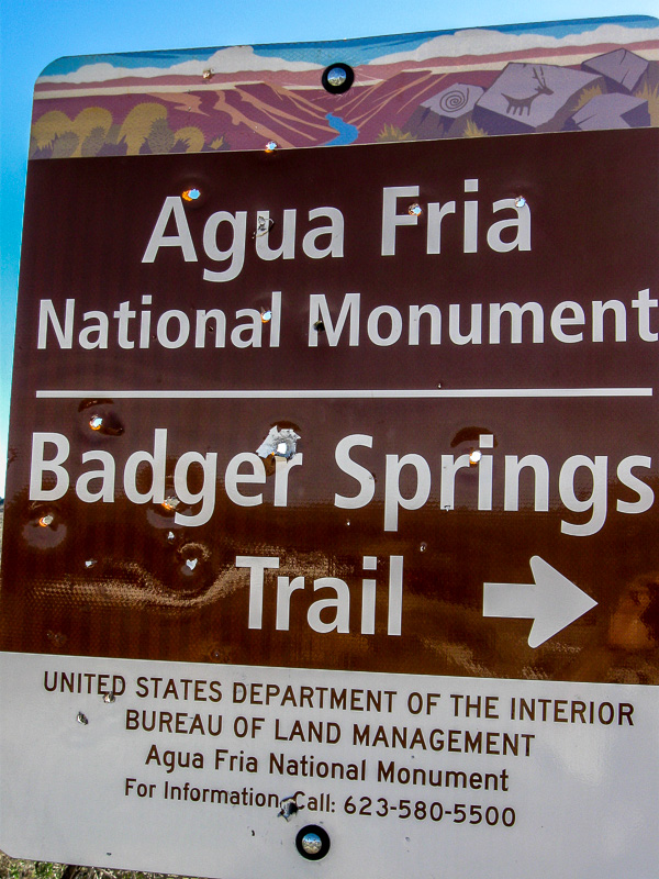
We decided to investigate the beach area while the rain was only a drizzle as we did not know what the rest of the day would portend. We came across this sign which is not one seen on most of our hikes.


Unusual shark sighting sign
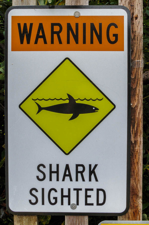
A sign not seen on a normal hiking day

In spite of the weather or perhaps because of it, the beach scene was starkly beautiful.


Stark beauty of the shore and cliffs
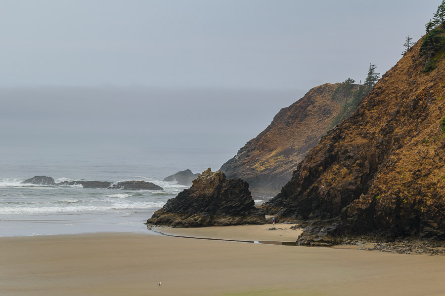
The cliffs and shore radiated their stark, stormy beauty

Most of the gulls tolerated the humans and did not scurry until a relatively close approach.


Seagulls gathered along the beach
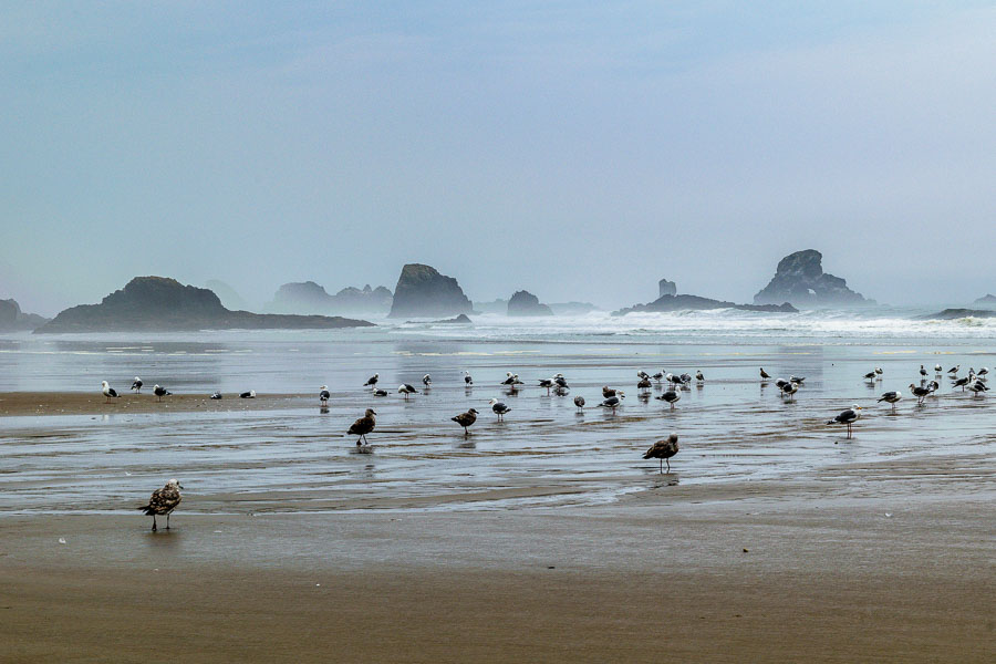
Seagulls seemed to be enjoying the misty morning on the beach

The sand was covered in a palette of light browns which played well against the darker brown and black rocks.


Sand and rock created a brown palette
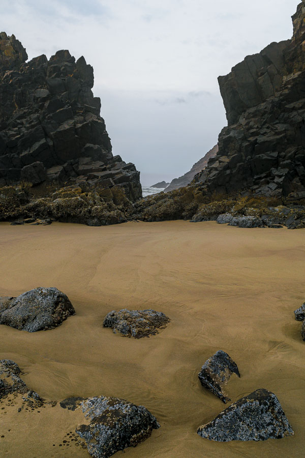
The storm induced palette of browns and blacks was attractive

Here the barnacles added texture to the rugged rocks.


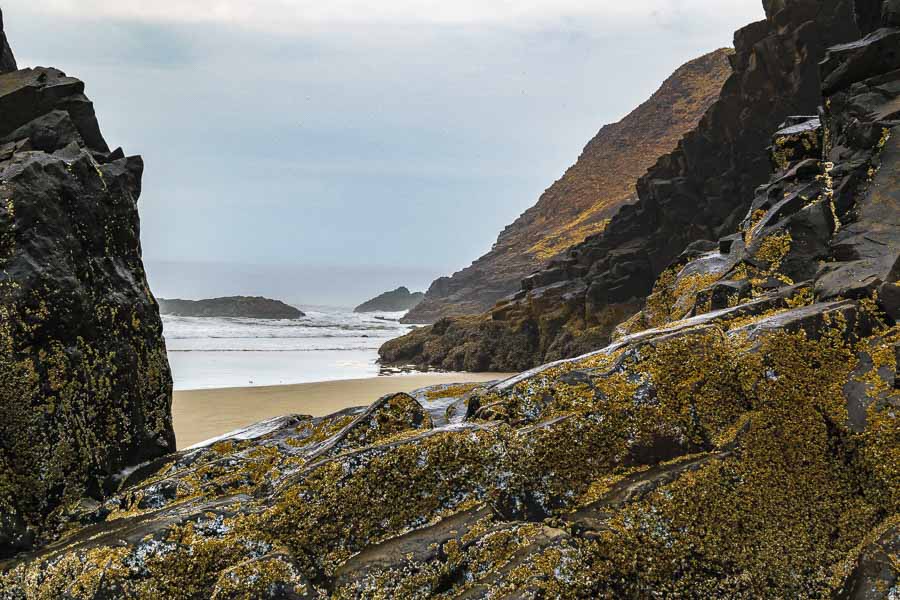
Barnacles added texture to the rocky outcroppings

I can’t say whether or not these anemones would be as pretty on a brighter, drier day, but they were jewel-like in their emerald green tones.


Green anemone among the rocks
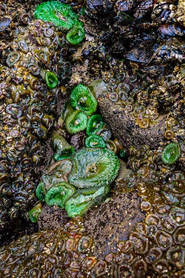
Emerald colored anemone among the rocks

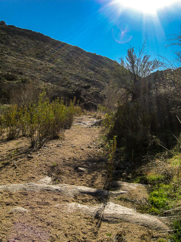
After wandering along the beach, we decided to take a seaside hike. The description of the Clatsop Loop sounded appealing with a promise of a potential sighting of the Tillamook Rock Light (lighthouse). While we like hiking in general, the trips we enjoy most are those which have us close to the sights and sounds of nature. We did not realize the the Clatsop Loop trail would take visitors along an access road uphill. The footing was good, but we prefer wooded, non-paved terrain.

The one snap I did take along our hike uphill, was of this radiant fern among the other green vegetation and forest floor mulch.


A radiant fern along the Clatsop trail
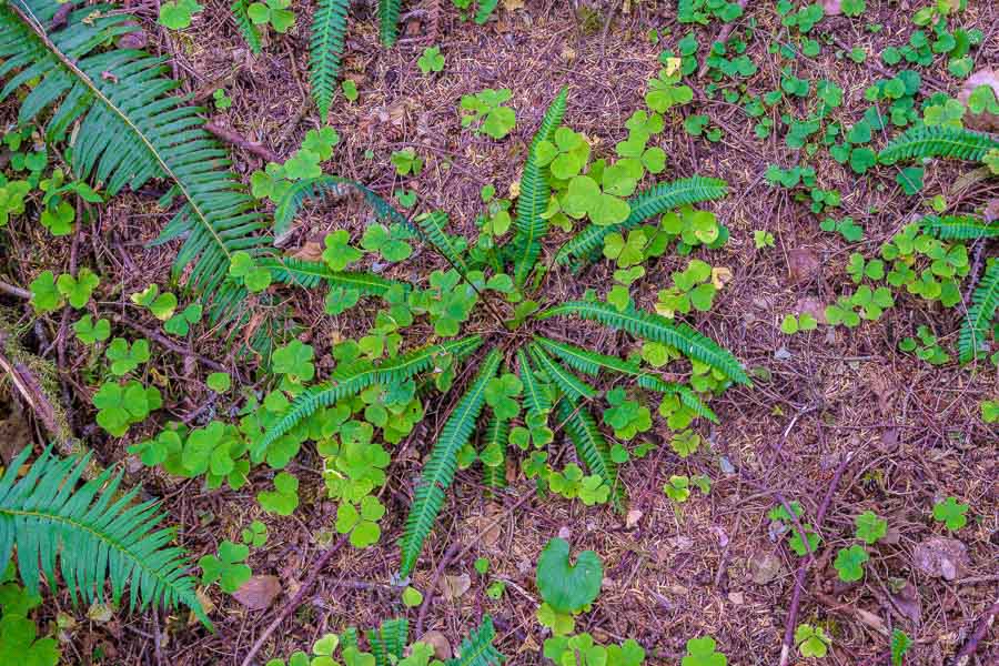
A radiant fern seen along the Clatsop Loop Trail

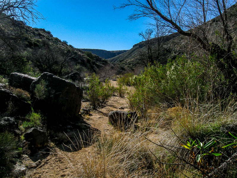
The return part of the loop was much more picturesque as parts were near the shoreline or through the woods. We arrived back at the trailhead and were once again drawn to experience the changeable atmosphere of the ocean on this morning.

PS – The fog and cloudy day precluded any view of the lighthouse from the trail.


A large rock formation lined the ocean's shoreline
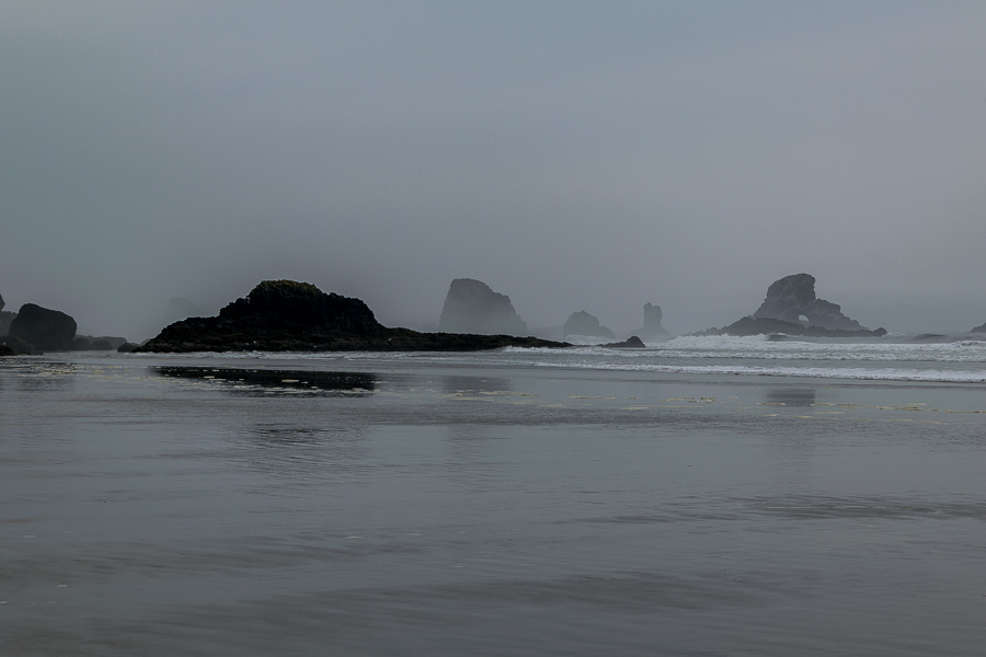
An abundance of large rocks along the shoreline


The seagulls continued to take advantage of the wet weather
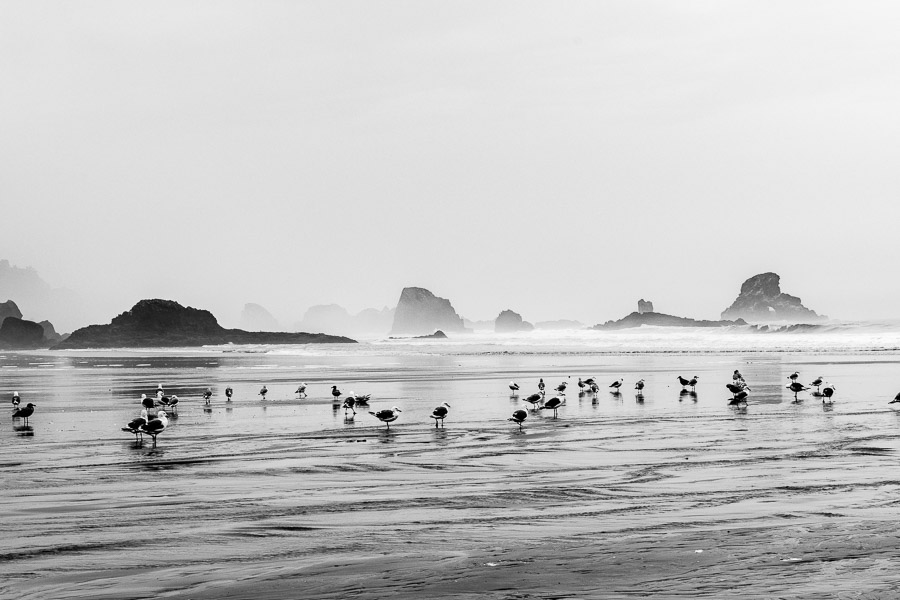
Gulls continued to enjoy the stormy morning


Read more about Ecola State Park HERE

Read more about the Clatsop Loop Trail HERE


**********

Read previous posts about our adventures hiking and exploring in Oregon:

Exploring Astoria, Oregon – Part 1

Exploring Astoria, Oregon – Part 2

Exploring Astoria, Oregon – Part 3

Adventures in Oregon: Warrenton to Seaside


Read more Hiking and Exploration posts HERE


**********


All original content on this blog is copyrighted by Jeffrey B. Ross with ALL Rights Reserved. While reference links back to JBRish.com are appreciated and encouraged, please acquire approval for any reproduction of original content from this website.

©Jeffrey B. Ross – 2017 – JBRish.com


Cascade Falls (The Cascades) – Year of Yosemite (YOY) – Day 266

Cascade Falls

One segment of Cascade Falls

The last several posts addressed some of the more robust and thus impressive waterfalls at Yosemite National Park and hikes that let visitors get up close to nature’s gushing faucets.

When it comes to natural beauty, however, power isn’t necessarily the main determinant. Cascade Falls, for example, is a series of waterfalls that meander and zig-zag down a mountain forming very pretty shaped spills. Some are delta shaped while others find their own abstract expression as they roll between and over the creek’s boulders.

The result is a beautiful array of colors, sounds and visual displays. The picture above was taken from the bridge that passes over the falls separating the upper region from the more powerful lower region below.

There is an associated hike with Cascade Falls, but a stop along the road and a visit to each side will also offer a worthy view of the rushing waters.

To read more about Cascade Creek and the waterfalls, click HERE.

 
Do you have a question about our visit to Yosemite? Ask it in the comment section.


JBRish.com originally published this post
*All photographs Copyright by Jeffrey B. Ross with all rights reserved.

 
See previous Year of Yosemite (YOY) posts HERE. If you want to read the introduction to the YOY series, CLICK HERE.

***********************************

Meta Data – Day 266 YOY – Year of Yosemite

File Name: 3524.JPG
Capture time: 8:54:20 PM
Capture date: June 7, 2016
Exposure: 1/60 sec @ f/3.2
Focal Length:5.8mm
ISO 80
Canon PowerShot A590 IS


Bridalveil Fall Hike – Year of Yosemite (YOY) – Day 265

Bridalveil Fall

Bridalveil Fall

Bridalveil Fall has an associated hike as well as the previous waterfalls discussed over the last few days. If you want to say that you hiked to the top of a Yosemite waterfall, then this might be the one for you.

Bridalveil Fall is rated as one of the easiest hikes in the park. The trail is less than 700 feet which may place it within reason for a multitude of visitors. The bad news is that it is a very popular stopping point and may be crowded. Another point of concern may be the mist that often blows along the hiking trail.

You can read more about the Bridalveil Fall hike HERE.

 
Do you have a question about our visit to Yosemite? Ask it in the comment section.


JBRish.com originally published this post
*All photographs Copyright by Jeffrey B. Ross with all rights reserved.

 
See previous Year of Yosemite (YOY) posts HERE. If you want to read the introduction to the YOY series, CLICK HERE.

***********************************

Meta Data – Day 265 YOY – Year of Yosemite

File Name: 3542.JPG
Capture time: 6:42:30 PM
Capture date: June 7, 2016
Exposure: 1/250 sec @ f/4
Focal Length:5.8mm
ISO 80
Canon PowerShot A590 IS


A Hike in the Agua Fria National Monument – Valentine’s Day

This may not sound like a very romantic Valentine’s Day, but for my wife and me, it was exactly the type of day we like. We took a hike in the Agua Fria National Monument in Arizona near Cordes Lakes just 40 miles or so North of Phoenix.

Agua Fria Nat'l Monumnet Sign

The area is a diverse riparian habitat which has been described as a “perennial river” meaning that there is water flowing in the area nearly all year long even though it is a semi-desert grassland.

This is what the trail looks like at the start. It hadn’t rained in a number of days so the river bed was dry and rocky.

Beginning of the Sandy Trail

As you can see many other people have been on this trail which follows the river bed and can be quite wet at times so be prepared. There are higher trails alongside most of the riverbed that can offer some drier terrain along parts of the hike if needed.

Many footprints in the sand

This was a perfect day for hiking. The weather was cool and the sky was clear and beautiful.

Boulders and vegetation appear in the river bed

This is a noted birding environment and while we saw some cardinals and a phainopepla, this curve-billed thrasher was the only picture I was able to take of the avian denizens on this day. While this isn’t the most flattering side of the bird, it does show how it got its name.

Profile of a cruve-billed thrasher

Along this stretch the stream was more pronounced.

The stream begins to run more abundantly

After hiking a bit in an easterly direction, the stream bed opens up to a river area which is more north and south in orientation. The boulders and hills form a picturesque setting even when the foliage of the landscape is not full.

picturesque area where the river is quite substantial as well as the boulder fields

Canyon walls and boulders along the banks

The nearby cliffs create a canyon wall on one side.

Cliffs around the the river bed

Detail of cliffs

On the cliff pictured above, we found this artifact which was probably used to support a cable or pipe of some sort.

An artifact of sorts for able or pipe

After continuing past this point we had to scramble across the boulder fields to continue to seek the path which would appear from amid the rocks at intervals.

More river and boulders of the Agua Fria

One challenge was finding a way to cross the river. People would seek their own “stepping stone” path hoping to make it to the other side.

Crossing the Agua Fria via boulders

While crossing the rocky terrain there would be fast running areas where the rocks would create eddys or small waterfalls.

waterfalls and eddys

Some of the literature notes that on warm summer days, pools will form where people can take a dip in the shallow water held by the circles of rocks.

Pools form amid the boulders

There was a group of hikers making their way into the canyon on this pleasant hiking day.

hiking group along the trail

Other visitors took time to sit and enjoy the tranquil setting.

Woman resting on a large section or rocks

Generally speaking, saguaro cactus do not grow in this area primarily because of the elevation, but this somewhat protected environment was well-enough suited for some to grow on the south-facing hillside.

Saguaros along the top of the cliff; unusual for this area

A number of rocks had curious patterns which I am sure geologists would be able to explain and perhaps find even more interesting than I did.

Darker gray pattern cover the rock

Butteflies were making their first forays into the field and here we see a slightly tattered Mourning Cloak (Nymphalis antiopa) upside down most likely looking for a place to lay some eggs.

Mourning Cloak Butterfly

Here is another picture with the wings slightly closed, but in a more appropriate and customary orientation.

Mourning Cloak Butterfly

The unusually warm days were probably responsible for this Ashen Milkvetch (Astragalus Tephrodes) to put forth its floral display. I like the detailed leaf formation of this particular plant.

Ashen Milkvetch plant with interesting leaf pattern

It was time to head home after a super hike!

Click HERE for more information about the Agua Fria


JBRish.com originally published this post

 
See more JBRish hiking posts here HERE

Fall Hike – West Fork of the Oak Creek, AZ – Pt. 1

Much of our lives were spent in the northeast and although we now live in the southwest and we are fond of the desert, once in a while we get the urge to experience a true change of seasons like those we experienced during the fall in our rural New Jersey home.

When this happens, we look to northern Arizona to satisfy our yearning. Recently we decided to take a November foray to an area just north of Sedona, AZ and hike the trail of the West Fork of the Oak Creek.


West Fork Trail #108 Sign

The trail is located off of highway 89A between mileposts 385 and 384. As always, dress appropriately, be sure to have waterproof/resistant footwear and perhaps bring an extra pair of socks. One other hint…many will find hiking sticks useful especially during the stream crossings. If you don’t have hiking sticks, a dead branch can usually be found along the way and often they are left at the trailhead sign.

Soon after we began, we were treated to this beautiful, red rock fall scene. It was a very crisp, clear fall day at the Oak Creek.

Beautiful Colors at the Trailhead Approach

Snow remnants

We were aware that it had snowed a week or so before our planned excursion, but we did not realize remnants would still be found. Mary picked up a handful; something we can’t do in the Valley of the Sun.

Mary grabs a handful of snow

As you may note, there are no officially maintained crossings of the stream which number thirteen each way for a total of twenty six. All hikers are left to decide the best route to attempt. Rocks are not always steady, logs are sometimes slippery and the dry footholds may be far apart. This provides some excitement and challenges. Many hikers brought their four-legged companions along for a frolic.

Mary at stream crossing; dog waiting

Gymnastics training could come in handy.

Gymnastic creek crossing

The creek widens and narrows along the route providing interesting and contrasting vistas among the red sand and rocks.

Contrast of stream and red rocks

Of course we need to mention the leaves; yes the leaves. In the desert, we don’t have fall leaf colors and shapes like these.

fall leaf colors

The contrast of reds, yellows and bronze against the dark bark and red cliffs was very pretty.

gold bronze leaves amid the  gray of fall

Change was definitely in the air. Leaves were donning their seasonal finery as they fell to the ground or attempted to cling to the branches just a bit longer.

Leaves change color

The patches of dried, brown foliage also provided a pretty foil for the remaining snow which provided the background for the patterns of fall.

patterns of dead ferns against the snow

To be continued…

For more information about the West Fork of Oak Creek, Sedona including hours of operation, fees and restrictions, see the links below:

West Fork Oak Creek #108

Hiking the West Fork of Oak Creek

Trail Map of West Fork Oak Creek

Hikeographer at the Delicate Arch

I guess you could say that I often adopt the role of hikeographer. You might wonder exactly what this is so let me explain. I enjoy photography. I wouldn’t say that it is exactly a passion, but it is a significant interest of mine. I also enjoy hiking and seeing different natural things.

My favorite subjects are scenery, animals (especially birds), flowers and unusual signs. I must admit that I am not one to usually try to time my arrival at a destination to get the best light. I understand that this is one reason I may never be a great photographer and I am willing to accept that limitation.

What I like to do is take my camera with me when hiking and capture the scene at hand to the best of my ability. I apply whatever skills I have learned to render the best picture possible while I am hiking various trails and arriving at remarkable vistas. That is why I refer to myself as a hikeographer. I am a hiker who likes photography.

With that in mind, here are some pictures I took at Arches National Park (ANP),Utah. It is a wonderful place to hike and to photograph. If you enjoy either of these hobbies or both, I highly recommend that you visit ANP.

Most Utah license plates have a drawing of the Delicate Arch on it…so called because it is slowly eroding. If you look at the pictures below, you will note that the left-side leg of the arch is very thin at one point. It won’t be there forever. Several other arches at ANP have already collapsed and are lost to the ages.

If you don’t like to hike, then you can see the Delicate Arch (DA) from a parking lot. Here is a picture taken from the parking lot without a long zoom lens. The arrow points to the DA.


XXXXXX

Notice the people walking along the path. This may provide an indication of how far away the arch actually is.

I had a 4x zoom camera so this is the best picture I could get from the parking lot.

XXXXXX

We had hiked all day and the DA was the last planned hike, but we had no idea how difficult this trek would be after such a long day. The incline up to the arch (the trail is from a different area and not shown) is significant so if you are incline-challenged, you may think twice about attempting it.

Once at the arch, however, the scene is spectacular.

XXXXXX

An interesting culture seemed to have evolved at this natural wonder. It is understood, I suppose, that many people would want a picture of the Arch without a person in it and, at the same time, many people want to have their picture taken at the arch. Much to my surprise, people would walk to the arch, have their picture taken and then the next person would wait for ninety seconds (+/-) before moving into place so others can snap away without a person in the scene. This was a very interesting and much appreciated behavior.

Here I am standing near the left pillar of the DA.

XXXXXX

I have some close ups just for the record.

Isn’t this view breathtaking?

XXXXXX

As we began to descend on our return trip to the parking lot, the sun was setting. By the time we arrived at the car, it was dark. This will give you some idea of the slope we needed to climb and as you can see, on the way up it is certainly a HIKE!

XXXXXX

NOTE: These pictures were taken with a Canon A590 IS point-and-shoot camera. It is nowhere near the top of anyone’s line, but as you can see, the pictures are quite nice. It is an 8 MP camera with a 4x lens, but it is quite serviceable. I have since upgraded to a Canon SX50HS; big difference.


JBRish.com originally published this post

Valles Canyon – Sierra de las Uvas, NM

After several days of hiking the trails of the Organ Mountains-Desert Peaks (OMDP) National Monument, we headed for Valles Canyon located about 25 miles to the northwest. The hiking guide described it as slightly challenging, and would likely provide different terrain and vistas than the OMDP.

As cited on the websites below, there are dips in the road and warnings about flooding, but on this sunny (but very windy day) the roads were basically fine. (Note: Read the location directions carefully as Valles Canyon is somewhat tricky to find)

It was a bit of a trek from the parking area to the canyon itself. The road has some tire tracks and a number of rocky spots. Although there was evidence of 4×4’s use, rocks and high spots preclude the use of most vehicles
Road to the Canyon

One of the first landmarks that assured the accuracy of the trail was the correct one was a defunct windmill and nearby water basins.

Defunct Windmill

Old walls (ruins) now provide a nesting places for birds and (likely) other critters.

Rock wall ruin

Mountains surrounding the canyon provided an impressive backdrop of color and form.
Vista near canyon start

River bed canyon trail

The geology of the canyon was very interesting. Here is a wall of one of the side canyons. Notice how it is made of sand that is embedded with rocks of various shapes and sizes and several that are rather large.

Canyon geology

There were times that the path was not obvious and required the “most likely this way” option. We generally mark a waypoint on our GPS so we can readily backtrack if necessary.

Path hard to discern at times

Petroglyphs were noted and initially thought to be bogus, but further review apparently supported their credibility.

First of several petroglyphs

Some of the descriptions of the trail remarked about “boulder scrambles”!!!

Boulders to climb over

And perhaps this is a more dramatic version!

Narrow rock crevice to navigate

Nearly halfway into the floor of the canyon we noticed something partially buried in the sand of the canyon. Can you tell what it is?

Buried tin coffee cup

This handmade tin coffee mug was carefully exhumed for a photo, but then returned to the place and orientation it was originally found.

Artsy version of artifact

There were areas where the walls were high and the trail was narrow.

Steep canyon walls

Other spots had a wide river bed that permitted easy walking.

Wide riverbed trail

Valles Canyon connects with Broad Canyon. A 500 foot segue into this latter canyon was strewn with light colored boulders and rock formations.

Where Broad Canyon meets Valles Canyon

On the “long and winding road” back to the car, a section of a decayed Yucca holding water for insects and other small denizens was spotted.

Part of a dead yucca

There were more petroglyphs. Is that a whale on the top? A dinosaur?

More petroglyphs

Still more petrogylphs

A barbed wire fence tied around a tree required some tricky negotiation to continue through the dry canyon riverbed.

barbed wire to climb over
En route out of the canyon, a bull enjoyed a welcome drink oblivious to passing hikers.

Thirsty bull drinking

Leaving Valles Canyon, a sign caught our eye (and apparently many other things as well!!)
Bullet riddled sign

Heading back to Las Cruces on Route 10, a large statue of a Road Runner about 20-25 feet tall caught our attention! Being an enthusiastic bird watcher, I needed to have a picture!!

Large Road Runner Sculpture

If you go, read these:

2012-09-09 Valles Canyon

Southern New Mexico Explorer – A blog about exploring the natural areas of New Mexico focusing on but not limited to Dona Ana, Luna, Otero, Sierra, Grant, Lincoln,Socorro and Catron counties.


JBRish.com originally published this post

Sunrise, sunset, swiftly flow the days*

My wife and I are classified as “senior citizens,” but in spite of that title we still like to hike. We do have our aches and pains so several years ago we decided to hike in as many places on our bucket list that our knees, hips and other joints would allow.

Last summer we chose to hike along parts of the northern California coast. It was such a beautiful trip along route 1. Nearly every turn provided a post card-like scene. We stopped many times to take pictures.

The Timber Cove Inn located in Jenner, CA is one of the nicest places to stay in the area. The two pictures below show a scene from the rear of the inn. One was a sunset and the other a sunrise of approximately the same area. It was beautiful indeed!

Timber Cove Sunset, Jenner, CA

Timber Cove Sunrise, Jenner, CA

* Title of this post from the song, Sunrise, Sunset – Fiddler on the Roof