Adventures in Oregon: Inland to Crater Lake

We loved the adventures we had driving southward down the coast of Oregon. We saw much of the ocean and nautical scenes as well as a variety of mountain hikes and nature preserves. It was the type of hiking we enjoy the most.

The weather was a bit disappointing from time-to-time, but considering coastal fickelness, I think we fared fairly well. It was now time to head inland for our last and perhaps most anticipated stop, Crater Lake National Park.

We were aware of the wildfires in Washington and Oregon as we had followed them prior to arriving in Portland, OR. If we were skeptical, our doubts vanished at the airport where ash was landing on our luggage as we waited for our rental car and most the the staff were wearing masks. We were believers!

Along the coast, the wildfires made only a small impact on our visit, but when we arrived at Crater Lake after a good day’s drive, this is what we saw.
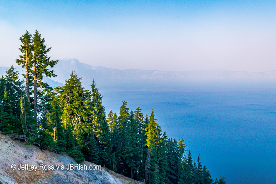

Smoke and smog over Crater Lake
This was the best view. There were times when it was worse.

We had booked our room at Crater Lake Lodge more than a year ahead of time and paid an upcharge for a lakeside view. To say we were disappointed, is an understatement. We visited the ranger station, but the news was not good. The smoke predictions for the week were bleak indeed.

We were betwixt and between trying to decide what to do. We took some rides along the rim of the lake, but really there was not much we could see. Crater Lake is supposed to be an astonishing color and reportedly has some of the purest water in the world, but it could not be truly appreciated.

After consulting the weather/wind forecasts with our minimal wi-fi connection, discussions with the rangers and the hotel staff, we decided it would be wise to cancel the rest of our trip and head home.

***NOTE*** – I must extend plaudits to the park and the hotel for their willingness to provide a refund for all but the day we were staying at the hotel. The room was costly and the hotel was sparsely populated with guests. It wasn’t pleasant for the park service or those guests who were playing board games in the lounge when they would rather have been out hiking.

We were able to change our flights, etc. and we were prepared to head for Portland the next morning. I decided to wake up early to see if the quiet morning atmosphere would yield a worthy view.
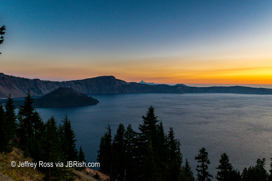

A nice view the next morning!

I could not believe how nice the lake looked. I could finally see some detail and the color of the light was picturesque. That island to the left is known as Wizard Island.
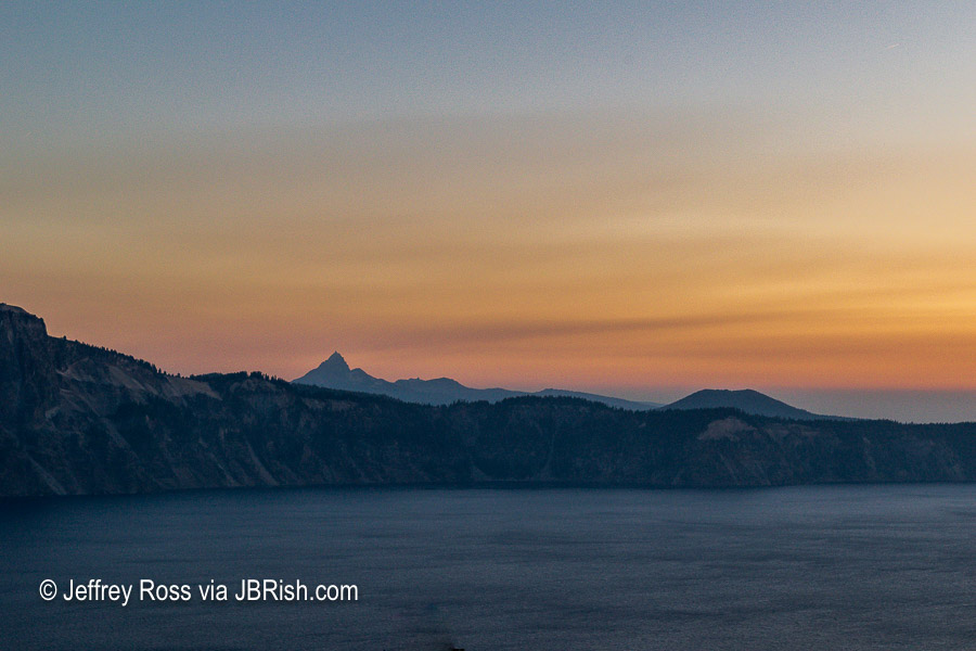

Mount Thielsen from Crater Lake at Sunrise

The photo above shows a mountain rising in the distance which I believe to be Mount Thielsen with a height of over 9,000 feet at the peak. Google Maps suggests that the access road is only 6 miles from Crater Lake, but then there is the road from highway 138 to the mountain.

You can read more about Mount Thielsen HERE

I was so excited to be able to see parts of the lake and the surrounding area, that I took this panorama to document the scene.


Worthy of a Panorama

As we were loading the car for the trip to Portland and doubts arose in our minds, I was able to snap some daylight photos of the lake.
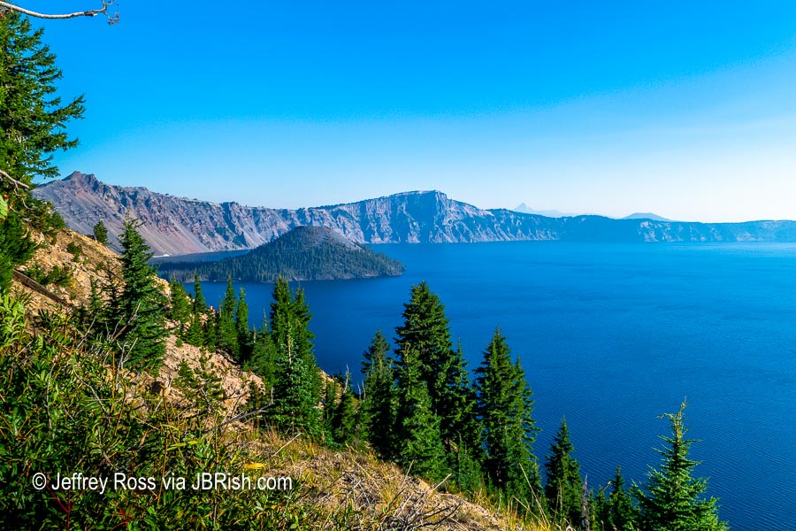

Wizard Island with the smoke lifting.

There is Wizard Island looking pretty good!

Here is a closer look!
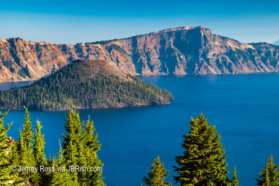

A closer look at Wizard Island

Although it was a bit perplexing, we were set on returning to our desert home. Along the way we kept checking the weather reports to validate our decision to leave. We were able to learn that the smoke was once again heading to Crater Lake and more scenes like the one below were to be in the offing.
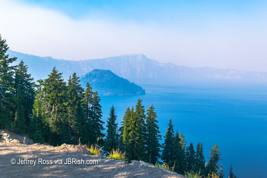

Another view with the Smoke closing in.

All in all we were satisfied we made the best decision we could. We were heading out early and stopped for breakfast and lunch. We thought we would have a smooth trip to the Portland airport, but nothing could prepare us for the traffic which nearly kept us from making our flight; but that’s another story.


**********

Read previous posts about our adventures hiking and exploring in Oregon:

Exploring Astoria, Oregon – Part 1

Exploring Astoria, Oregon – Part 2

Exploring Astoria, Oregon – Part 3

Adventures in Oregon: Warrenton to Seaside

Adventures in Oregon: Hiking at Indian Beach

Adventures in Oregon: Views from Ecola Point

Adventures in Oregon: Movin’ On Down the Road

Adventures in Oregon: Garibaldi’s Graces and Pier

Adventures in Oregon: Tillamook – Cape Meares Lighthouse

Adventures in Oregon: Pacific City, Neskowin & Lincoln City

Adventures in Oregon: Cascade Head and Hart’s Cove in Lincoln City

Adventures in Oregon: Cape Foulweather & Drift Creek Falls

Adventures in Oregon: Newport to Yachats

Adventures in Oregon: Heceta Head & Sand Dunes

Adventures in Oregon: State Parks: Umpqua to Shore Acres

Adventures in Oregon: From the Shore to the Falls


Read more Hiking and Exploration posts HERE


**********


All original content on this blog is copyrighted by Jeffrey B. Ross with ALL Rights Reserved. While reference links back to JBRish.com are appreciated and encouraged, please acquire approval for any reproduction of original content from this website.

©Jeffrey B. Ross – 2018 – JBRish.com
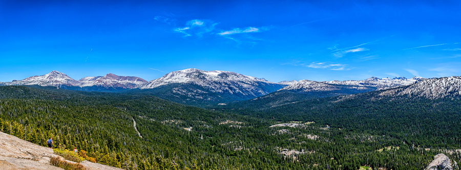


Lembert Dome Panorama 3/3 – Year of Yosemite (YOY) – Day 247

A panorama taken on top of Lembert Dome

Last panorama from the top of Lembert Dome


The last panorama from the top of Lembert Dome moves the viewer a bit more towards the north in a north-westerly direction. As you may notice a couple of people were off to the side taking in the gorgeous view.

The sun and shadows were playing nice in the valley and on the mountains creating pockets of contrast. It was time to start heading back down.

To see a larger photo of the scene, click HERE

 
Do you have a question about our visit to Yosemite? Ask it in the comment section.


JBRish.com originally published this post
*All photographs Copyright by Jeffrey B. Ross with all rights reserved.

 
See previous Year of Yosemite (YOY) posts HERE. If you want to read the introduction to the YOY series, CLICK HERE.

***********************************

Meta Data – Day 247 YOY – Year of Yosemite

File Name: 236.DNG
Capture time: 1:29:08 PM
Capture date: June 7, 2016
Exposure: 1/125 sec @ f/13
Focal Length: 18mm
ISO 100
Nikon D3300


Lembert Dome Panorama 2/3 – Year of Yosemite (YOY) – Day 246

A panorama taken on top of Lembert Dome

Another panorama from the top of Lembert Dome

Following yesterday’s post, I wanted to show additional panoramas to provide the full scope of the amazing view from on top of the Lembert Dome. After what, for me, was a relatively long trek, this was the pay off.

This composite of several individual photos moves more toward a westerly direction. In the middle left, you might be able to see a bit of the Tuolumne River just in front of the distant mountains. On the right side of the frame is a jutting portion of the Lembert Dome. It was truly breathtaking!

To see a larger photo of the scene, click HERE

NOTE – The larger version was taken from a screen shot to reduce memory requirements.

 
Do you have a question about our visit to Yosemite? Ask it in the comment section.


JBRish.com originally published this post
*All photographs Copyright by Jeffrey B. Ross with all rights reserved.

 
See previous Year of Yosemite (YOY) posts HERE. If you want to read the introduction to the YOY series, CLICK HERE.

***********************************

Meta Data – Day 246 YOY – Year of Yosemite

File Name: 227.DNG
Capture time: 1:28:40 PM
Capture date: June 7, 2016
Exposure: 1/125 sec @ f/13
Focal Length: 18mm
ISO 100
Nikon D3300


Lembert Dome Panorama 1/3 – Year of Yosemite (YOY) – Day 245

A panorama taken on top of Lembert Dome

Panorama from the top of Lembert Dome

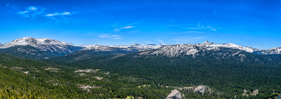
The panorama above was composed of several pictures taken from on top of Lembert Dome. So impressive was the view before me that I started looking southwest-ish and began to take a series of pictures panning to the west.

I believe this photograph is a view of the mountains from Lembert Dome looking in the approximate southwestern direction. Tuolumne Meadows spread out before me with a view of the distant mountains and sections of the Tuolumne River peeking out here and there.

To see a larger photo of the scene, click HERE

 
Do you have a question about our visit to Yosemite? Ask it in the comment section.


JBRish.com originally published this post
*All photographs Copyright by Jeffrey B. Ross with all rights reserved.

 
See previous Year of Yosemite (YOY) posts HERE. If you want to read the introduction to the YOY series, CLICK HERE.

***********************************

Meta Data – Day 245 YOY – Year of Yosemite

File Name: 2018.DNG
Capture time: 1:27:54 PM
Capture date: June 7, 2016
Exposure: 1/160 sec @ f/13
Focal Length: 18mm
ISO 80
Nikon D3300

Year of Yosemite (YOY) – Day 174 (Lembert Dome Trail – Panorama 8/8)

A panorama taken from the top of Lembert Dome

The panorama from the edge of Lembert Dome highlights several key features of the area

After arriving on the very top of the dome and taking in the 360 degree view, I couldn’t help, but try my hand at taking some panoramas. I like this one in particular because of the way the tip of the dome provides some perspective.

In the small view on your browser, the river in the background just beyond the tip of the dome is hard to see, but it meanders through the meadow at that point and was interesting to see as it pointed the way to the mountains off to the right.

(To see a larger view of the Panorama, click HERE)

Of course just to the left of the edge of the dome, in the distance, is Cathedral Peak which I have highlighted in several other posts. You can see a better picture of Cathedral Peak HERE.

 
Do you have a question about our visit to Yosemite? Ask it in the comment section.


JBRish.com originally published this post
*All photographs Copyright by Jeffrey B. Ross with all rights reserved.

 
See previous Year of Yosemite (YOY) posts HERE. If you want to read the introduction to the YOY series, CLICK HERE.

***********************************

Meta Data – Day 174 YOY – Year of Yosemite

File Name: 0222.NEF
Capture time: 1:28:19 PM
Capture date: June 7, 2016
Exposure: 1/125 sec @ f/13
Focal Length: 18mm
ISO 100
Nikon D3300


Year of Yosemite (YOY) – Day 132 (Lembert Dome – On top of the World)

Hikers resting on top of Lembert Dome

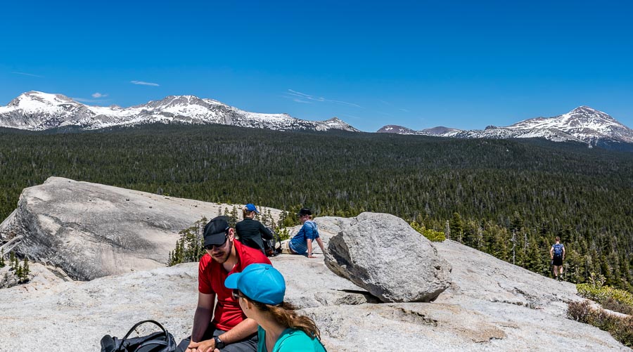
On top of Lembert’s Dome, hikers were resting and having a snack

This picture is a screen shot from part of a panorama. Of course I could have just singled out the one photo with the couple in the middle, but I had the pano handy. Because this is a section of a panorama, some of the people might have slight distortions.

**NOTE** when merging a number of photos into a panorama, items that are moving (i.e. people) have a tendency to be distorted.

It was absolutely breathtaking to stand on Lembert Dome and to slowly move in 360 degrees and view the total magnificence of the surrounding mountains. The sky was beautifully blue and clear with a few puffy clouds.

The feeling was exhilarating; trust me!

If you want to see the entire pano from a larger file click on the link below. Kindly keep in mind that as a courtesy, I have altered the faces of those who might be recognizable.

Large Pano

 
Do you have a question about our visit to Yosemite? Ask it in the comment section.


JBRish.com originally published this post
*All photographs Copyright by Jeffrey B. Ross with all rights reserved.

 
See previous Year of Yosemite (YOY) posts HERE. If you want to read the introduction to the YOY series, CLICK HERE.

***********************************

**Meta Data – Day 132 YOY – Year of Yosemite

File Name: 0233.NEF
Capture time: 1:28:50 PM
Capture date: June 7, 2016
Exposure: 1/200 sec @ f/13
Focal Length: 18mm
ISO 100
Nikon D3300

** Because this is part of a panorama, I have provided the Metadata for the one picture that makes up the central part of the image. The other images would have similar specs.


Lightroom 6 First Panorama – Las Cruces, NM

Readers of my blog may have noticed that I enjoy the outdoors, hiking, birding, etc. My wife and I were recently hiking in the recently created Organ Mountain-Desert Peaks National Monument in Las Cruces, New Mexico.

There were many excellent sightings that I hope to write about in the future, but for now I want to tell you about my very first attempt at creating a Panorama using Lightroom 6.

I have only been using LR for less than a year and I have been making progress in learning about the various tools. When LR 6 arrived with “built-in” panorama creation tools, I couldn’t wait to try it.

The Organ Mountains are very large and cannot be captured easily in one shot so I decided to create a Panorama.

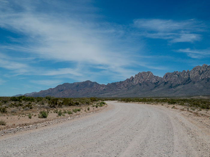
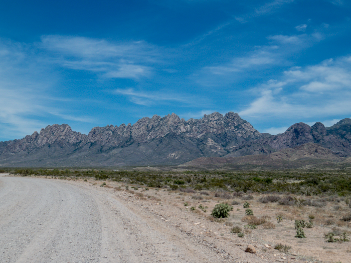
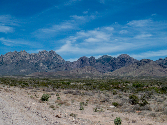
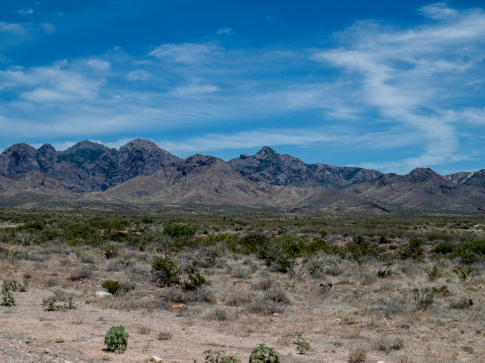
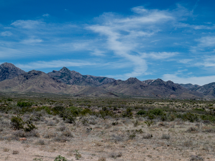
I took the following seven pictures with hopes of being able to “stitch” them together using LR.

Organ Mountains, Las Cruces, NM - Panorama Picture 1

Organ Mountains, Las Cruces, NM - Panorama Picture 2

Organ Mountains, Las Cruces, NM - Panorama Picture 3

Organ Mountains, Las Cruces, NM - Panorama Picture 4

Organ Mountains, Las Cruces, NM - Panorama Picture 5

Organ Mountains, Las Cruces, NM - Panorama Picture 6

Organ Mountains, Las Cruces, NM - Panorama Picture 7

I wasn’t sure exactly how to accomplish this task so I searched online and found Julieanne Kost’s blog post about it. She is an excellent and gifted instructor. I have used several of her videos before. If you are interested, you can watch her video below:

I heard that when doing a panorama, one should have about a 30% overlap and although I wasn’t too exact about this, I took a guestimation as I captured the various pictures while moving my camera as level as I could across the distant view.

Here is the final result via a thumbnail-ish rendering.

Organ Mountains, Las Cruces, NM - Panorama

You can see a large-sized image here at the link below:

Organ Mountains, Las Cruces, NM

The image needs a bit more editing, perhaps reducing the “noise” in the sky, etc., but I am pleased with my first attempt. Are you encouraged to try creating a panorama?