Adventures in Oregon: Views from Ecola Point


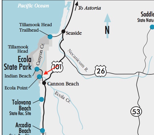
Map of Indian Beach and Ecoloa Point

While we were exploring Indian Beach at Ecola State Park, we noticed a sign pointing to additional viewpoints. The weather continued to be dreary. A few years ago, we hiked a week in the rain in the Grand Tetons so we weren’t going to shy away from exploring on this day either.

I can’t tell you the exact road, but it led us to a point further south of Indian Beach and there were quite a few other cars in the parking area. The overlook brought us to a place where we could see Cannon Beach and the famed Haystack Rock with the summer’s growth fading in the foreground.

NOTE – Apparently this is near Ecola Point and Crescent Beach (see map above). If all else fails, look for those landmaarks.
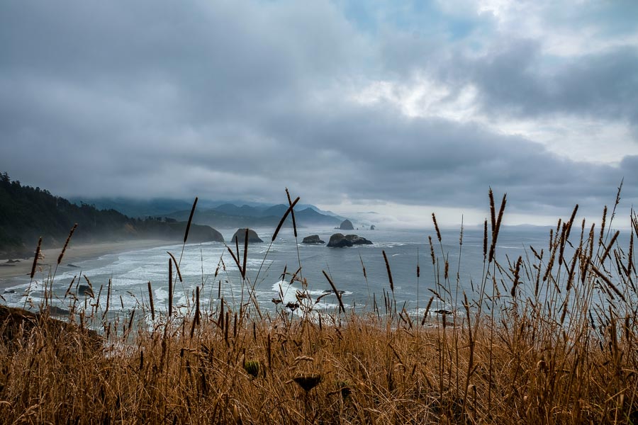

Cannon beach through the grassland
Cannon beach seen through the grassland

The sky would lighten and darken at times adding even more dramatic views.
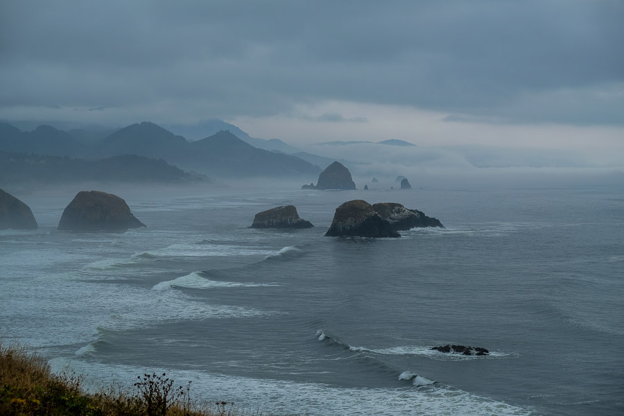

The sky turned stormy at times
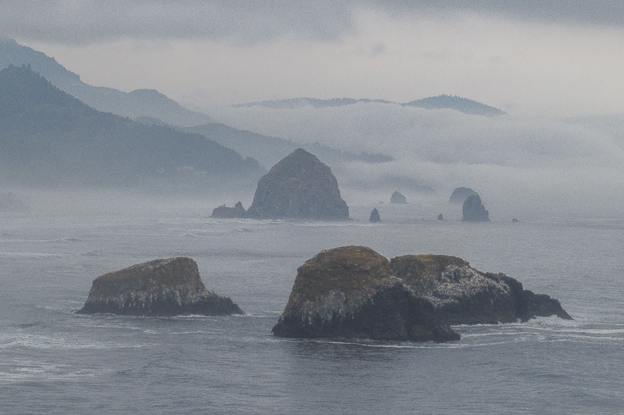


A closer view of the massive ocean rocks
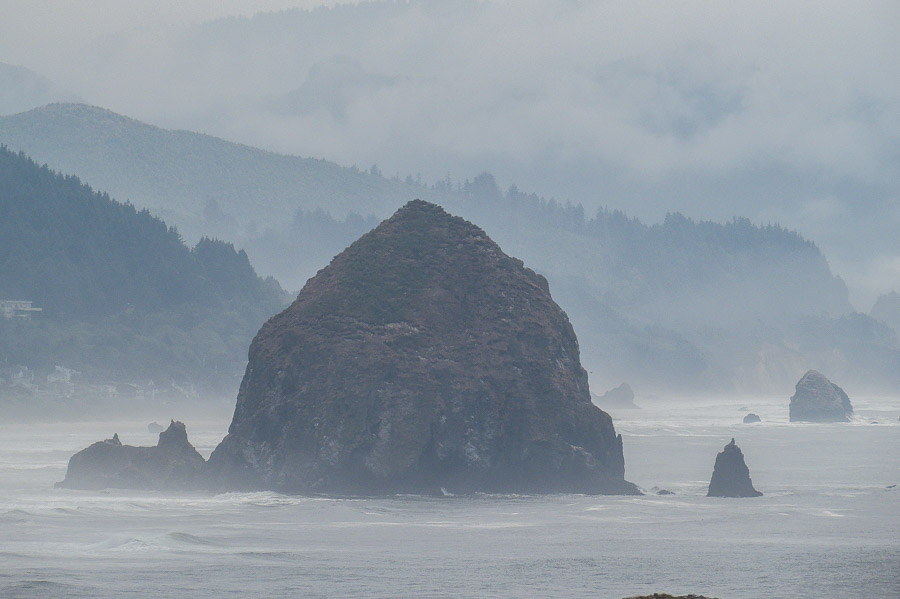


Haystack Rock is the iconic feature of Cannon Beach

This was not the only scene available at this stop. Sea Lion Rock could be seen off the coast and even on a grey day, it loomed large in the distance. Apparently native wildlife can often be seen in and around this protrusion, but not during our visit.


Sea Lion Rock awaits around the bend
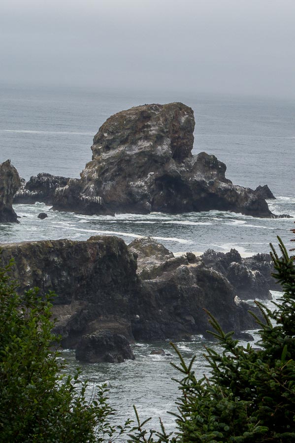


Craggy beauty surrounds the cove

Surprisingly, we caught a glimpse of the Tillamook Rock Light in the distance.
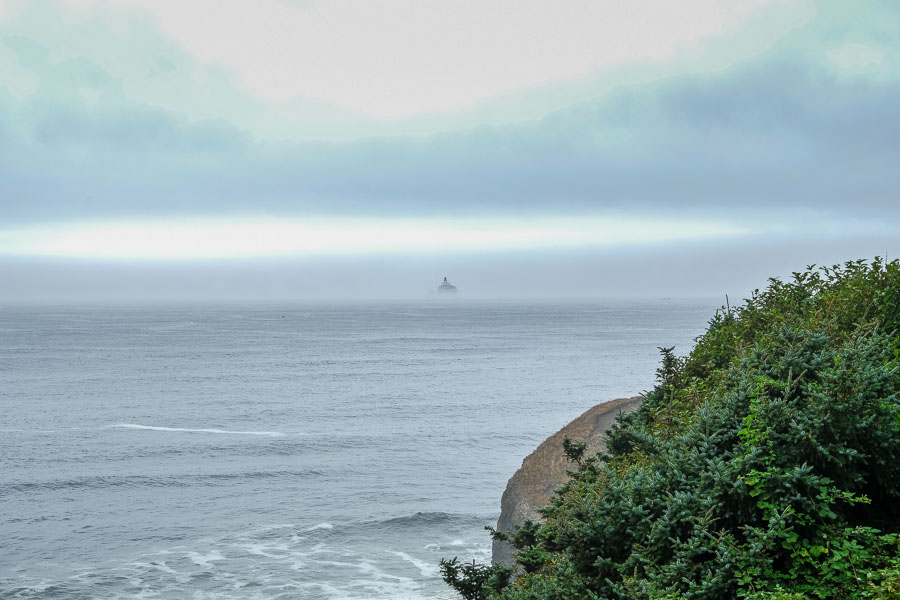

Tillamook Rock Light way in the distance

We tried to find this during our hike of the Clatsop Loop Trail with no success, but then the fog had lifted a bit and there it was in the distance.
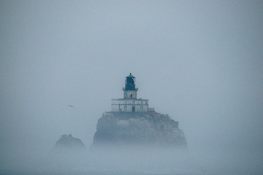

Tillamook Rock Light - the best shot I could manage
Tillamook Rock Light – the best shot I could manage

Although the rain held off and the sky had periods of brightness, we were ready to leave, but I needed to capture one or two more shots of Cannon Beach and Haystack Rock.


Parting shots of Cannon Beach and the Haystack
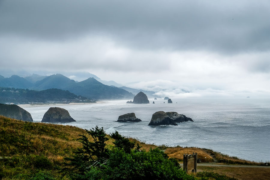


Parting shots of Cannon Beach and the Haystack

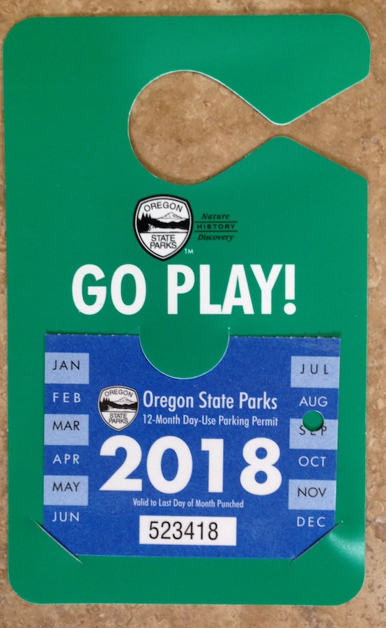
NOTE – I would like to point out that Oregon has a very enlightened approach to their shoreline. Most areas of the coast are open to the public and with the purchase of a yearly parking pass at $30 +/- visitors and residents alike can enter the state parks and enjoy the beauty of the state. We so enjoyed having this pass which gave us entré to all the areas we had earmarked. I highly recommend it.


Oregon State Parks parking permit

You can find more information about this resource HERE.

Read More about Ecola State Parkore


**********

Read previous posts about our adventures hiking and exploring in Oregon:

Exploring Astoria, Oregon – Part 1

Exploring Astoria, Oregon – Part 2

Exploring Astoria, Oregon – Part 3

Adventures in Oregon: Warrenton to Seaside

Adventures in Oregon: Hiking at Indian Beach


Read more Hiking and Exploration posts HERE


**********


All original content on this blog is copyrighted by Jeffrey B. Ross with ALL Rights Reserved. While reference links back to JBRish.com are appreciated and encouraged, please acquire approval for any reproduction of original content from this website.

©Jeffrey B. Ross – 2017 – JBRish.com


Aggregating anemones, Anthopleura elegantissima, Oregon Coast, Lane County, Strawberry Hill State Park
Adventures in Oregon: Hiking at Indian Beach

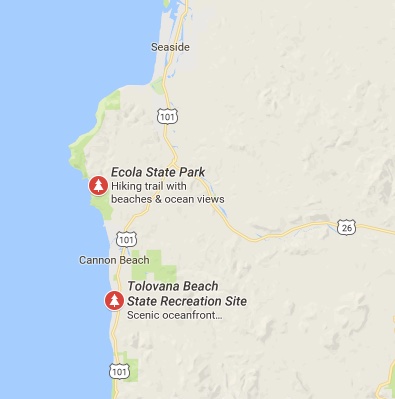
After our exploration of Warrenton and Seaside our next stop was Ecola State Park located between Seaside and Cannon Beach, OR.

Map showing Ecola State Park
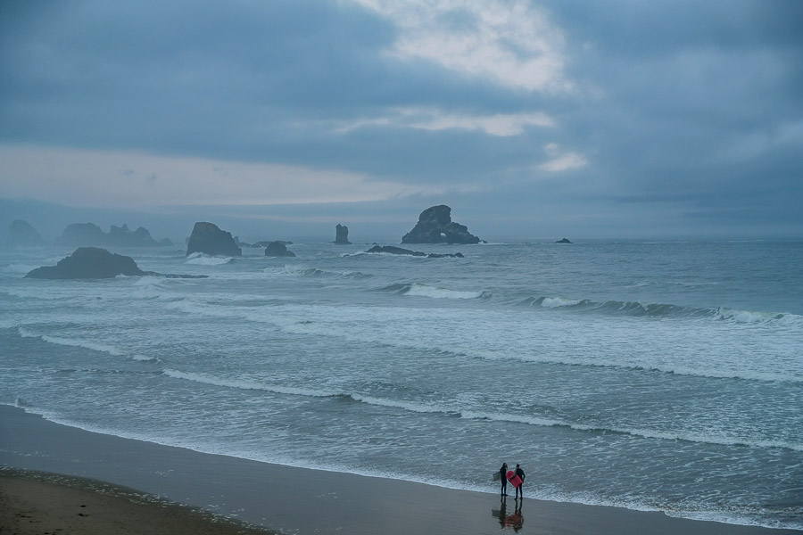
As you will note from the following series of photographs our day at Ecola State Park’s Indian Beach started off with clouds and rain.


Surfers along the stormy beach
Surfers welcomed the waves created by the storm

The rain didn’t bother the surfers who were sure to get wet anyway, but hiking in the rain can create some challenges. We were not to be deterred however.

Other adventurers also wanted to experience the more dour mood the ocean would offer this morning.


We were not the only people intrigued by the rumbling waves
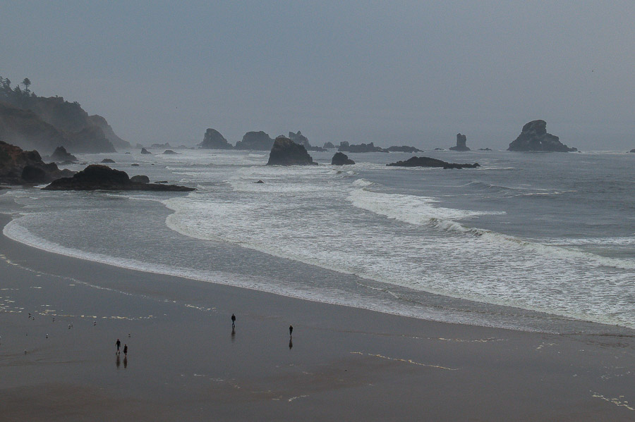
A number of beach lovers were attracted to the stormy shore

And there was enough wind and surf to accomodate those seeking the more somber beach experience.


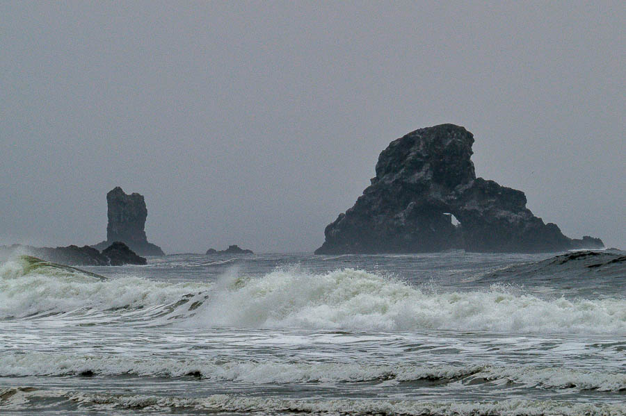
Dark, craggy rock formations just offshore
The grey day gave a more severe appearance to the rock formations

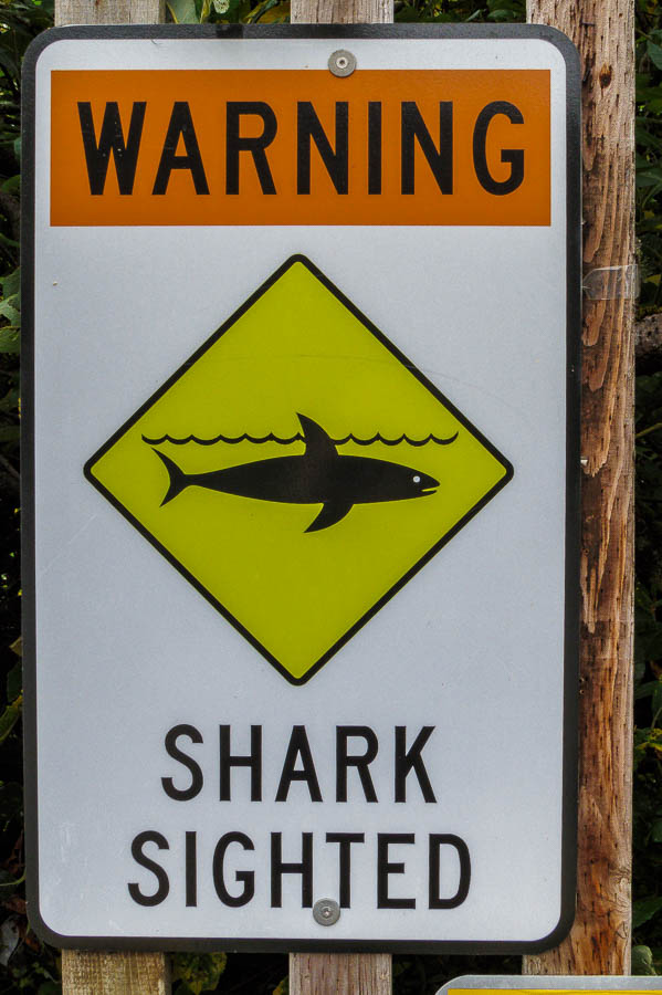
We decided to investigate the beach area while the rain was only a drizzle as we did not know what the rest of the day would portend. We came across this sign which is not one seen on most of our hikes.


Unusual shark sighting sign
A sign not seen on a normal hiking day

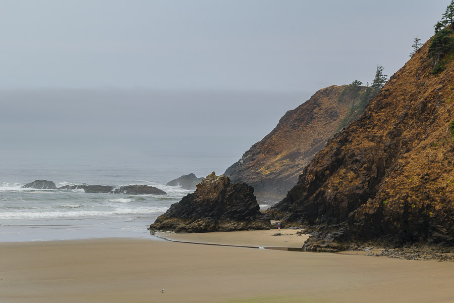
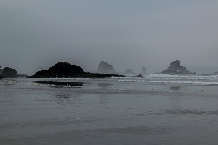
In spite of the weather or perhaps because of it, the beach scene was starkly beautiful.


Stark beauty of the shore and cliffs
The cliffs and shore radiated their stark, stormy beauty

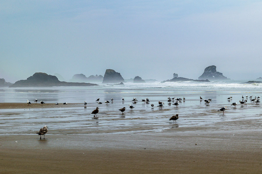
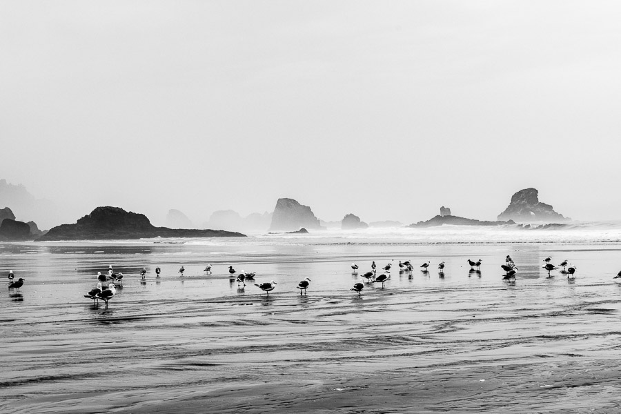
Most of the gulls tolerated the humans and did not scurry until a relatively close approach.


Seagulls gathered along the beach
Seagulls seemed to be enjoying the misty morning on the beach

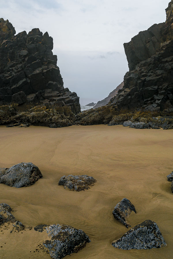
The sand was covered in a palette of light browns which played well against the darker brown and black rocks.


Sand and rock created a brown palette
The storm induced palette of browns and blacks was attractive

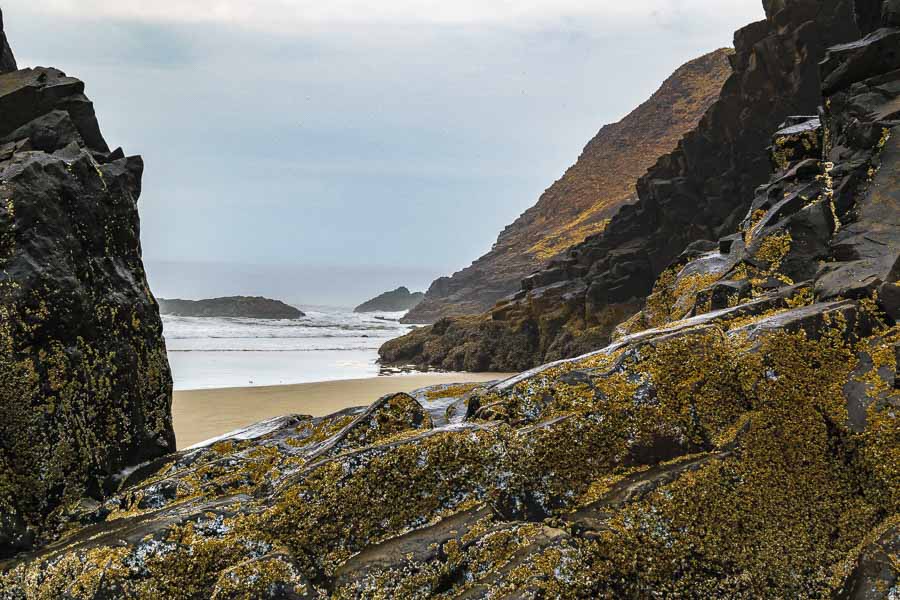
Here the barnacles added texture to the rugged rocks.


Barnacles added texture to the rocky outcroppings

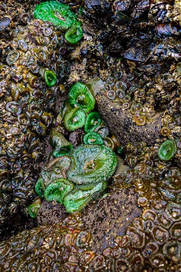
I can’t say whether or not these anemones would be as pretty on a brighter, drier day, but they were jewel-like in their emerald green tones.


Green anemone among the rocks
Emerald colored anemone among the rocks

After wandering along the beach, we decided to take a seaside hike. The description of the Clatsop Loop sounded appealing with a promise of a potential sighting of the Tillamook Rock Light (lighthouse). While we like hiking in general, the trips we enjoy most are those which have us close to the sights and sounds of nature. We did not realize the the Clatsop Loop trail would take visitors along an access road uphill. The footing was good, but we prefer wooded, non-paved terrain.

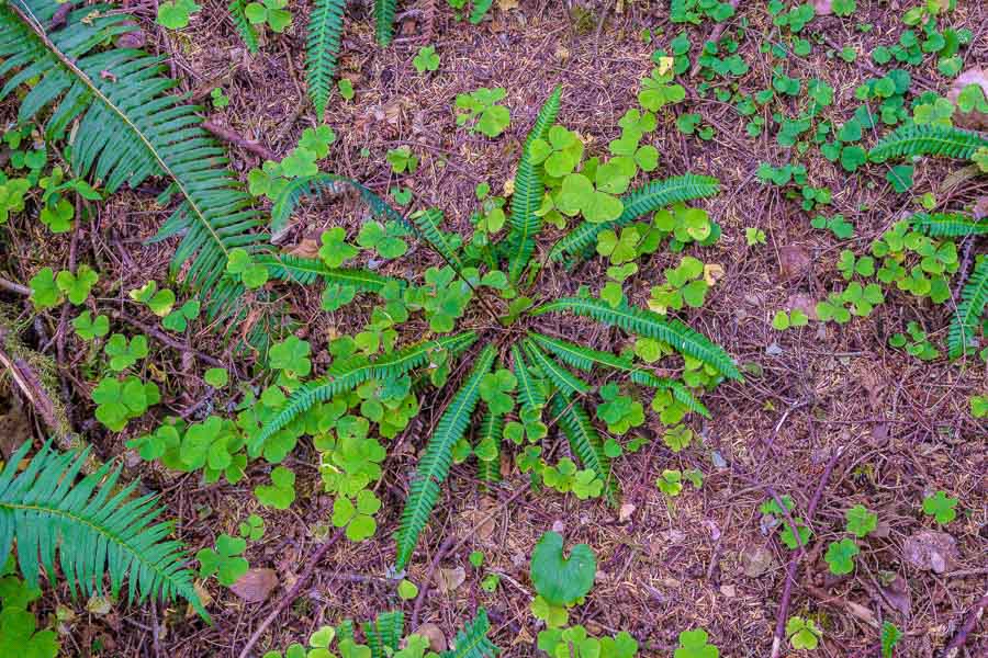
The one snap I did take along our hike uphill, was of this radiant fern among the other green vegetation and forest floor mulch.


A radiant fern along the Clatsop trail
A radiant fern seen along the Clatsop Loop Trail

The return part of the loop was much more picturesque as parts were near the shoreline or through the woods. We arrived back at the trailhead and were once again drawn to experience the changeable atmosphere of the ocean on this morning.

PS – The fog and cloudy day precluded any view of the lighthouse from the trail.


A large rock formation lined the ocean's shoreline
An abundance of large rocks along the shoreline


The seagulls continued to take advantage of the wet weather
Gulls continued to enjoy the stormy morning


Read more about Ecola State Park HERE
Read more about the Clatsop Loop Trail HERE


**********

Read previous posts about our adventures hiking and exploring in Oregon:

Exploring Astoria, Oregon – Part 1

Exploring Astoria, Oregon – Part 2

Exploring Astoria, Oregon – Part 3

Adventures in Oregon: Warrenton to Seaside


Read more Hiking and Exploration posts HERE


**********


All original content on this blog is copyrighted by Jeffrey B. Ross with ALL Rights Reserved. While reference links back to JBRish.com are appreciated and encouraged, please acquire approval for any reproduction of original content from this website.

©Jeffrey B. Ross – 2017 – JBRish.com


Hiking: Bootleggers Trail, Scottsdale, Arizona

  • Address: 31402 N. 136th St., Scottsdale, AZ
  • Hours: Sunrise to sunset daily
  • Amenities: Passenger vehicle and horse trailer parking. NO RESTROOMS OR WATER

A couple of days ago I wrote about capturing my first “decent” photograph of a Phainopepla while hiking along the Bootlegger Trail off of the Granite Mountain Trailhead which is part of the McDowell Mountain Preserve in Scottsdale, Arizona.

Kudos to the citizens of Scottsdale for fostering efforts to support the acquisition of desert lands to be kept in their natural desert form. As you may imagine the population growth in the southwest is booming and native desert is disappearing fast. Land put aside to remain undeveloped is a treasure that can be enjoyed by everyone.

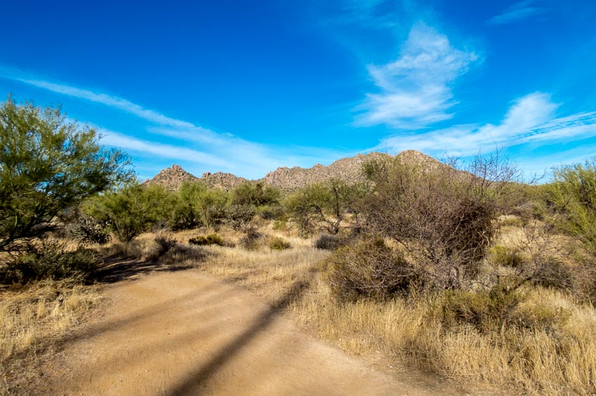
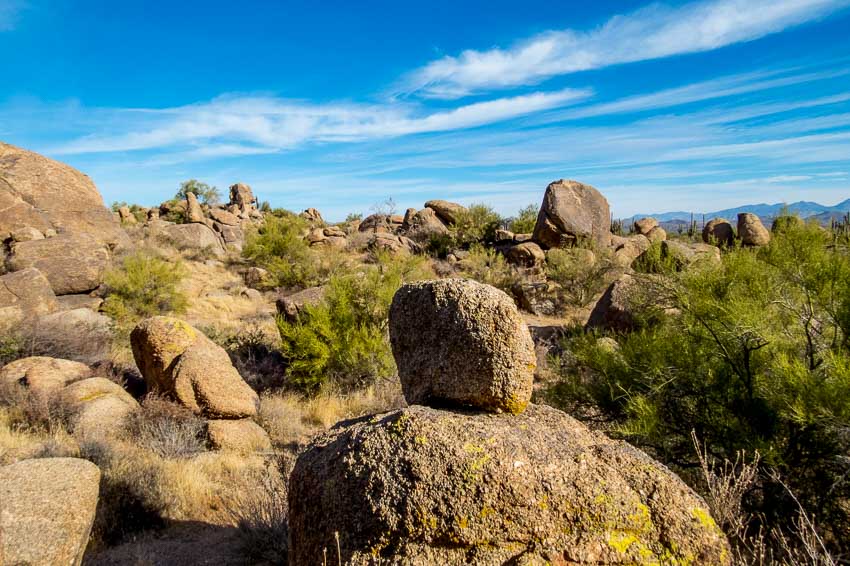
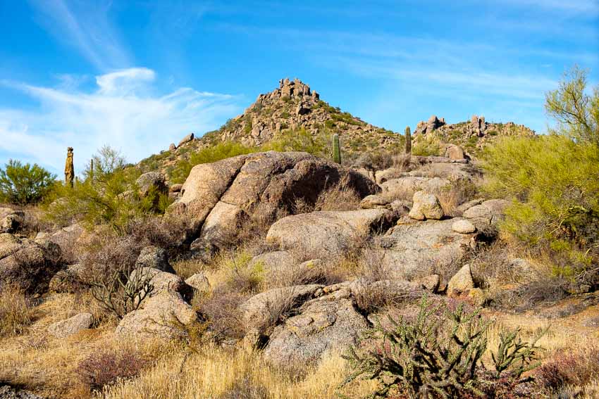
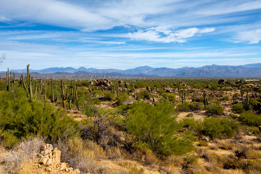
We have hiked other areas of the McDowell Mountain Presserve, but this was the first time at this particular location and we were not disappointed. Below is the view just a few yards away from the parking area.


View from the parking area

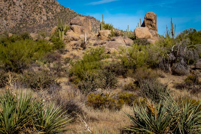
What helps to make this area somewhat unique and interesting are the boulders and boulder formations that populate the trail.


Numerous boulders along the trail

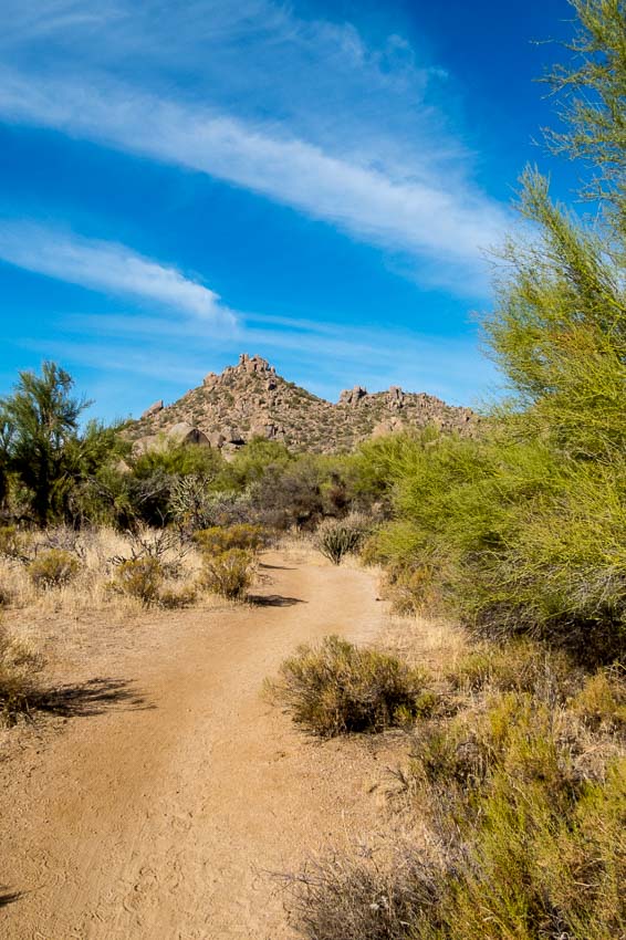
As we began to head west, the distant hills loomed large before us.


Granite hills rise up in the distance as we begin the hike.

The essence of the area really cannot be captured in individual photos so I hope the panorama below provides a sense of the expansive, hilly terrain.


A panorama reveals the full scope of the vista


To see a larger version of the panorama, click HERE

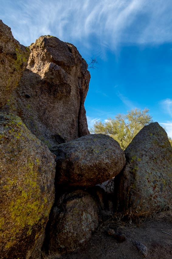
This was just one of the many boulder formations we studied as we hiked along the trail.


Interesting boulder formation

Boulder fields with rocks piled on top of each other often surrounded the trail.


Boulder fields with piles of rocks

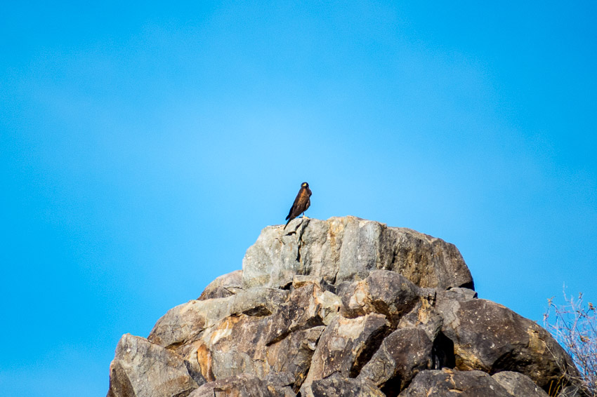
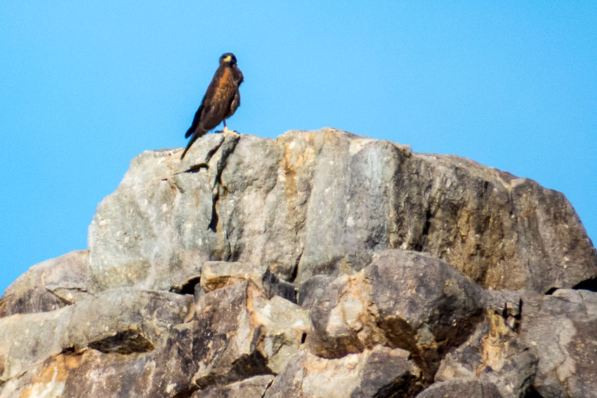
As we hiked, I spotted a bird atop the granite hill far in the distance. Unfortunately my telephoto lens was not long enough to acquire a very detailed photo, but my guess is that it was a Harris’s Hawk (see the second image).


A distant bird; I think a Harris's Hawk


Closer view of the hawk

This is a description of the Harris’s Hawk from All About Birds – Cornell Lab of Ornithology:

“A handsome hawk of the arid Southwest, Harris’s Hawk is a standout with bold markings of dark brown, chestnut red, and white, long yellow legs, and yellow markings on its face. The most social of North American raptors, these birds are often found in groups, cooperatively attending nests and hunting together as a team. When hunting, a group of hawks surround their prey, flush it for another to catch, or take turns chasing it. This hawk’s social nature and relative ease with humans has made it popular among falconers and in education programs. “

While this trail is listed as moderate, we are inclined to label it more appropriately as easy. There were some inclines and the path does lead up to the distant hills, but we didn’t find any sections that we felt were strenuous.


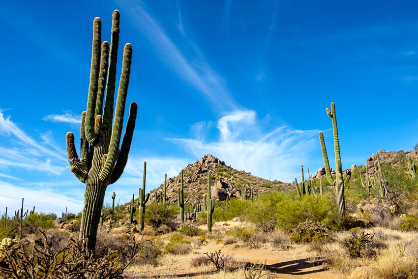
Picture of the saguaros in the foreground of the mountains


More pretty boulders with the mountains in the background

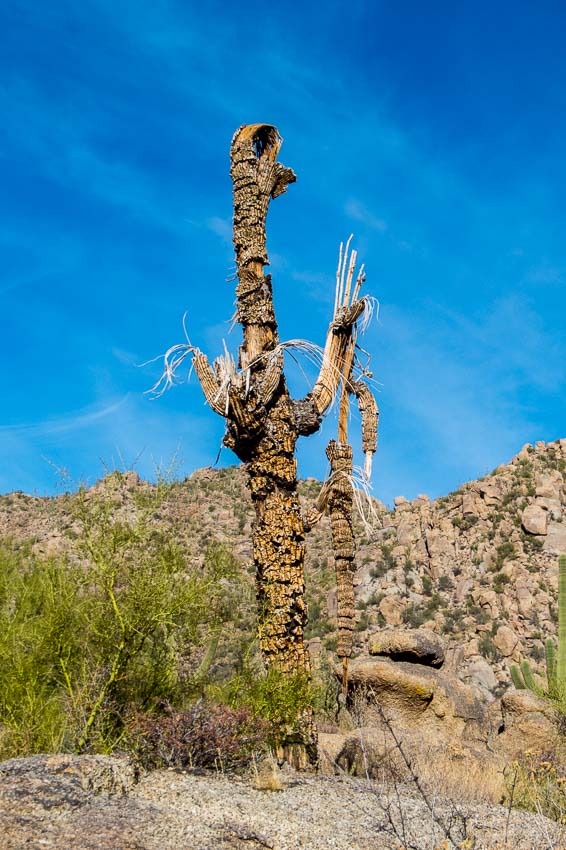
The desert is a very harsh environment and death is often in evidence. Once stately saguaros often succumb to damage or drought. Even in death, they grace the area and give evidence to the beauty that is the desert.


Dead saguaro still graces the desert

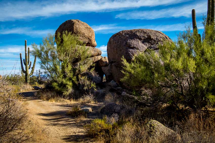
This was a lovely area with the saguaro straight ahead and the boulder formation off to the right in the shade. There was a small “window” in the bottom, middle portion of the rock formation which enabled us to get a peek of the upcoming distant vista.


A bend in the path with a saguaro and boulder formation

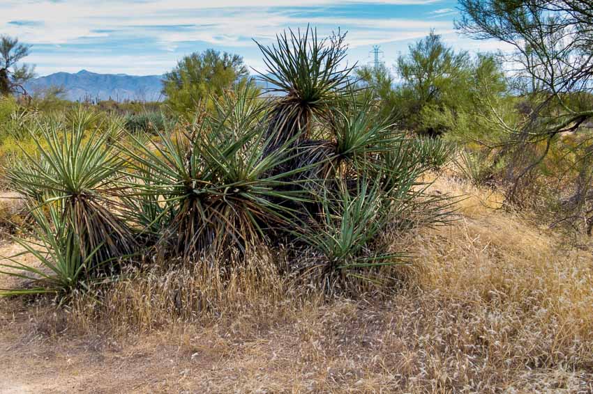
As desert gardeners and proponents of native vegetation we always enjoy seeing clusters of greenery in areas that receive scant rainfall.


Green desert plants contrast with all the brown rocks and land.

At the start of the trail and then again as hikers make their way back toward the parking area, there are distant views of desert mountains and nearby housing developments.


Another set of mountains can be seen off to the south-southeast

We plan to return to the Granite Mountain Trailhead to take other hikes that lead to different areas of this interesting region.

  • Length: 2.9 miles
  • Elevation change: 175 feet
  • Difficulty: Moderate
  • Use: hiking, biking and horseback riding


Read more Hiking and Exploration posts HERE


**********


All original content on this blog is copyrighted by Jeffrey B. Ross with ALL Rights Reserved. While reference links back to JBRish.com are appreciated and encouraged, please acquire approval for any reproduction of original content from this website.

© Jeffrey B. Ross – 2017 – JBRish.com


Adventures in Oregon: Warrenton to Seaside


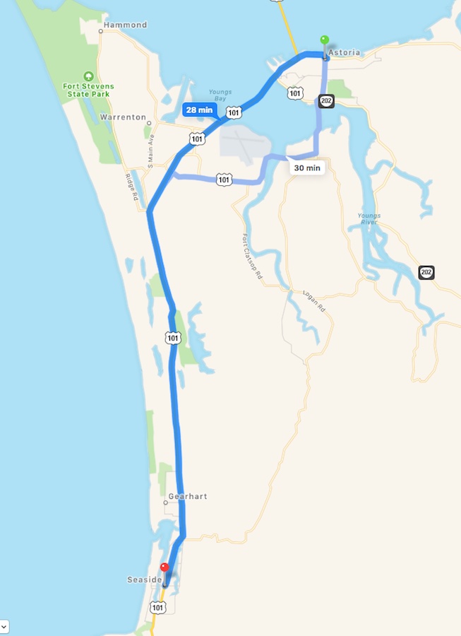
After a couple of days of adventures in and around Astoria, OR, we were heading south toward Seaside. We had our itinerary planned and were excited to begin the day’s exploits.


Map route from Astoria, OR to Seaside

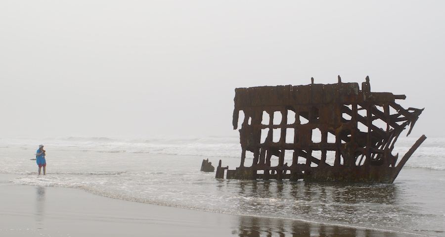
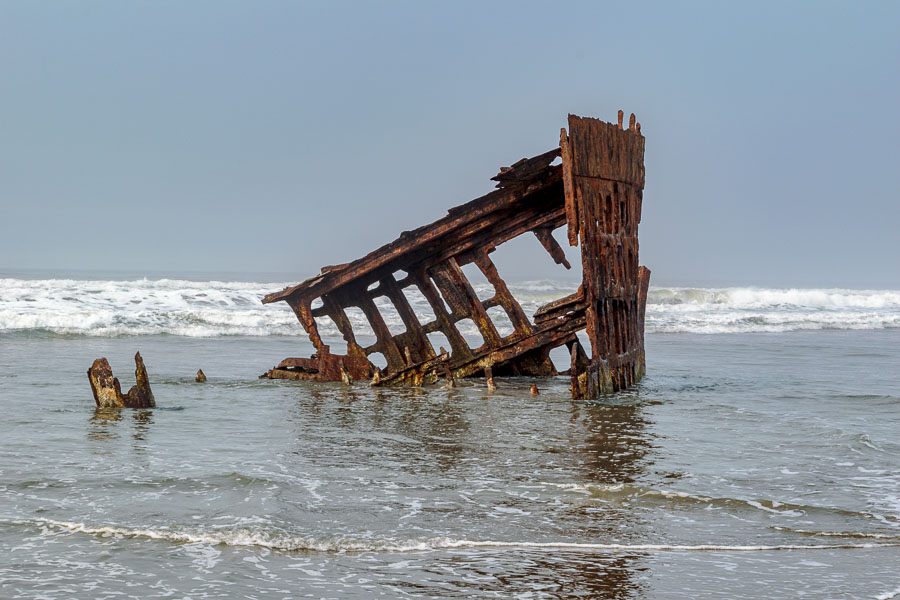
Living in the desert of Arizona we don’t often have a chance to visit shore towns and see nautical sights and the idea tha we could get a close up view of an actual shipwreck could not be resisted. The British vessel, the Peter Iredale, ran aground on October 25, 1906 on its way to the Columbia River and was abandoned near Fort Stevens in Warrenton. As you can see in the photo below, people can walk right up to the remainder of the wreck when the tide is low.


People can get very close to the remnants of the Peter Iredale

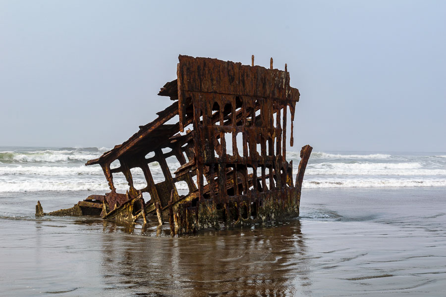
The hulk was quite impressive when considering it has been windswept and bathed in salt water for more than a century.


Remnants of the ship wreck draw visitors to the beach
The ship’s carcass remains after more than 100 years

Although this day didn’t provide the best weather, when the sun poked through visitors could appreciate the form and structure of the ship along with a stark beauty created by the rust tones against the blue-grey seascape.


Beauty amid the wreckage

At times, the crowds would grow as photographers and dog walkers visited the water’s edge to take in the sight. We soon moved to other areas of Fort Stevens State Park to continue our explorations.

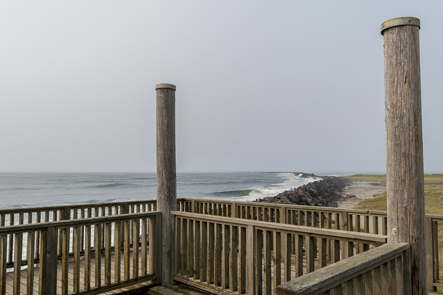
A viewing platfrom along a jetty or breakwall at Fort Stevens Park
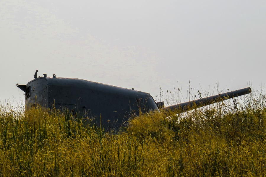
I never appreciated how much the west coast had prepared for invasion during WW II. Certainly Fort Stevens provided plenty of proof. This (below) was one of turrets that can be easily seen among the many other fortified batteries.


Defensive gun turret along America's western coast
Defensive gun turret along America’s western coast

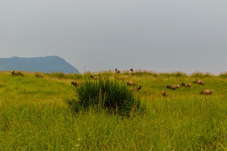
After hiking one of the major trails through Fort Stevens and gaining an understanding of the military preparations there, we made our way to another planned stop, the Necanicum Estuary near Seaside. I was hopeful that we could spot a bird or two that I would be able to mark off my birding list and indeed we did pass some birdwatchers eyeing a Cedar Waxwing. Much to our surprise, it wasn’t birds that caught our attention…

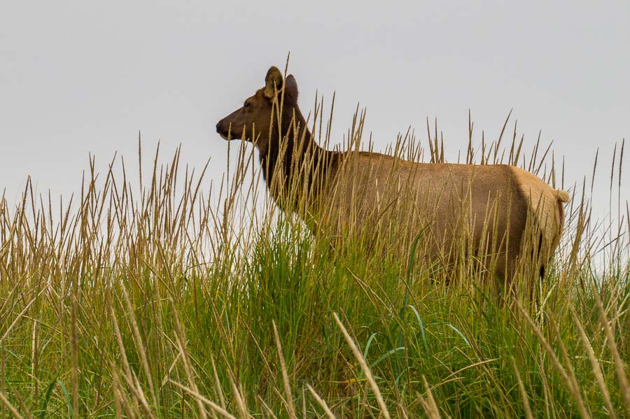
Roosevelt Elk along coastal Oregon

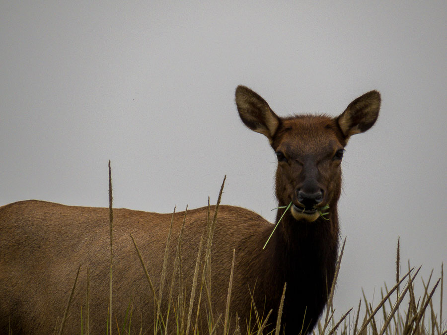
… there was a herd of elk. They were quite numerous. One doe found us interesting, but not enough to stop eating.


An elk doe eats as she watches us walk along the path

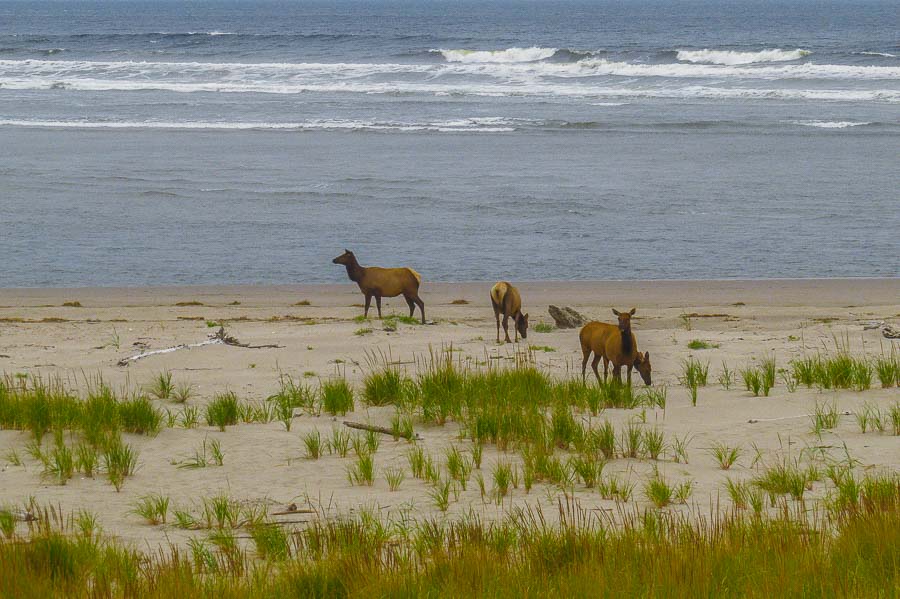
We found ourselves in an unusual and unexpected situation as the hiking path we used to get to the bay was soon surrounded by the herd. A few males, which can weigh nearly a half a ton, were not happy that we were among their harem. We carefully made our way to the shoreline. There were some does there as well, but only a few.


Elk along the shore
Elk along the shore

Another doe nearby looked on as we approached the beach.


Another doe watched as we walked to the beach

We were able to circle around to find a clear way back to the parking area and were glad to arrive safely at the car to head to our evening’s accommodations.


More information about the Peter Iredale shipwereck

Learn more about the elk at Gerhart’s preserve

Read more about the Necanicum Estuary in Seaside


**********

Read previous posts about our adventures hiking and exploring in Oregon:

Exploring Astoria, Oregon – Part 1

Exploring Astoria, Oregon – Part 2

Exploring Astoria, Oregon – Part 3


Read more Hiking and Exploration posts HERE


**********


All original content on this blog is copyrighted by Jeffrey B. Ross with ALL Rights Reserved. While reference links back to JBRish.com are appreciated and encouraged, please acquire approval for any reproduction of original content from this website.

©Jeffrey B. Ross – 2017 – JBRish.com


Exploring Astoria, Oregon – Part 3

We planned two days for our stay in Astoria, OR and as our visit to this river town was coming to an end, we wished we had planned a bit more time to further examine the nooks and crannies of this historic area.


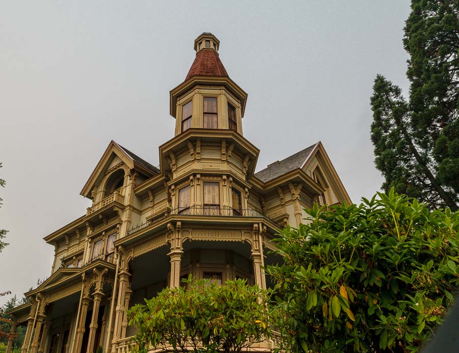
Exterior of the Flavel House Museum

One of the attractions of Astoria is the interesting architecture to be found in different parts of town. The notable Flavel House and Mueseum is a restored Victorian mansion that offers a self-guided tour with exhibits of period decor and Queen Anne era trappings,.

Read More about the Flavel House HERE.


Victorian features of the Flavel House Museum

Among the other noted buildings is the restored Liberty Theater, part of the Astor Building, showing its Italian Renaissance facade. The theater now serves as a premier showcase for a variety of arts including films, performing arts and student productions.

Read more about the restoration HERE.


Exterior facade of the Liberty Theater

The star of the town, however, is the Columbia River and a stroll along the waterfront properties will provide many opportunities for exploration and appreciation. This mural on the side of one of the larger riverside buildings was quite entertaining especially because we are fond of cats; dogs too!


Astoria riverside building mural as art
Mural by Jo Brown behind the Sears Store via

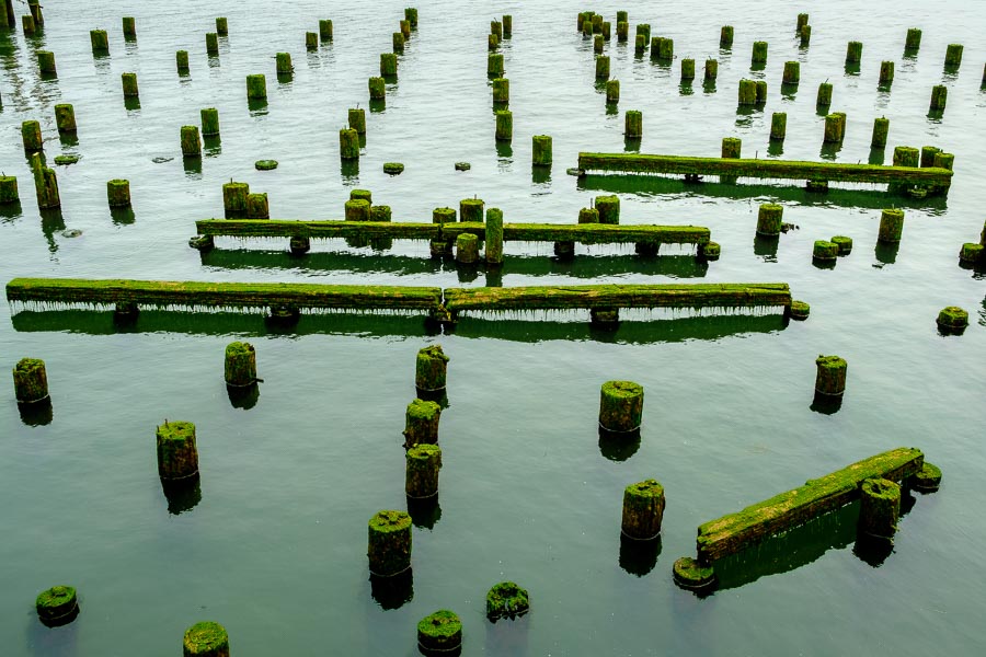
The remnants of once bustling piers hint at the extent to which Astoria was a waterfront mecca at one time.


Remnants of once bustling pier

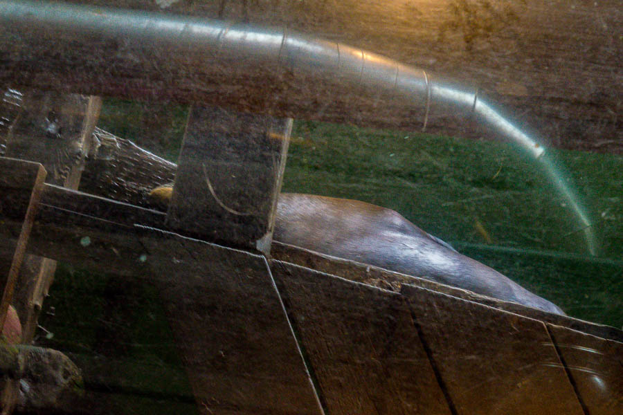
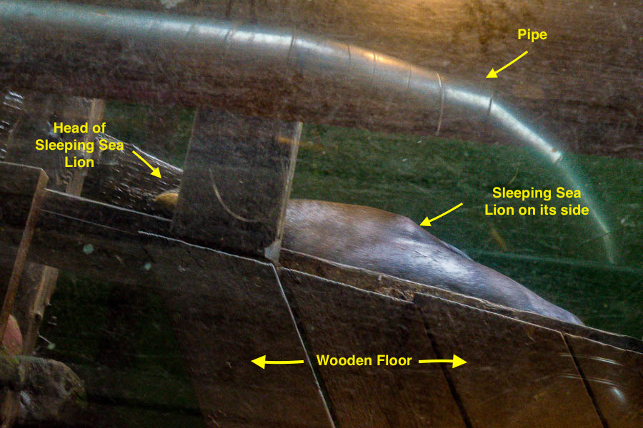
We read about a couple of restaurants in town that provide glass windows in their floors to show diners the seals that come to rest under the pier. One such eatery was the Buoy Beer Company. We had fish and chips which were quite good and took a look at their lone slumberer which may be hard to discern.


Sea Lion visualized through window in restaurant floor
alt=”Sea Lion visualized through window in restaurant floor”

If you had trouble visualizing the sea lion, here are some highlighted details:


Sea Lion visualized through window in restaurant floor
Sea Lion visualized through window in restaurant floor – notations

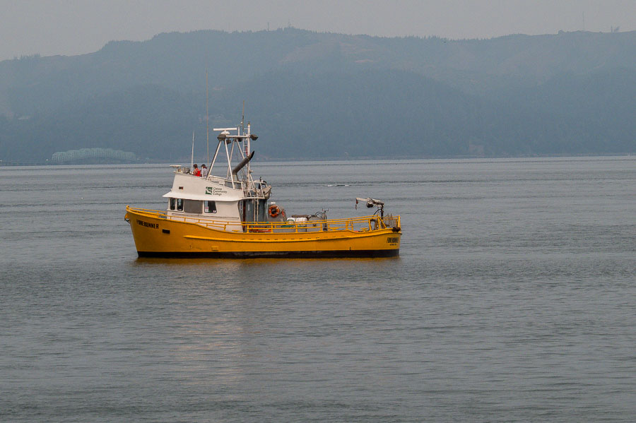
While we were dining, we were able to watch the boats…


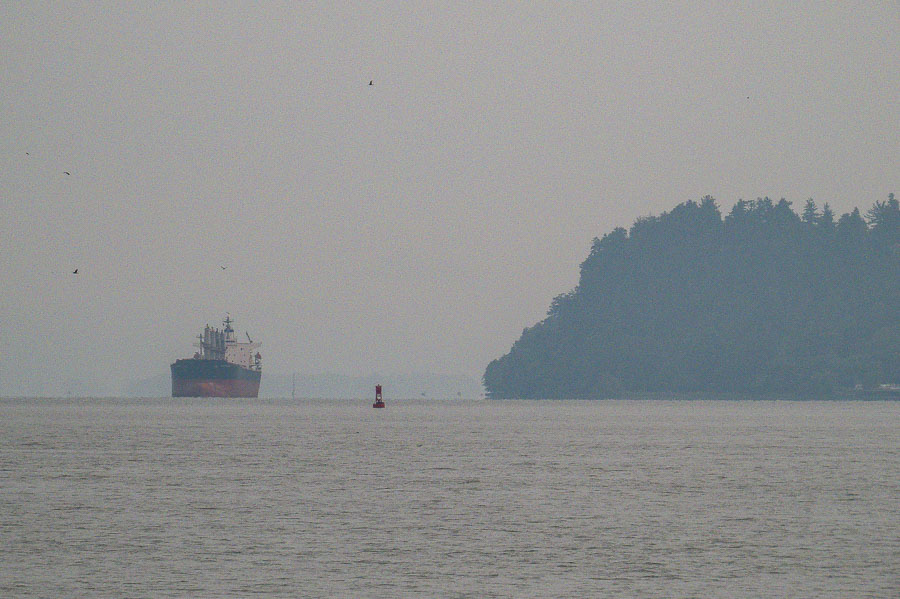
Boats busy studying and working along the Columbia River

and ships go sailing by.


Ships moving up and down the Columbia River

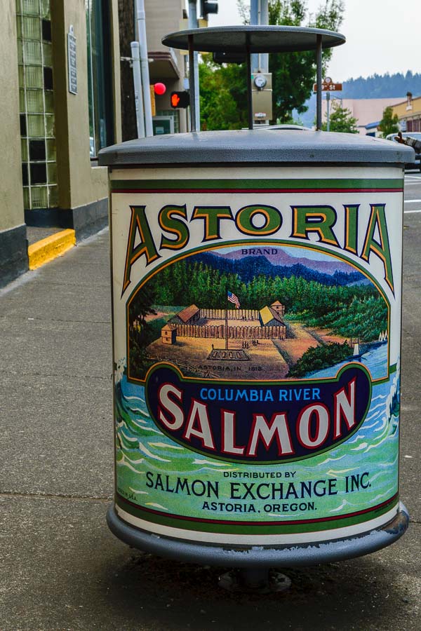
One could probably create a picture essay of just the interesting and historic-inspired trash cans found along the streets of this former fishing village.


Artistic trash can depicts a historic scene

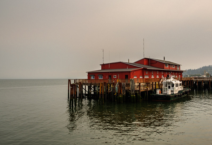
Although the weather was not ideal and the northern fires left the skies darkened, this picturesque area of Oregon provided a wonderful start to our exploration of the coastline


Picturesque riverside scene
picturesque riverside scene


**********

Read previous posts about our adventures hiking and exploring in Oregon:

Exploring Astoria, Oregon – Part 1

Exploring Astoria, Oregon – Part 2


Read more Hiking and Exploration posts HERE


**********


All original content on this blog is copyrighted by Jeffrey B. Ross with ALL Rights Reserved. While reference links back to JBRish.com are appreciated and encouraged, please acquire approval for any reproduction of original content from this website.

©Jeffrey B. Ross – 2017 – JBRish.com


Exploring Astoria, Oregon – Part 2

As I mentioned in my previous post (see link below), we found much to do during our August, 2017 visit to Astoria, OR. We continued to explore the town and the nearby riverfront. The morning was very hazy/foggy; some of it caused by the abundant wildfires in surrounding areas.

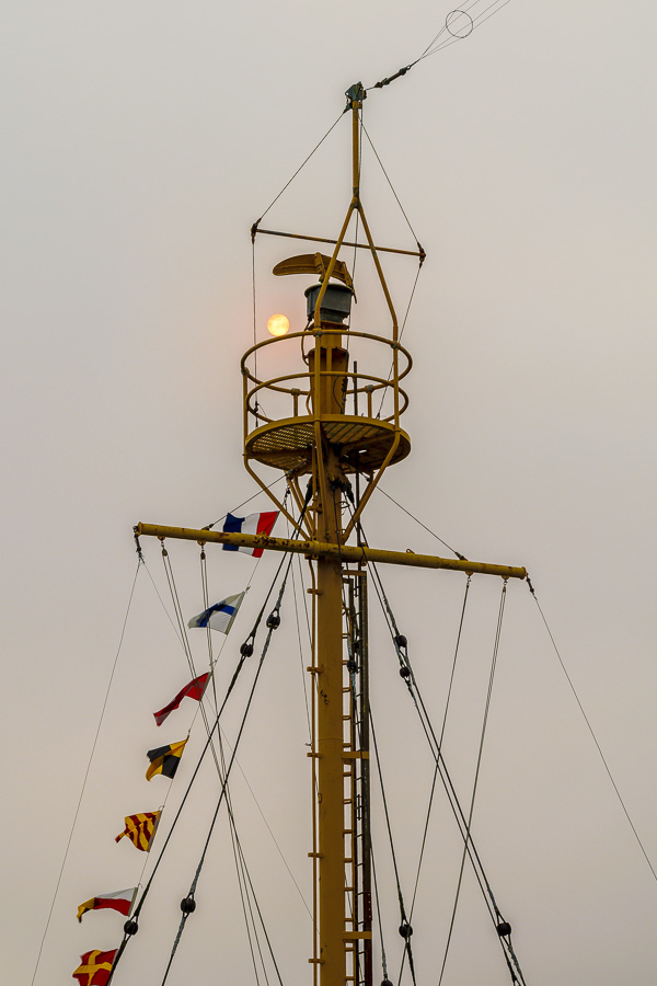
Walking by the river, there were many scenes I found picture-worthy such as this shot of the sun poking out behind the crows nest of a small ship.


Waterfront ship's crows nest with sun

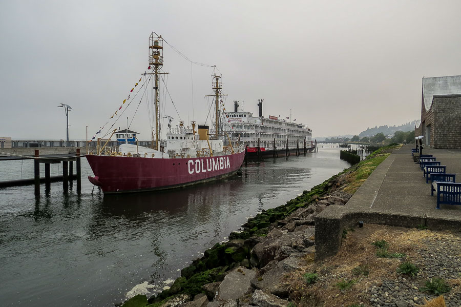
We were interested in a paddle wheeler, the American Empress, that was moored at a nearby dock. We headed toward the ship and met two passengers along the way. They explained that the steamship was sidelined because of the wildfires and was “stuck” in Astoria until the air quality and wildfires improved enough for them to head upriver.


Paddleboat Steamship anchored in Astoria

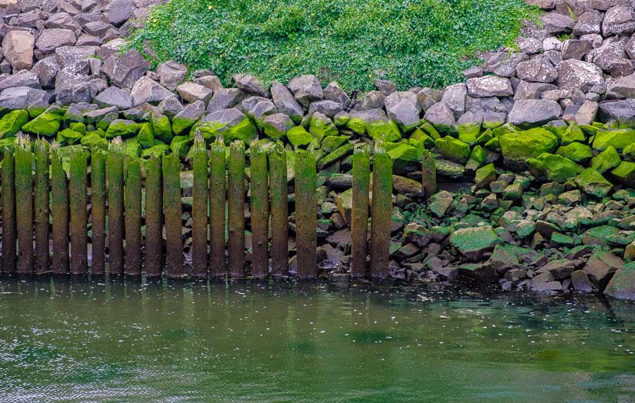
Even the moss covered pylons against the mossy green and grey of the rocks led to a few colorful snaps.


Moss covered rocks and pilons create a colorful scene

We often enjoy speaking with the agents at the local visitor’s center and I need to brag about the Astoria staff and facility. They had many varied and interesting resources and we enjoyed learning about some of the local favorites uncovered through our questioning of the agents. The bus below was parked outside and little did I know it was the living quarters of someone and not an attraction; sorry!


Fanciful bus outside the visitor's center

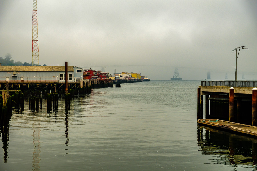
Even with the fog, the aura of the waterfront was alluring and picturesque.


The fog created an eeerie waterfront mood

We read about the Astoria Column and the staff at the visitor’s center encouraged us to visit. There is a small parking fee of $5 that covers a year of parking. The car ride was uphill and the road to the tower was curvy. The column was constructed 600 feet above sea level on Coxcomb Hill. It is 125 feet high and those electing to ascend it will need to climb 164 steps.

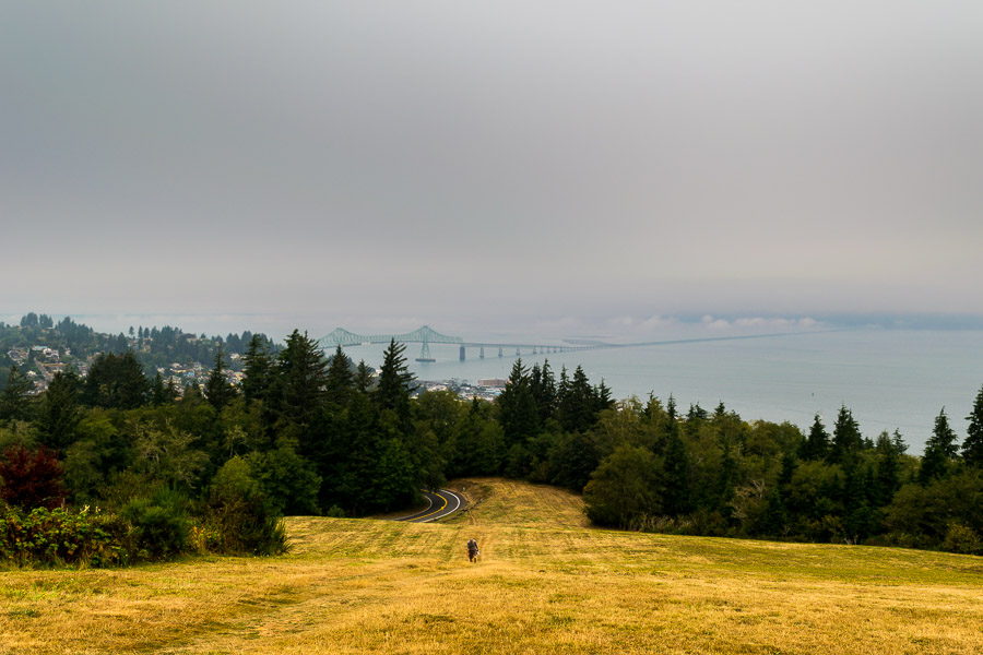
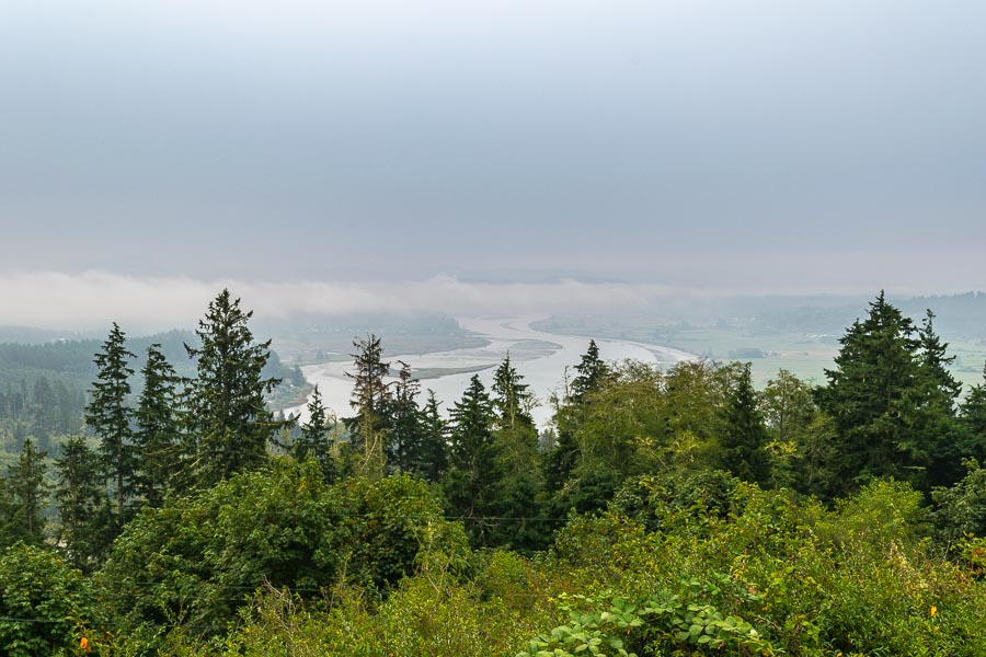
Once in the parking area, you can look around and notice some of the sights Astoria has to offer. The view below shows the Megler Bridge partially covered by fog.


walking up the hill to the Astoria Column

You can see a person walking to the tower. If you don’t need to park, the visit is free!

Below is another view from the parking area.


Another view from the Astoria Column's parking area

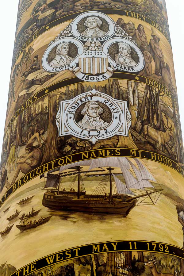
Leaving the car, we hiked up the small hill to the base of the tower that commemorates the major events in Astoria history.


A closeup of the lower portion of the Astoria Column

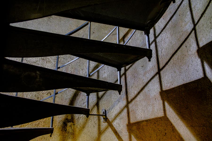
It took a while to ascend the tower’s steps, but it really wasn’t too difficult (IMO).


Asotria Column circular stairway

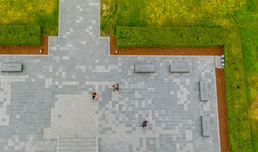
The bird’s-eye view afforded by the column’s vantage point was very interesting.


Bird's-eye view from the top of the Astorial Column

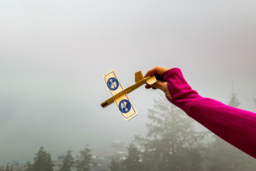
There was a young man doing his morning exercises on the grounds and he ran up the tower and handed small, wooden gliders to the visitors so they could be tossed into the wind. He explained that he will later go around to collect them.


Small model gliders flung from the top of the Astoria Column

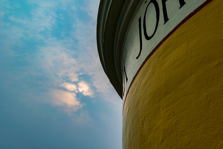
I enjoyed this view (below) of the tower against the cloudy blue-grey sky.


Partial closeup view of the top of the Astoria Column

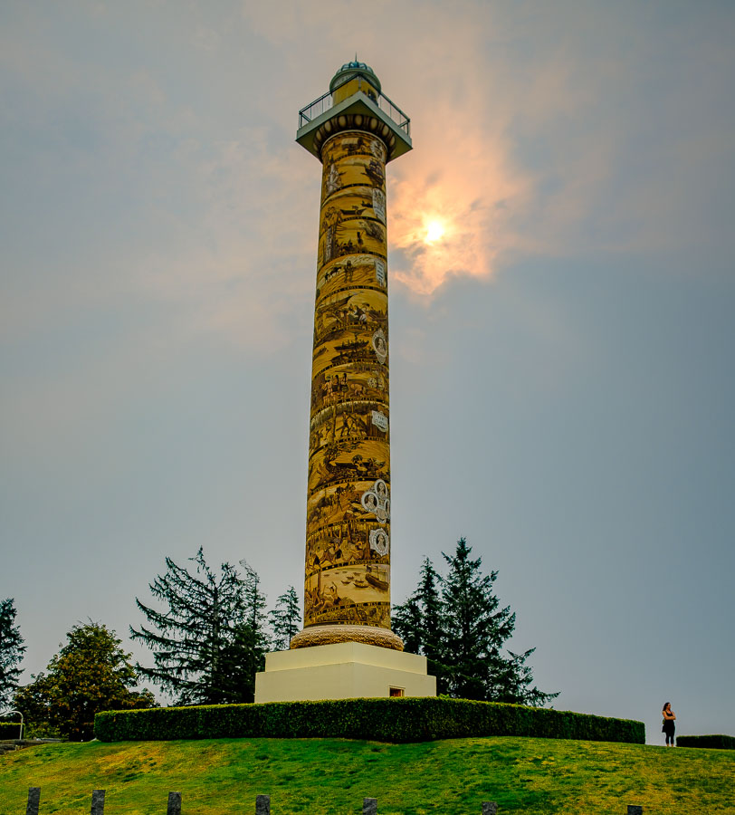
I can recommend a visit to the tower if you are in the area. There is a small gift shop and I am sure when the skies are bluer and brighter, the views will be even better.


Moody sky and visitor at the Astoria Column

Here is a short paragraph from the Astoria Column Website Organization’s webpage:

“Standing above the city–600 feet above sea level to be exact–the Astoria Column unleashes an unrivaled view of Young’s Bay, the Coast Range, the mighty Columbia River, and in the distance—the Pacific Ocean. Its light shines each night as a silent testament to the pride, fortitude, and resolve of the people who settled the Pacific Northwest, and to those who live here today.”

This was just a small portion of our day exploring Astoria. JBRish.com will soon have more stories about Astoria and other adventures in Oregon.


**********

Read previous posts about our adventures hiking and exploring in Oregon:


Read more Hiking and Exploration posts HERE


**********


All original content on this blog is copyrighted by Jeffrey B. Ross with ALL Rights Reserved. While reference links back to JBRish.com are appreciated and encouraged, please acquire approval for any reproduction of original content from this website.

©Jeffrey B. Ross – 2017 – JBRish.com


Hiking: Brins Mesa – Sedona, AZ


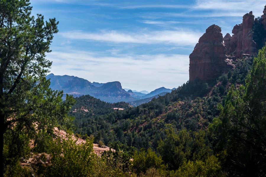
along the Brins Mesa Trail - Sedona, AZ

Years ago we tried to hike the Brins Mesa trail with some visiting friends, but they weren’t hikers and soon decided that they weren’t prepared for the adventure so we returned to the car to visit other nearby and easily accessible vistas.

The Brins Mesa trail is probably best described as moderate to a bit more than moderate (at times). The trail is relatively well marked, but it is primarily uphill if you are starting from the main trailhead at the outskirts of town.

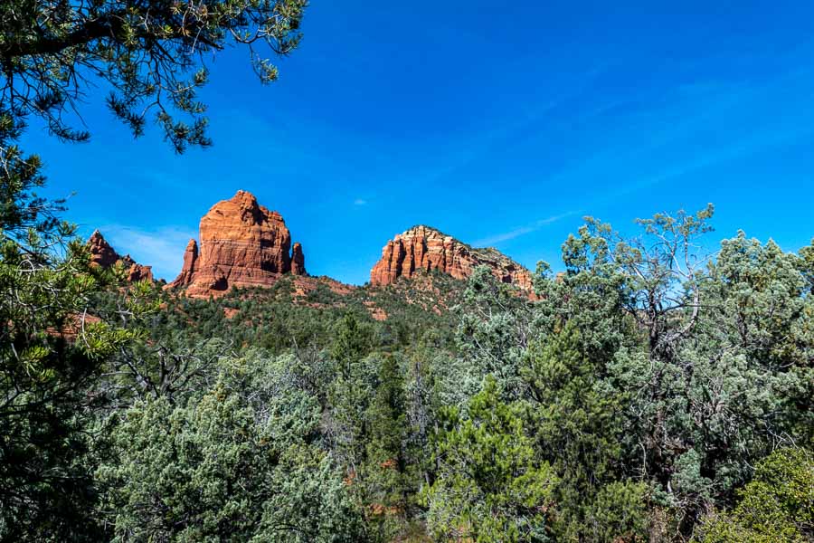
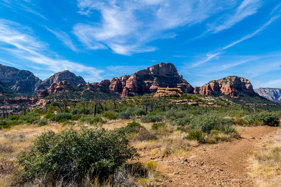
Soon after starting the climb, this is one of the scenes you will see.


along the Brins Mesa Trail - Sedona, AZ

One of the reasons for undertaking this hike is to admire the beautiful scenery and red rock vistas encountered along the entire trail.

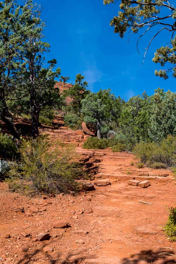
There are what has been referred to as “natural stairs,” but the operative word there is natural. Creating steps from a rock face formed by nature is no easy task and as you might imagine, the spacing is not always ideal. Hiking sticks may be helpful for those who are less sure-footed.


along the Brins Mesa Trail - Sedona, AZ

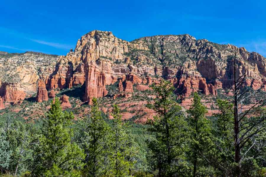
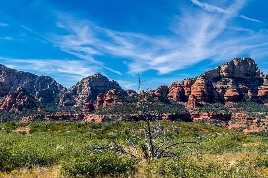
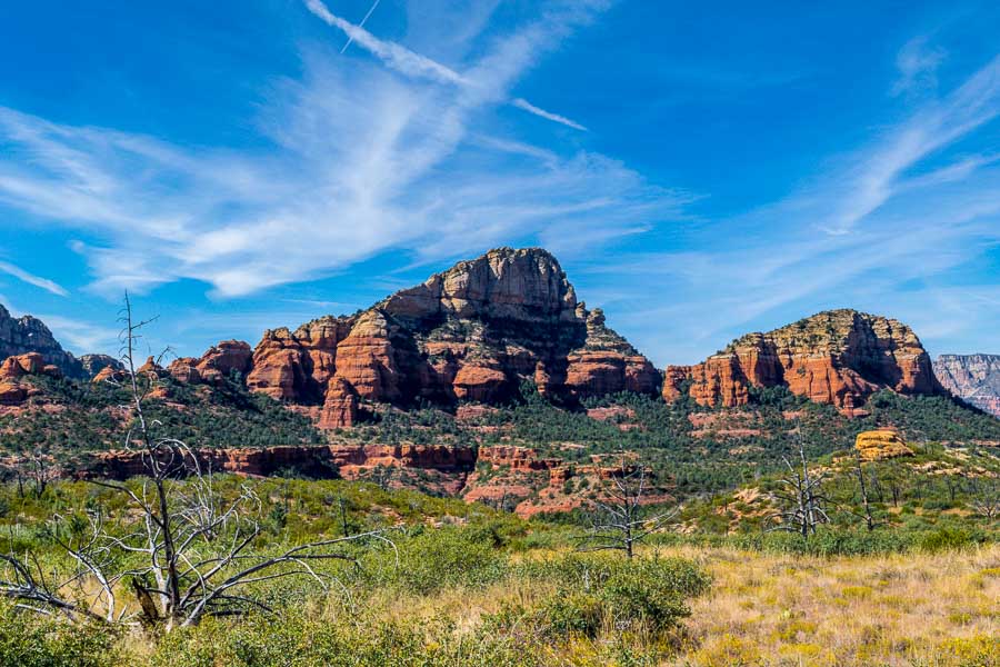
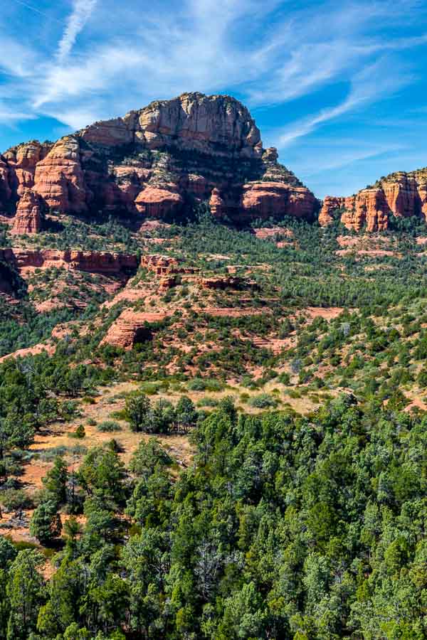
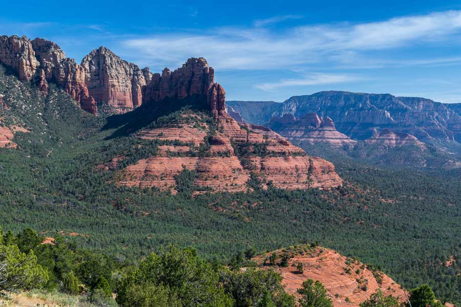
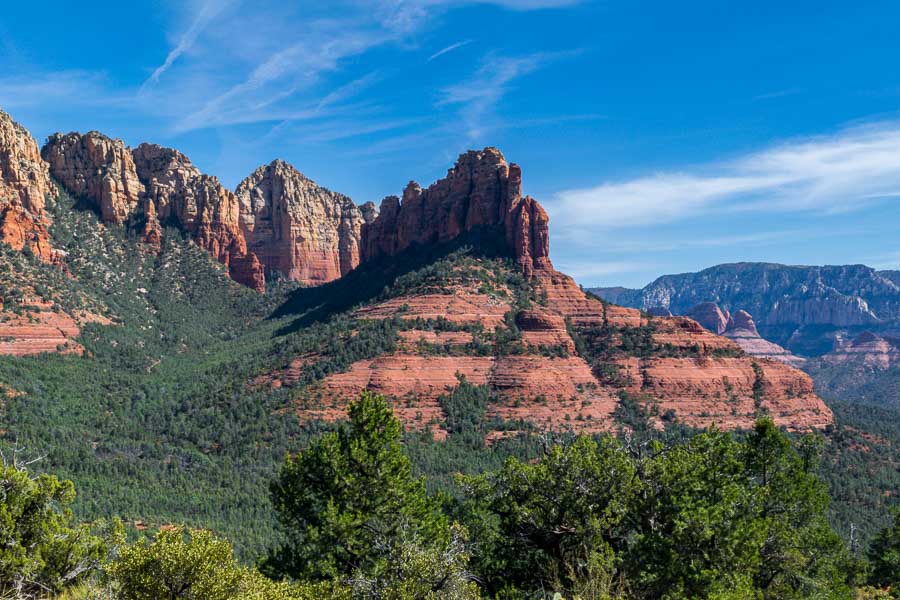
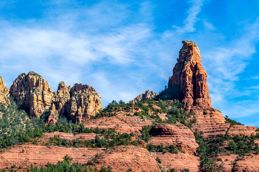
In almost every direction, the red and sand-colored rocks rise above the trees to the wonder and appreciation of trailblazers.


along the Brins Mesa Trail - Sedona, AZ

You don’t see the mesa itself for a while, but persevere and you will come to a shelf-like geological feature that is the Brins Mesa (pictured below).


along the Brins Mesa Trail - Sedona, AZ

It is unfortunate that years ago there was a fire that destroyed many of the trees and the carcasses of those sentinels can be seen along the mesa’s trail.


along the Brins Mesa Trail - Sedona, AZ


along the Brins Mesa Trail - Sedona, AZ

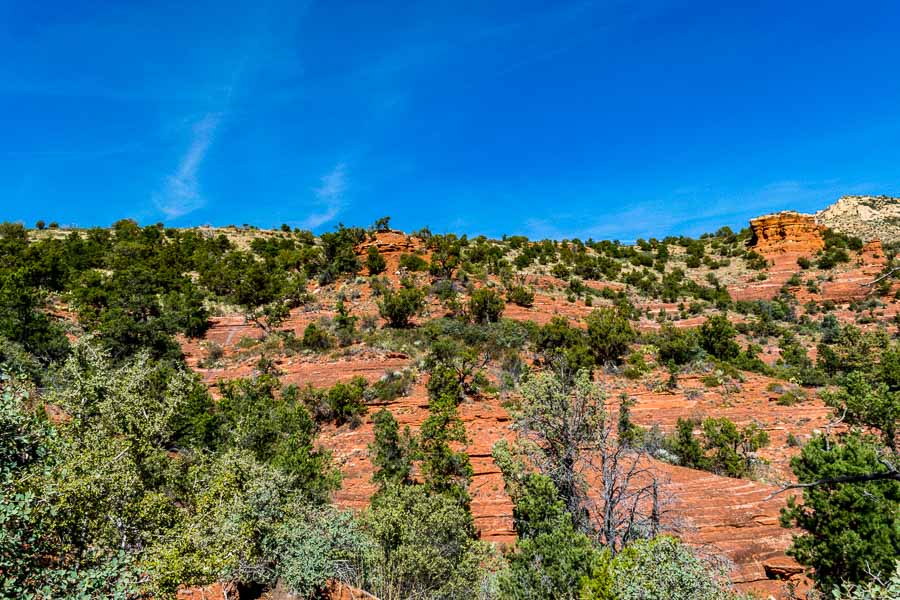
For those who enjoy photography, there are numerous opportunities to capture memorable landscapes.


along the Brins Mesa Trail - Sedona, AZ

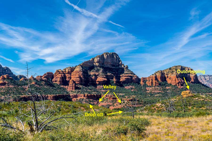
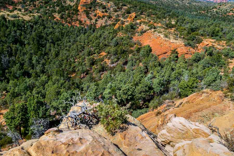
As we were hiking along the trail, we noticed what looked like a ledge (drop off) and a valley. We also spotted an outcropping or rather a small hill and we decided to explore. There is a trail leading in that general direction.


along the Brins Mesa Trail - Sedona, AZ

The picture below was taken while I was standing at the ledge. Notice the darker, reddish dirt in the valley.


along the Brins Mesa Trail - Sedona, AZ

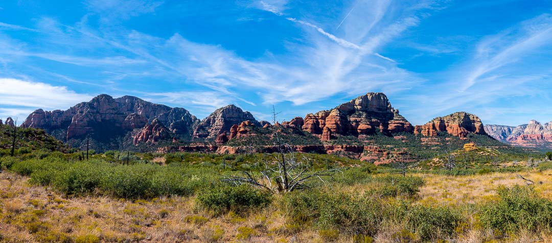
I took a couple of panoramas (linked below) as the red rock mountains were spread out before me. It was too wide and too beautiful for me to capture in just one or two pictures. After some exploration and appreciatiion, we decided to return to the trailhead. Although it was mid-October, the day was quite warm and we had a long day. This is the scene looking back toward the ridge and surrounding mountains.


along the Brins Mesa Trail - Sedona, AZ

One rule of photography is to look behind you as you travel because sometimes, the best view is not in front, but in back. When returning along the same trail, this maxim becomes self-fulfilling. These are a few of the pretty formations we captured during the return to the trailhead.


along the Brins Mesa Trail - Sedona, AZ


along the Brins Mesa Trail - Sedona, AZ

Famous Bell Rock can be seen in the center of the photo below where the sky seems to meet the low-lying structure. It is hard to pick out, but look for the little nub on top.


along the Brins Mesa Trail - Sedona, AZ

Red rock spires and hoodoos (column of rock) are abundant.


along the Brins Mesa Trail - Sedona, AZ

Here are the two panoramas…


along the Brins Mesa Trail - Sedona, AZ

To see a larger photo of the scene, make your browser window larger and click HERE


along the Brins Mesa Trail - Sedona, AZ

To see a larger photo of the scene, make our browser window larger and click HERE

More information about the Brins Mesa trail can be found at the following links:

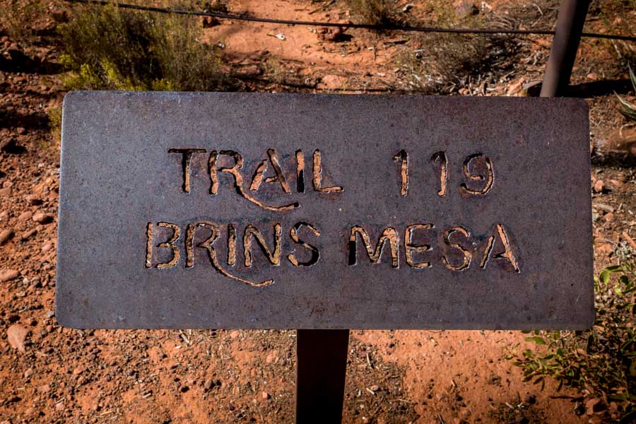
Brins Mesa Trail No. 119 – Forest Service (USDA)

Brins Mesa Trail – AZ Highways


Read more Hiking and Exploration posts HERE


**********


All original content on this blog is copyrighted by Jeffrey B. Ross with ALL Rights Reserved. While reference links back to JBRish.com are appreciated and encouraged, please acquire approval for any reproduction of original content from this website.

©Jeffrey B. Ross – 2017 – JBRish.com


Exploring Astoria, Oregon – Part 1


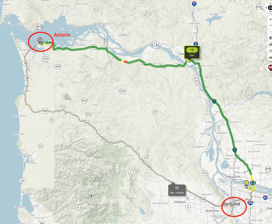
Map route from Portland to Astoria, OR
Map route from Portland to Astoria, OR – Green

As part of our “hike while you still can” regimen, my wife and I decided to schedule a hiking vacation along the coast of Oregon and then on to Crater Lake for September, 2017. Even before we landed at Portland International Airport, we could smell fire in the airplane. We knew it wasn’t the Boeing, but the fires breaking out all over Oregon which tainted the air.

We retrieved our luggage and made a beeline for the car rental counter. After dusting the ash off of our suitcases and getting the trunk of the car packed, we headed toward the Oregon coast and the town of Astoria.

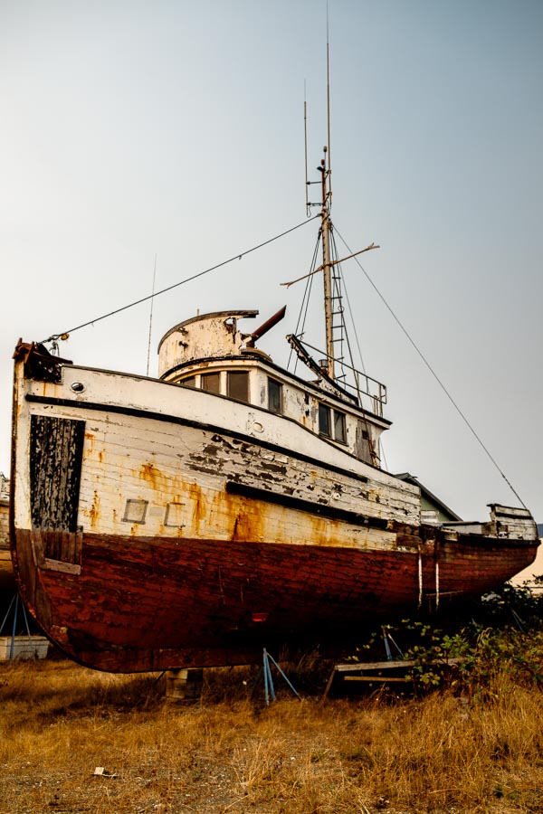
Astoria is a river town sharing space along the Columbia River and it has the requisite trappings of a riverside town. Our hotel was just yards from a shipyard with a number of ships and boats in a variety of conditions. The sun was setting and I was tired, but I couldn’t resist the photographic opportunities. I took my Fuji X-T2 and snapped just two pictures.


Shipyard along the Columbia River, Astoria Oregon
Shipyard along the Columbia River

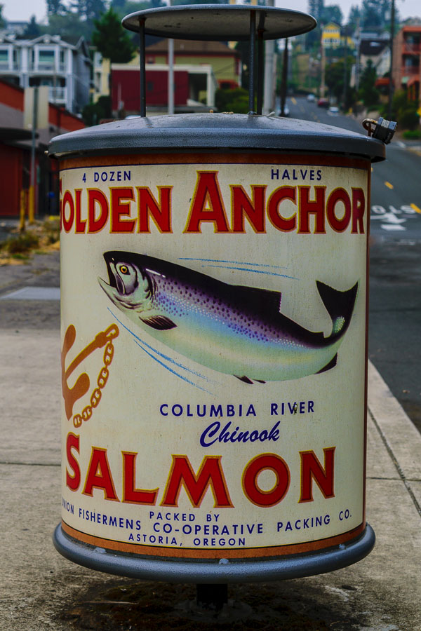
A better image of the boat above appears in my previous post Fuji X T-2: The Magic of Beginnings. We enjoy walking around towns and discovering the variety of shops and sights. As we explored the streets the next day, the reminders that this was a fishing and river town were abundant.


Salmon-themed trash can - Astoria, Oregon
Salmon-themed trash can

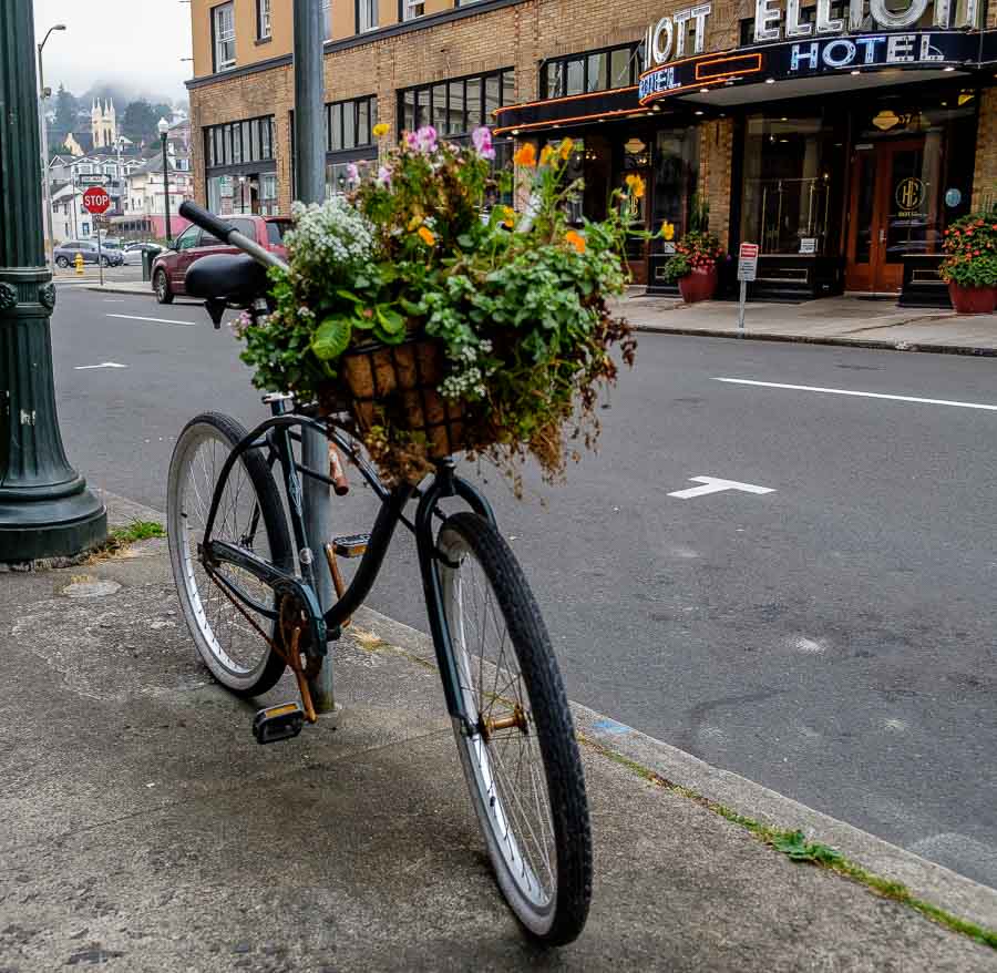
The antique shops, cafes and other stores proudly adorned their windows with sailing memorabilia and accessories. There were a number of “general” decorative touches along the sidewalks as well.


Bicycle planter along 12th Street - Astoria, Oregon
Bicycle planter along 12th Street

Our first major stop was the Garden of Surging Waves. This was a small, inner city park celebrating Astoria’s Chinese heritage dating back to the days of John Jacob Astor. Interestingly, “The Chinese written characters for the words ‘surging wave’ are also used to express hardship and struggle — experiences shared by many of America’s early immigrant groups.” *
* Read more about the Garden of Surging Waves and HERE.

We entered the garden, part of Astoria’s Heritage Square project, through the Moon Gate which appeared to be the main entrance although there are a number of entryways. The ironwork was bold and attractive.


Traditional Moon Gate entrance to the Garden of Surging Waves - Astoria, Oregon
Traditional Moon Gate entrance to the Garden of Surging Waves

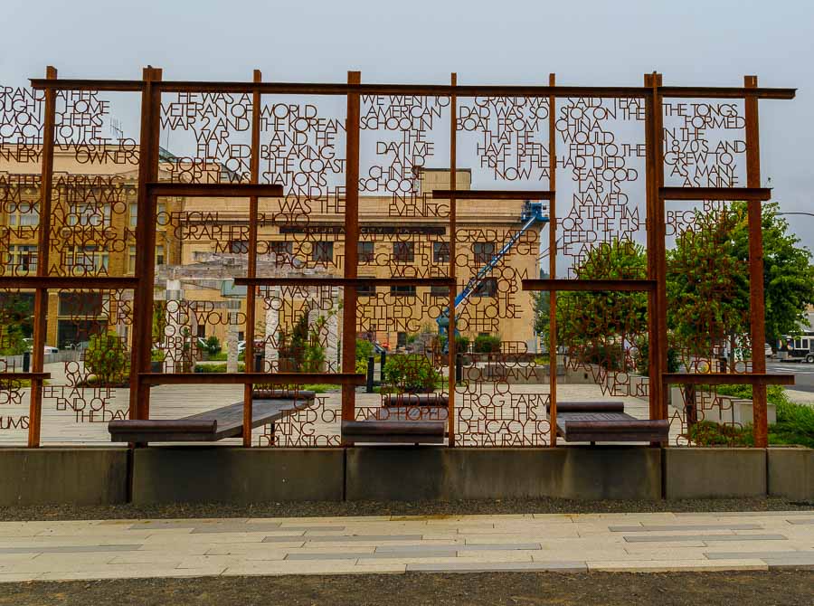
The ironwork not only serves as an entry, but also a story screen. There are a multitude of quotes and phrases related to the experience of the Chinese families and workers who helped to build the town of Astoria.

One touching quote appearing in the picture below, across two vertical sections, reads:

“Grandma said that Dad was so sick on the boat from China that he would have been fed to the fish if he had died. Now a seafood lab is named after him for the fish feed that he and his team developed.”


Part of a story screen near the entrance to the Garden of Surging Waves - Astoria, Oregon
Part of a story screen near the entrance to the Garden of Surging Waves”

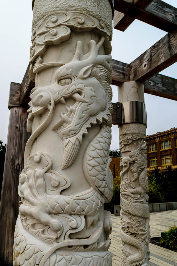
There are granite columns carved with traditional dragon, Chinese cloud and ocean wave symbols.


Traditional dragon columns of the central pavilion at the Garden of Surging Waves - Astoria, Oregon
Traditional dragon columns of the central pavilion at the Garden of Surging Waves

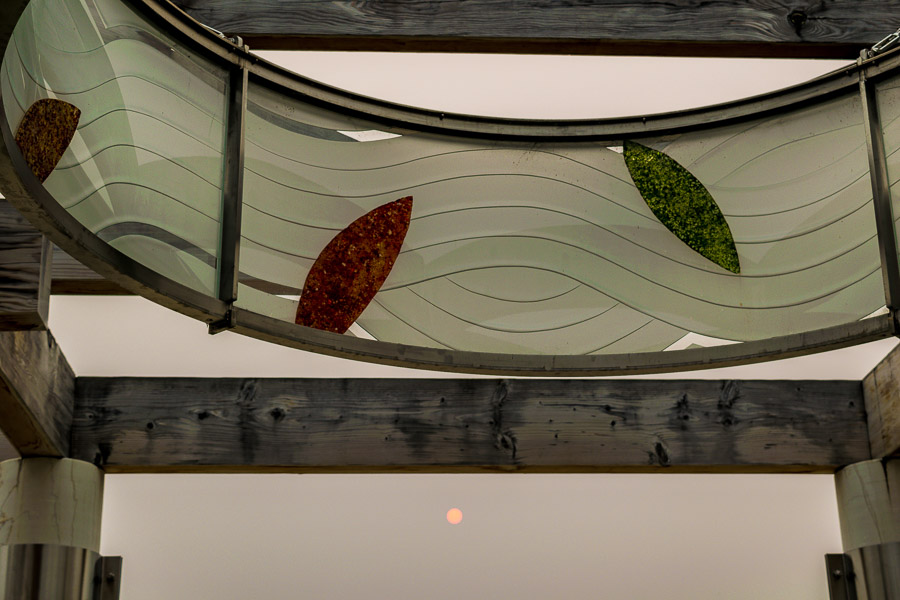
The columns hold a series of wooden beams which in turn serve to frame a colorful stained glass crown-like structure. Although the day was grey, the sun did try to poke through as we stood in the open air pavilion.


Circular glass artwork at the central pavilion at the Garden of Surging Waves - Astoria, Oregon
Traditional dragon columns of the central pavilion

Further investigation led us to a large cast bronze lantern in the style of an incense burner which depicts characters in a story about a mythical dragon and a wise monkey. You can read about the statue and myth HERE. This was our last stop in the garden before we headed for 11th St. and more discoveries.


Cast bronze lantern in the style of an incense burner at the Garden of Surging Waves - Astoria, Oregon
Cast bronze lantern in the style of an incense burner

This was just a small portion of our day exploring Astoria. JBRish.com will soon have more stories about Astoria and other adventures in Oregon.


Read more Hiking and Exploration posts HERE


**********


All original content on this blog is copyrighted by Jeffrey B. Ross with ALL Rights Reserved. While reference links back to JBRish.com are appreciated and encouraged, please acquire approval for any reproduction of original content from this website.

©Jeffrey B. Ross – 2017


Photography and Birding: Good Photo, Bad Photo

Introduction

We were recently visiting Sequoia & Kings Canyon National Parks on one of our bi-yearly hiking vacations where we take to America’s beautiful national parks and spend a week or so hiking up and down mountains and admiring as many beautiful and natural areas as possible during the time we have set aside.

As stated on this blog before, I am an occasional bird watcher. For those who are just chiming in, I enjoy locating and identifying birds especially when I am in a new area. Here’s my problem…I am not a very well educated birder. I am a rank novice, but I don’t let that discourage me.

How I Bird

Here is my approach. A couple of years ago, I purchased a bridge camera with a long zoom lens. It has the equivalent of a 24-1200mm lens on a 35mm camera. That is a long zoom and it allows me to photograph birds at quite a distance. Truth must be told here…I can’t say this is a great camera. It is a good camera and certainly good enough for me. When I chose the Canon SX50 HS, it was a “cost-benefit” decision. In other words, it was a camera that had what I wanted at a price I thought was reasonable and I was willing to compromise a bit on picture quality.

That being said, it has done most of what I asked of it. The one thing I now know that I didn’t know before is that it has a relatively slow autofocus and doesn’t always select the object of my photographic desire. Even the best cameras, costing ten times more than my selection, have misfires as well.

OK, so let’s get to the meat of this post. I have my bridge camera and we are hiking through Zumwalt Meadow near Road’s End, Kings Canyon. BTW when they say Road’s End, they mean it. That is where the road ends!

The meadow was beautiful. We had some concern that parts of the Zumwalt Meadow trail would be under water, but we got lucky and the water at receded enough that we could complete the loop.

During our walk, shortly after we crossed the boardwalk portion, I saw a quick moving bird a distance away. Surprisingly, it looked like a shore bird that I would see on the coastline. What was it doing here?

I quickly got my SX50 HS ready and began to focus on the moving subject. I fired away and, at the time, I knew I was missing some of the shots because the focus was “hunting” for the bird, but I also knew it was getting some pictures of the bird.

Lucky for me, I was able to capture three photos that, added together, enabled me to identify the avian mystery.

WARNINING *** These photos are not of great quality. They are what I call “good enough.” I generally take time to compose and double check focus, etc., but with moving birds it is a bit difficult.

The Evidence

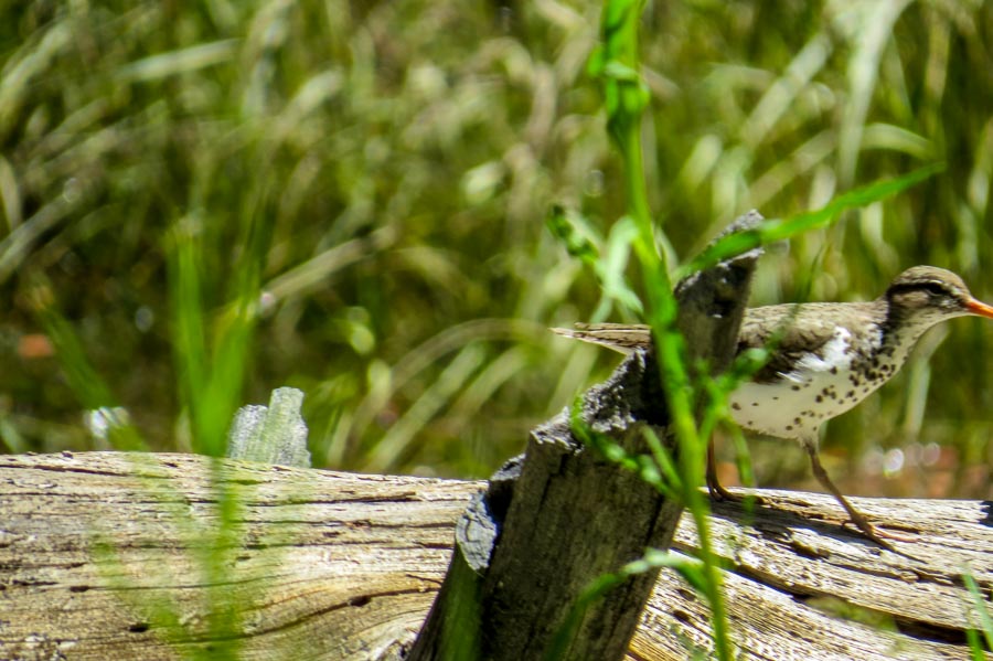
Here is the worst picture of them all.


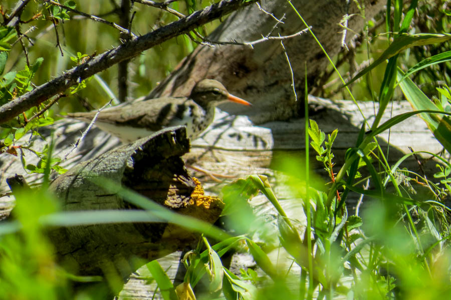
Sandpiper Photo number 1
Spotted Sandpiper moving across a fallen log

As you will note from the photograph, there is a lot of debris between me and the bird. Now remember the camera is zoomed in so it is difficult to keep the bird in the viewfinder. If you ever tried to follow a bird or even find a stationary bird using a binocular, I think you will understand the problem.

The camera had a hard time deciding what was the area of focus. It appears the camera locked on the branch or broken part of the log as the main subject. I really can’t find fault with that. The bird was scurrying so there was no way for me to change the focus options at that point. This is a small version of the photo so it may look sharp to you, but the bird is not in focus.

My main goal in this situation is to get the pictures of the bird and worry about the details later. It doesn’t always work, but more often than not I have success (check out Photography – When is good enough, good enough? A bird story).


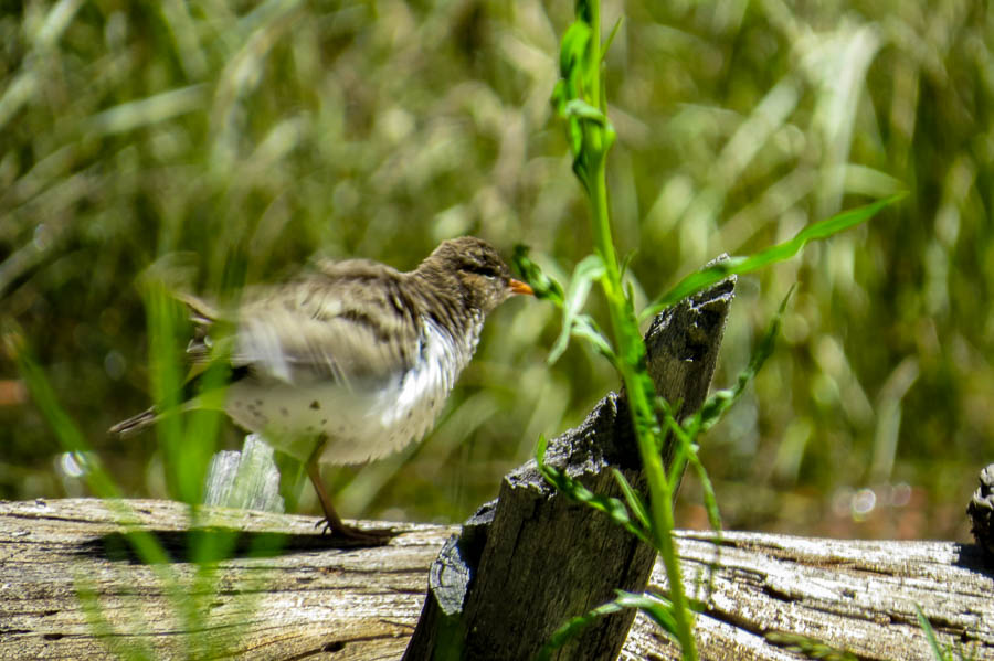
Spotted sandpiper picture number two
A photo of the Spotted Sandpiper just as it started to move its wings

The photo above is a bit better because more if it is in focus and the movement of the wings still leaves the head relatively clear.


Spotted sandpiper photo number three
This was the last photo I took in the sequence before the bird was totally hidden by the nearby foliage

This is perhaps the sharpest overall photograph I was able to capture of this particular bird. It is a shame that the sandpiper was slightly out of frame and the beak is only partially visible, but that’s the way it goes sometimes!

Please understand…I am not blaming the camera. I am not as skilled in using this equipment as I should be, but I do the best I can. That being said, when I added all three pictures together, I have a good idea of what this bird looks like.

Solving the Mystery

My modus operandi is to review my photos when I get home and then gather my bird identification books and a good piece of birding software – iBird Ultimate – to identify the mystery bird.

Let me say one thing about iBird Ultimate. This is a great program for someone like me. One of the major benefits is that the user can enter a geographic location in the United States and it will show which birds may be visiting at that time of the year. This helps to narrow the search.

Additionally, if you find a bird that looks like the potential subject, there are usually several additional photos to view which enables users to see a variety of views and variations for that particular bird.

Once I queued up my resources, I was easily able to determine this bird was a Spotted sandpiper. The last thing I do, which is much fun, is I take out my ABA North America birding list and mark off the bird as “seen.” Now I have one less bird to worry about although I will continue to seek a better photograph if the opportunity presents itself.

Read more about the Spotted Sandpiper HERE.


**********


All content on this blog is copyrighted by Jeffrey B. Ross with ALL Rights Reserved. While reference links back to JBRish.com are appreciated and encouraged, please acquire approval for any reproduction of original content from this website.

©Jeffrey B. Ross


Hiking the Peralta Trail, Gold Canyon, AZ – 20160701

The Finale of the Peralta Trail Photo Essay

NOTE – Keep in mind that we took this hike and these pictures represent the trail as we saw it in December, 2009. The trail may have changed a bit since them and some of the flora may no longer be exactly where we are reporting, but this is a good representation of things you may find along the way. Perhaps you will find even more intriguing highlights.

Of course the large rock formations and mountains will remain largely unchanged.


Long shadows, time to head backk
Toward Sunset

After spending some time at the Fremont Saddle and having a snack, we wanted to head back to the trailhead. As you can note from the picture, the shadows were getting longer and with that the cool, soon to be followed by cold, December chill would be setting in.

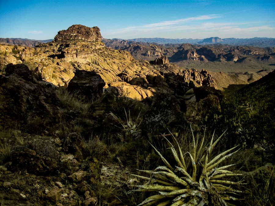
Even the decaying plants add a beauty to the desert if we take time to notice and appreciate them. Desert life is hard and any plant or animal that can survive gains my immediate and ever-lasting respect.

This is the final post about our experience along the Peralta Trail, Gold Canyon, Arizona. If you like moderate hiking and a walk in a very different and beautiful landscape, I recommend it. Just be prepared, heed all warning signs and read about the hike before you commit.

Read more about the Peralta Trail HERE.

Previous posts and photographs in the Peralta Trail series in chronological order:


**********


All content on this blog is copyrighted by Jeffrey B. Ross with ALL Rights Reserved. While reference links back to JBRish.com are appreciated and encouraged, please acquire approval for any reproduction of original content from this website.


©Jeffrey B. Ross