Photography: As Shot – Stormy Mendocino Headlands


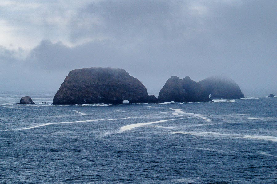
Stormy Ocean - Mendocino Headlands

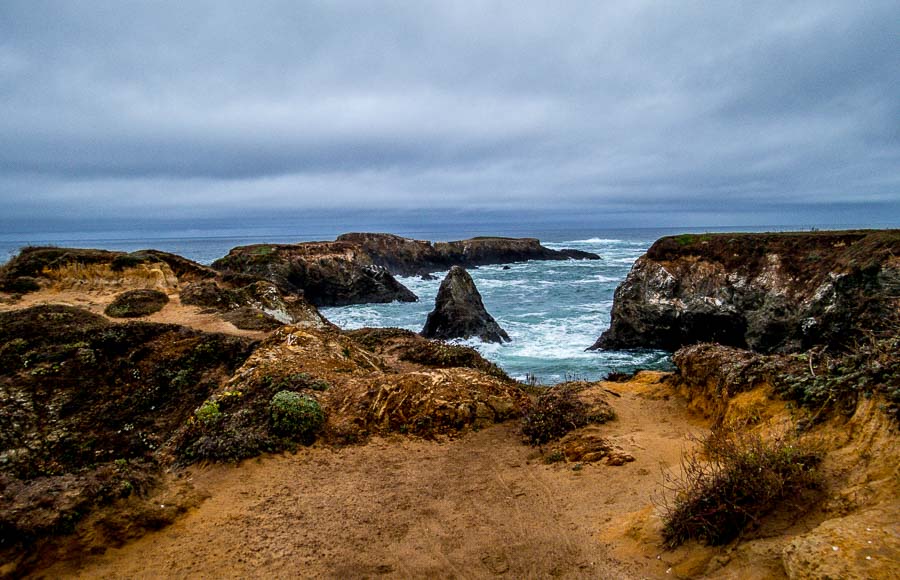
There is something about a stormy sea that attracts me. Knowing that I am standing on terra firma looking at the churning water and feeling the building strength of the impending storm carries a thrill with it. On such a day we were drawn to the edge of the ocean in Mendocino Headlands State Park. There were only a few adventurers at the water’s edge this morning.

The grey skies could not hide the beauty of the scene. The browns of the beach and rocks against the bluish grey water and sky created a very pleasing panorama.

Read more about Mendocino Headlands State Park – Click HERE

**********

Metadata

File Name: IMG_1636.CR2
Capture time: 9:51:17 AM
Capture date: September 24, 2014
Exposure: 1/250 sec @ f/4.0
Focal Length: 4.3mm
ISO: 100
Camera: Canon PowerShot SX50 HS
Lens: 4.3-215mm

Edited in Lightroom

**********

Read more photography posts HERE


**********


All original content on this blog is copyrighted by Jeffrey B. Ross with ALL Rights Reserved. While reference links back to JBRish.com are appreciated and encouraged, please acquire approval for any reproduction of original content from this website.

©Jeffrey B. Ross – 2017 – JBRish.com


Adventures in Oregon: Tillamook – Cape Meares Lighthouse


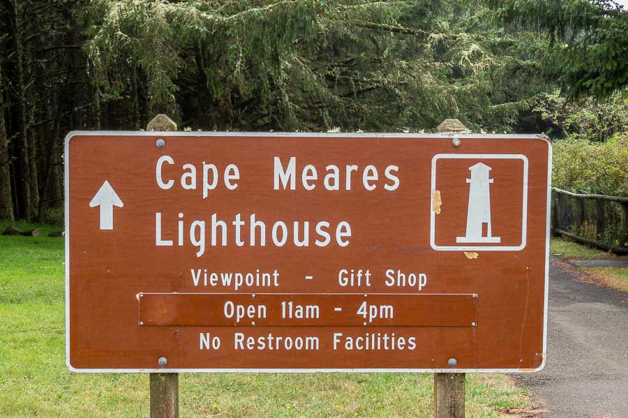
Cape Meares Sign

I knew little about Tillamook, OR except that it was a dairy town and I only knew that because our grocery stores have Tillamook cheeses and ice cream. The town of Tillamook itself wasn’t a major stop on our itinerary, but served more as a jump off point for the hiking areas relatively nearby.

Our first adventure outside of Tillamook was to the Cape Meares Lighthouse.

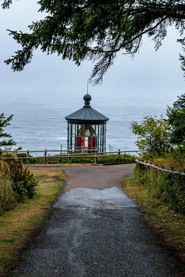
As you can see in the picture below, there is a clear path from the parking lot to the lighthouse area. It was a dreary day, but the seaside’s dramatic ambience was enticing. Ocean storms can be dramatic!


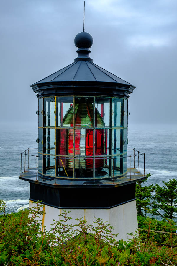
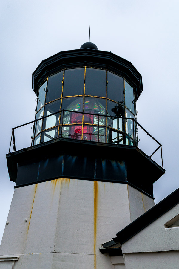
The top of the Tillamook Lighthouse
The top of the Tillamook Lighthouse seen from the walking path

I hadn’t appreciated the fact that lighthouses have lights with different color patterns. The red and clear glass created a “signal” to let captains know that this is Cape Meares. Not only are there different color patterns, but the duration that each color is visible is very precise.


Color glass pattern of the lighthouse lens
Clear and Red glass create the signal that this is Cape Meares

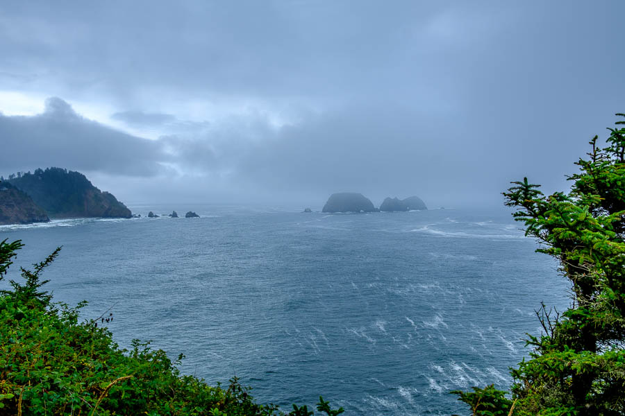
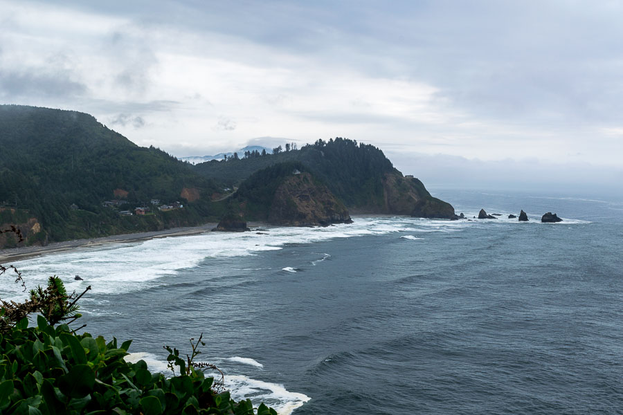
Before taking the lighthouse tour, we walked to the edge of the visiting area to capture a few stormy photographs of the picturesque rock formations and the choppy waters of the Pacific.


The rocky coastline was stormy this day

Here’s a closer view…


A closer view of the rock formations offshore

The lighouse was near the edge of the cliff overlooking the ocean and therefore did not have to be too tall for the sake of visibility.


Tillamook Lighthouse is located on the edge of a cliff
The roofline to the right helps point to the short stature of the lighthouse

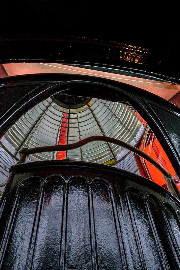
From the inside, visitors can appreciate the lens arrangement and all of the mechanisms required to operate and maintain a lighthouse


Colorful glass seen inside the lighthouse
The colorful glass seen against the dark metal provide visual appeal

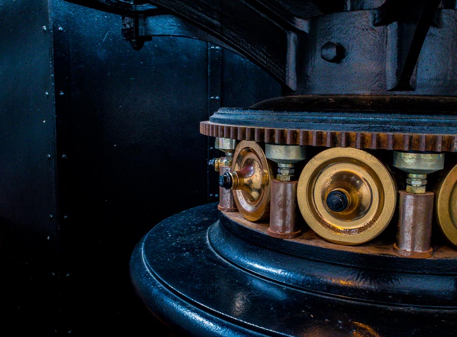
The polished gears gave evidence to the excellent condition of this lighthouse and the machinery needed to operate the turret.


Gears used to rotate the light
Gears used to rotate the turret

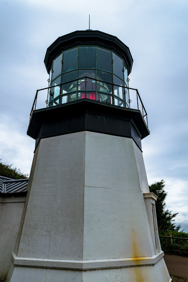
This picture gives a good representation of the size of the main tower of the lighthouse.


A picture of the vertical portion of the lighthouse
The vertical portion of the lighthouse

The tour was very interesting and the docent was very knowledgeable about lighthouses in general and of the Cape Meares structure specifically.

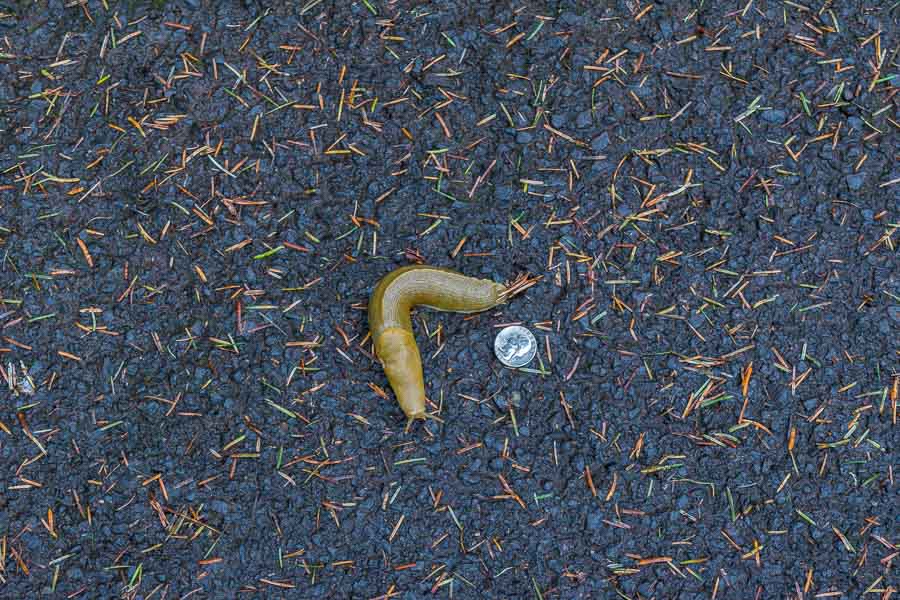
There were a few more stops we could have made in the park, but the weather was not conducive so we decided to head back to town. On the return path, we came across a very large Banana Slug (Ariolimax columbianus). I placed a quarter next to it to help viewers understand the size of this animal; impressive for a slug.


A very large Banana Slug (Ariolimax columbianus)

One last look back at the coastline before the trip back to Tillamook.


The coastline near the lighthouse


**********

Read previous posts about our adventures hiking and exploring in Oregon:

Exploring Astoria, Oregon – Part 1

Exploring Astoria, Oregon – Part 2

Exploring Astoria, Oregon – Part 3

Adventures in Oregon: Warrenton to Seaside

Adventures in Oregon: Hiking at Indian Beach

Adventures in Oregon: Views from Ecola Point

Adventures in Oregon: Movin’ On Down the Road

Adventures in Oregon: Garibaldi’s Graces and Pier


Read more Hiking and Exploration posts HERE


**********


All original content on this blog is copyrighted by Jeffrey B. Ross with ALL Rights Reserved. While reference links back to JBRish.com are appreciated and encouraged, please acquire approval for any reproduction of original content from this website.

©Jeffrey B. Ross – 2017 – JBRish.com


Cape Meares, lighthouse, ocean, pacific, beach, scenery, history, landscape, pacific ocean

Photography: As Shot – Storm Brewing – Hereford, AZ

NOTE – “As Shot” photographs are some that I have posted on Instagram, but without any imposed crop, less detail reduction and more of an explanation.


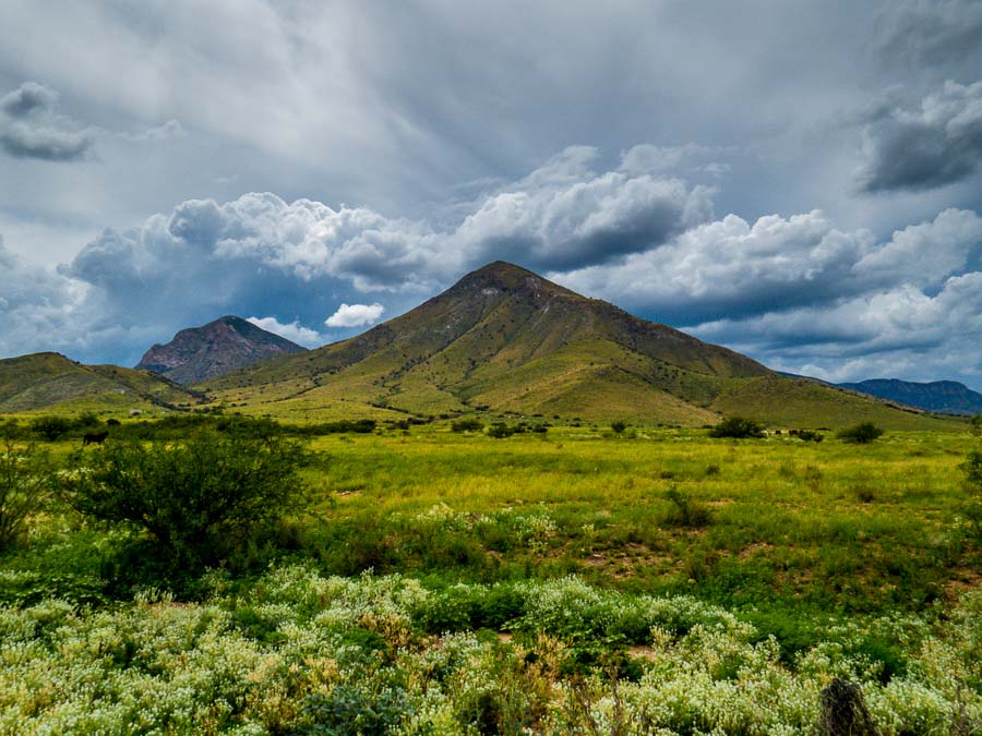
On the road near Hereford, Arizona with storm clouds closing in

On the road near Hereford, Arizona with storm clouds closing in.

We were on a bird watching and hiking trip to southern Arizona near Hereford and Sierra Vista, when we were returning from hiking in Coronado National Memorial. Storm clouds began to close in on the area creating a dramatic scene.

Read more about Coronado National Memorial

**********

Metadata

File Name: 2369_sierra_vista_20150709
Capture time: 2:50:18 PM
Capture date: July 9, 2015
Exposure: 1/800 sec @ f/5.6
Focal Length: 5.33mm
ISO: 100
Camera: Canon PowerShot SX50 HS
Lens: 4.3-215mm
Edited in Lightroom

**********

Read more photography posts HERE


**********


All original content on this blog is copyrighted by Jeffrey B. Ross with ALL Rights Reserved. While reference links back to JBRish.com are appreciated and encouraged, please acquire approval for any reproduction of original content from this website.

©Jeffrey B. Ross – 2017 – JBRish.com


Photography: As Shot – The Mittens

NOTE – “As Shot” photographs are some that I have posted on Instagram, but without any imposed crop, less detail reduction and more of an explanation.


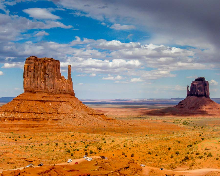
East and West Mittens at Monument Valley, Arizona

East and West Mittens at Monument Valley as storm begins to roll in

Several years ago we visited Monument Valley. The only camera I had with me was a simple 8MP Canon PowerShot AS590 IS, but I think I was still able to acquire several fine photographs to document our visit.

The picture above is of two structures referred to as “mittens.” a name derived from the fact that they look like two giant mittens when viewed from certain angles.

**********

Metadata

File Name: 8834_mv_mittens
Capture time: 3:04:22 PM
Capture date: September 10, 2012
Exposure: 1/640 sec @ f/5.6
Focal Length: 9.9mm
ISO: 80
Camera: Canon PowerShot AS590 IS
Lens: 5.8-23.2mm
Edited in Lightroom

**********

Read more photography posts HERE


**********


All original content on this blog is copyrighted by Jeffrey B. Ross with ALL Rights Reserved. While reference links back to JBRish.com are appreciated and encouraged, please acquire approval for any reproduction of original content from this website.

©Jeffrey B. Ross – 2017 – JBRish.com


Hiking: Brins Mesa – Sedona, AZ


along the Brins Mesa Trail - Sedona, AZ

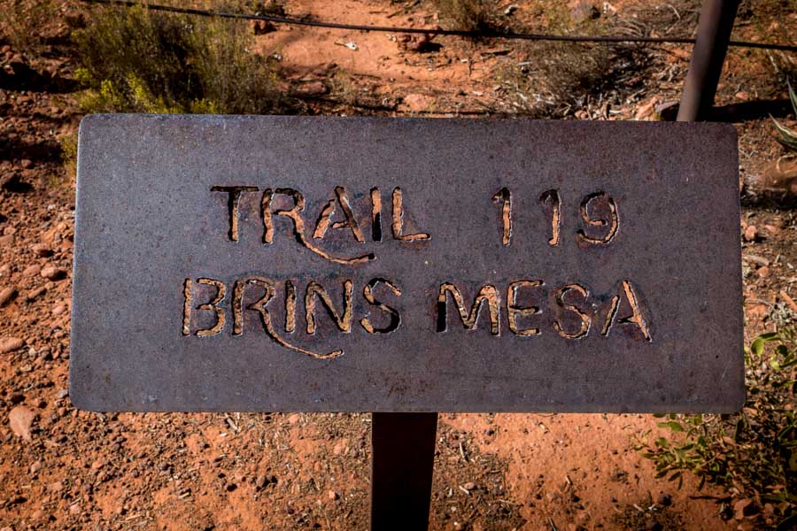
Years ago we tried to hike the Brins Mesa trail with some visiting friends, but they weren’t hikers and soon decided that they weren’t prepared for the adventure so we returned to the car to visit other nearby and easily accessible vistas.

The Brins Mesa trail is probably best described as moderate to a bit more than moderate (at times). The trail is relatively well marked, but it is primarily uphill if you are starting from the main trailhead at the outskirts of town.

Soon after starting the climb, this is one of the scenes you will see.
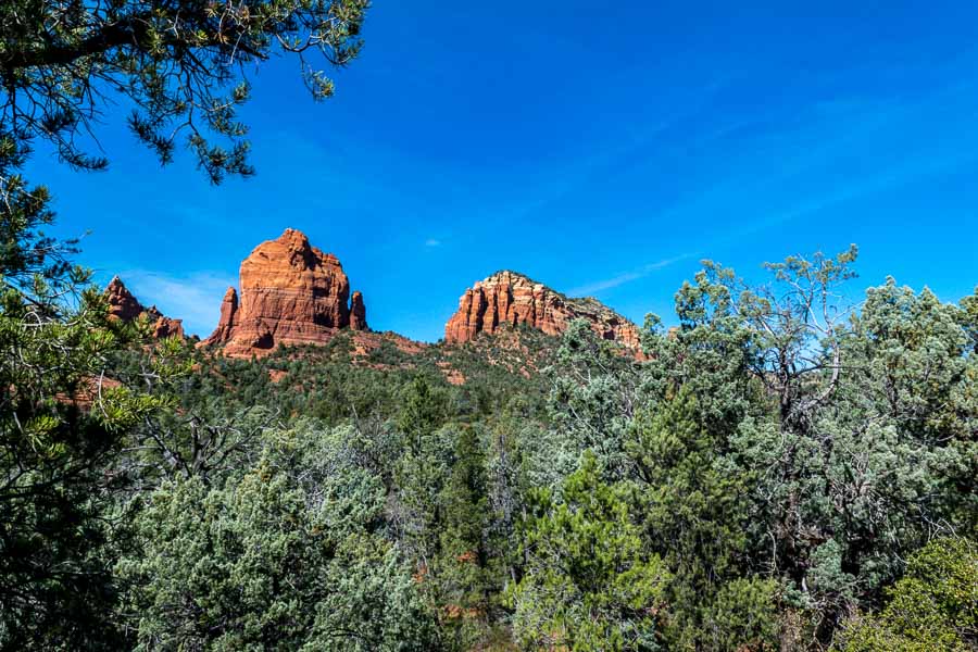

along the Brins Mesa Trail - Sedona, AZ

One of the reasons for undertaking this hike is to admire the beautiful scenery and red rock vistas encountered along the entire trail.

There are what has been referred to as “natural stairs,” but the operative word there is natural. Creating steps from a rock face formed by nature is no easy task and as you might imagine, the spacing is not always ideal. Hiking sticks may be helpful for those who are less sure-footed.
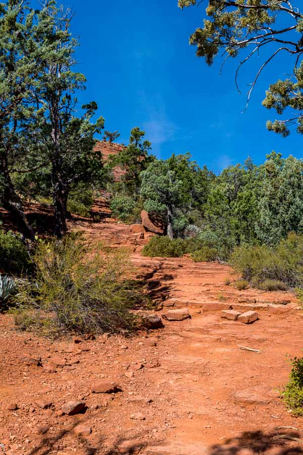

along the Brins Mesa Trail - Sedona, AZ

In almost every direction, the red and sand-colored rocks rise above the trees to the wonder and appreciation of trailblazers.
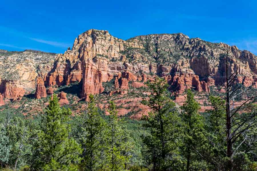

along the Brins Mesa Trail - Sedona, AZ

You don’t see the mesa itself for a while, but persevere and you will come to a shelf-like geological feature that is the Brins Mesa (pictured below).
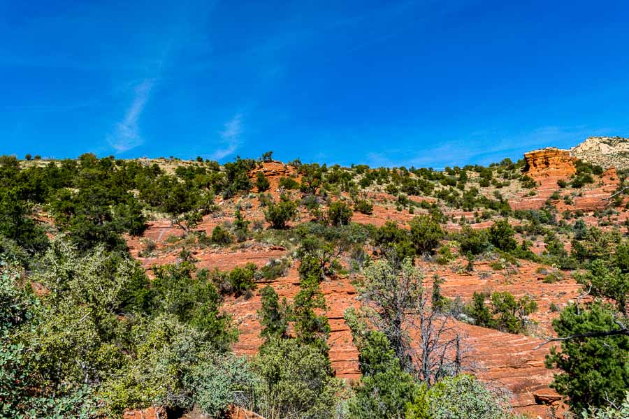

along the Brins Mesa Trail - Sedona, AZ

It is unfortunate that years ago there was a fire that destroyed many of the trees and the carcasses of those sentinels can be seen along the mesa’s trail.
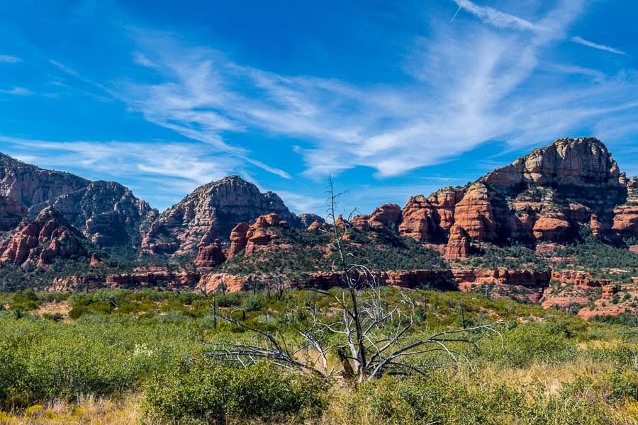
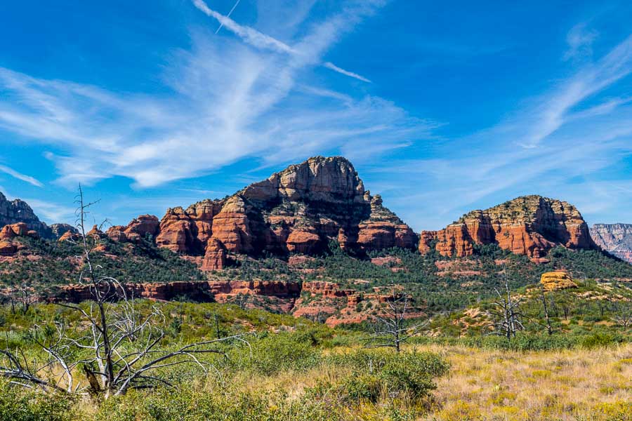
along the Brins Mesa Trail - Sedona, AZ


along the Brins Mesa Trail - Sedona, AZ

For those who enjoy photography, there are numerous opportunities to capture memorable landscapes.
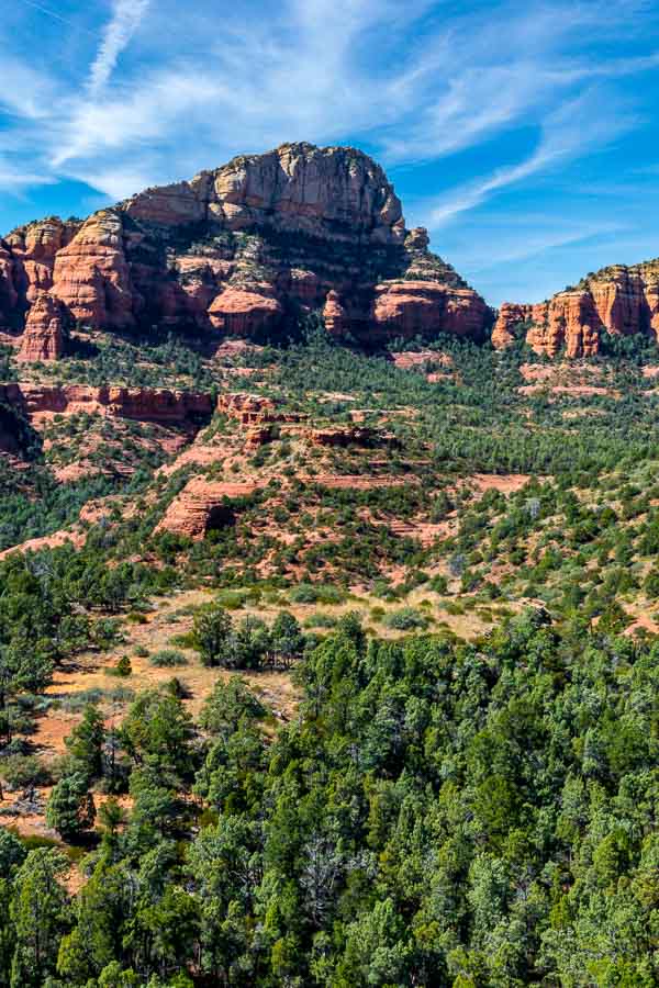

along the Brins Mesa Trail - Sedona, AZ

As we were hiking along the trail, we noticed what looked like a ledge (drop off) and a valley. We also spotted an outcropping or rather a small hill and we decided to explore. There is a trail leading in that general direction.
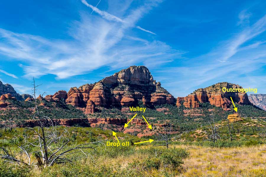

along the Brins Mesa Trail - Sedona, AZ

The picture below was taken while I was standing at the ledge. Notice the darker, reddish dirt in the valley.
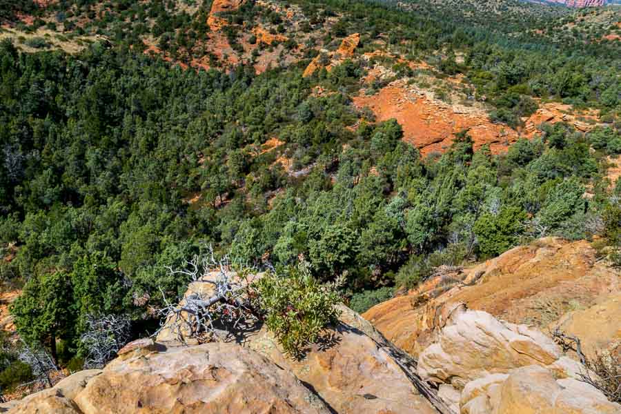

along the Brins Mesa Trail - Sedona, AZ

I took a couple of panoramas (linked below) as the red rock mountains were spread out before me. It was too wide and too beautiful for me to capture in just one or two pictures. After some exploration and appreciatiion, we decided to return to the trailhead. Although it was mid-October, the day was quite warm and we had a long day. This is the scene looking back toward the ridge and surrounding mountains.
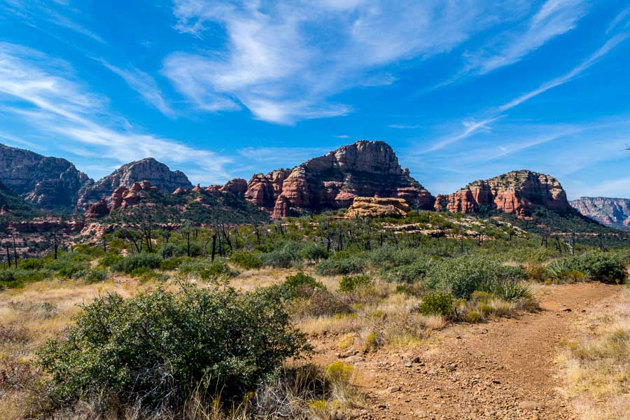

along the Brins Mesa Trail - Sedona, AZ

One rule of photography is to look behind you as you travel because sometimes, the best view is not in front, but in back. When returning along the same trail, this maxim becomes self-fulfilling. These are a few of the pretty formations we captured during the return to the trailhead.
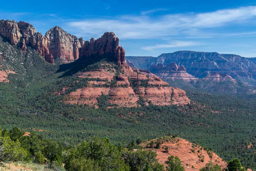
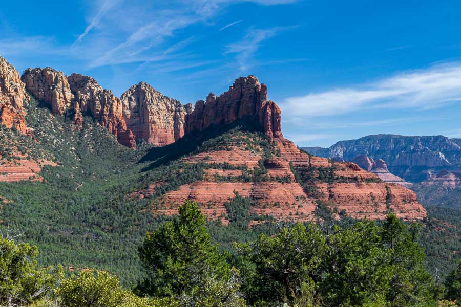
along the Brins Mesa Trail - Sedona, AZ


along the Brins Mesa Trail - Sedona, AZ

Famous Bell Rock can be seen in the center of the photo below where the sky seems to meet the low-lying structure. It is hard to pick out, but look for the little nub on top.
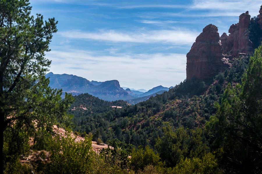

along the Brins Mesa Trail - Sedona, AZ

Red rock spires and hoodoos (column of rock) are abundant.
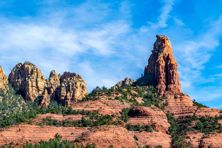

along the Brins Mesa Trail - Sedona, AZ

Here are the two panoramas…


along the Brins Mesa Trail - Sedona, AZ

To see a larger photo of the scene, make your browser window larger and click HERE
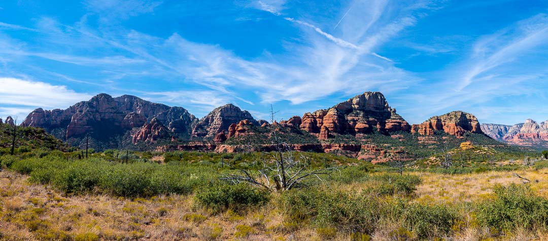

along the Brins Mesa Trail - Sedona, AZ

To see a larger photo of the scene, make our browser window larger and click HERE

More information about the Brins Mesa trail can be found at the following links:

Brins Mesa Trail No. 119 – Forest Service (USDA)

Brins Mesa Trail – AZ Highways


Read more Hiking and Exploration posts HERE


**********


All original content on this blog is copyrighted by Jeffrey B. Ross with ALL Rights Reserved. While reference links back to JBRish.com are appreciated and encouraged, please acquire approval for any reproduction of original content from this website.

©Jeffrey B. Ross – 2017 – JBRish.com


Hiking the Peralta Trail, Gold Canyon, AZ – 20160605


A signpost along the trail
Soon after starting along the trail, a signpost appears

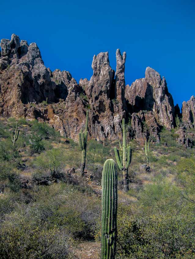
It isn’t long before the Peralta trail leads hikers upward and toward the rugged mountains and rock formations. The saguaros and native flora are plentiful and provide added interest.

Read more about the Peralta Trail HERE.

Previous posts and photographs in the Peralta Trail series in chronological order:


**********


JBRish.com originally published this post
*All photographs Copyright by Jeffrey B. Ross with all rights reserved.

Landscape Photography More or Less?

Readers of JBRish know that I enjoy hiking and photography. If the truth be told, I enjoy photography more. Interestingly, however, when I put the two together, they have a beautiful synergy that gives me great satisfaction. Taking photographs also helps to keep the memories alive.

I found Thomas Heaton’s video (below) engaging. It contains worthy messages and photographs. On his blog, he uses this quote:

“We are not content with a nice view. We need the best view.”

This is very true. MOST landscape or scenery photographers do want the “best view.” I have come to realize that at my age, having captured a nice view or perhaps a very good view, might be good enough for me.

Most landscape photographers strive for the golden hours near sunrise and sunset and I agree that generally is the best light for landscapes, but can’t those vistas have a beauty of their own under different lighting conditions? I think they can.

After you watch the video, Wake Up. There’s More to Landscape Photography (below), I want to refer you to one of Heaton’s blog posts:

Yosemite Valley – I am People in which he decries the crush of the crowd at Yosemite, but then moves on to exclaim the wonder of it all.

When we visited Yosemite last June, which is the basis for my Year of Yosemite project, we found it extremely busy. It was so busy that even though we stayed in the Valley and paid for a nice room near the Lodge, we were NOT GUARANTEED a parking space.

It felt a bit like a Seinfeld episode. They can take the reservation for the room and you probably need a car to get there, but there may not be a parking spot. When I lived in NYC as a child, my parents would have to think really hard before we moved the car and relinquished our parking spot. I have come full circle more than fifty years later; but I digress…

If you liked any of my photographs of Yosemite, Thomas Heaton has captured much more of the majesty than I could manage and I think you will really like his work!


JBRish.com originally published this post

See previous Photography posts HERE

Year of Yosemite (YOY) – Day 67 (Floating on the Merced)

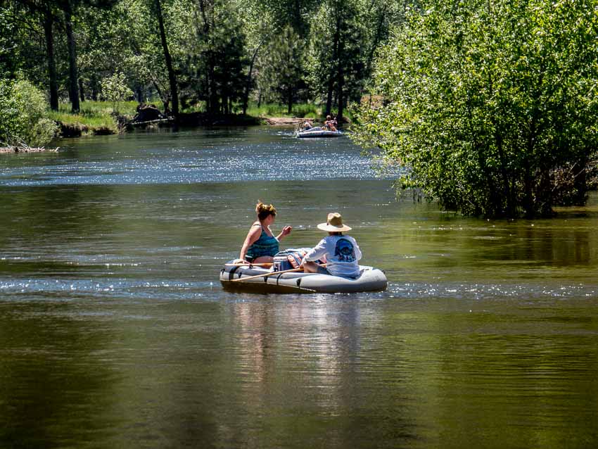
Rafting on the Merced River-Yosemite

Scores of rafters enjoyed the well-flowing pace of the Merced River

Yosemite is truly an outdoor playground and there was ample opportunity for those who enjoy rafting or kayaking. The Merced River was near peak performance as this picture taken near the Swinging Bridge picnic area attests.

 
Do you have a question about our visit to Yosemite? Ask it in the comment section.


JBRish.com originally published this post
*All photographs Copyright by Jeffrey B. Ross with all rights reserved.

 
See previous Year of Yosemite (YOY) posts HERE. If you want to read the introduction to the YOY series, CLICK HERE.

***********************************

Meta Data – Day 67 YOY – Year of Yosemite

File Name: MG_0367.CR2
Capture time: 1:59:35 PM
Capture date: June 8, 2016
Exposure: 1/200 sec @ f/6.3
Focal Length: 54mm
ISO 125
Canon PowerShot SX50 HS

Photography – Grand Teton National Park, Cascade Canyon (B&W)


As most of JBRish readers know, I am an amateur photographer. I have explained my photography philosophy on my blog before, but let it suffice to say that I am an “opportunistic” photographer. I do not wait for a scene to unfold, but I capture those scenes before me that resonate in some way.

As an enthusiastic hobbyist, I am trying to learn to use Adboe’s Lightroom and some associated ad ons. I have only begun this journey so if you find that my submissions via this website are lacking, kindly understand that I am learning along the way.

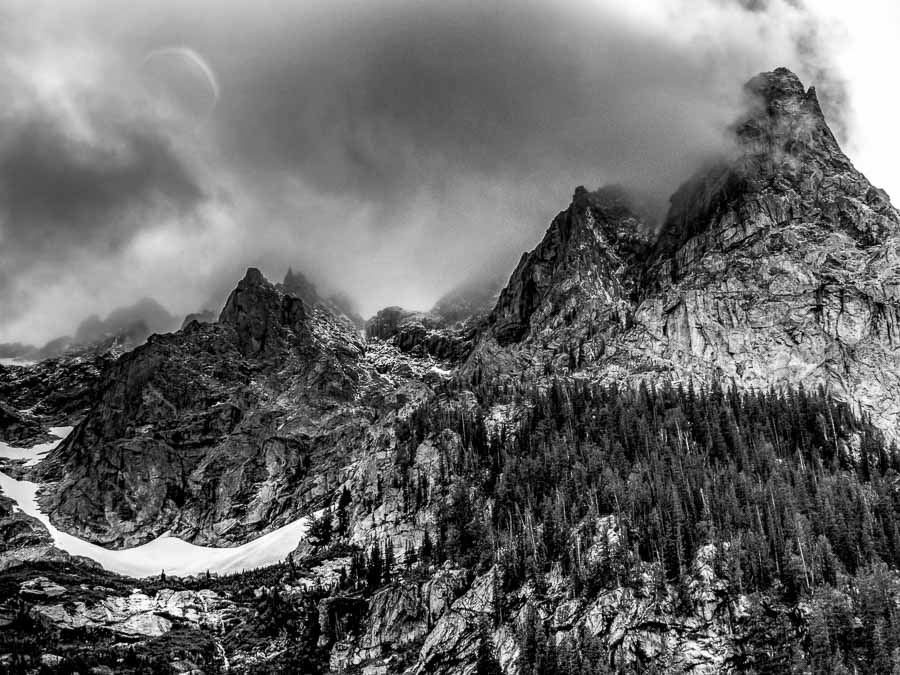
Below is a picture of some of the mountains we encountered while hiking the Grand Teton National Park’s Cascade Trail. The day was overcast with very little color, but when converted to black and white, I think the picture has a special quality. What do you think? Leave any suggestions, remarks, etc. in the comment section below.


Grand Teton National Park, Cascade Canyon Trail
“Black and white rendition of a portion the Grand Teton National Park’s Cascade Trail”

Meta Data – Grand Teton National Park, Cascade Canyon (B&W)

File Name: 1297.CR2
Capture time: 11:10:13 AM
Capture date: August 24, 2014
Exposure: 1/400 sec @ f/7.1
Focal Length: 16mm
ISO 125

See more of Jeff’s photography on Instagram

Other photography posts can be found HERE as well!

Year of Yosemite (YOY) – Day 45 (Half Dome at Sunset)

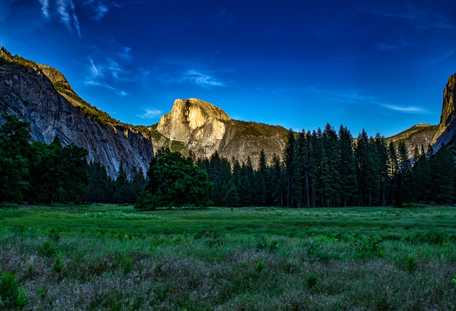
Half Dome Meadow at SunsetHalf Dome Meadow at Sunset

While Half Dome is always impressive as it rises up from a multitude of vantage points at Yosemite, during the sunrise and sunset hours it takes on a special majesty. I particularly like this photograph with the contrasting dark colors of green and some purple highlights among the wildflowers in the foreground.

This field was only a short walk from our lodging and it was difficult to get enough of this view!

Fact: Did you know that the North Face outdoor company uses a stylized version of Half Dome as their Logo?

North Face Logo 

The North Face Logo is a Copyrighted and Registered Trademark

 
Do you have a question about our visit to Yosemite? Ask it in the comment section.


JBRish.com originally published this post
*All photographs Copyright by Jeffrey B. Ross with all rights reserved.

 
See previous Year of Yosemite (YOY) posts HERE. If you want to read the introduction to the YOY series, CLICK HERE.

***********************************

Meta Data – Day 45 YOY – Year of Yosemite

File Name: 0277.NEF
Capture time: 7:06:37 PM
Capture date: June 7, 2016
Exposure: 1/20 sec @ f/14
Focal Length: 18mm
ISO 100
Nikon D3300