Hiking the Peralta Trail, Gold Canyon, AZ – 20160620

NOTE – Keep in mind that we took this hike and these pictures represent the trail as we saw it in December, 2009. The trail may have changed a bit since them and some of the flora may no longer be exactly where we are reporting, but this is a good representation of things you may find along the way. Perhaps you will find even more intriguing highlights.

Of course the large rock formations and mountains will remain largely unchanged.
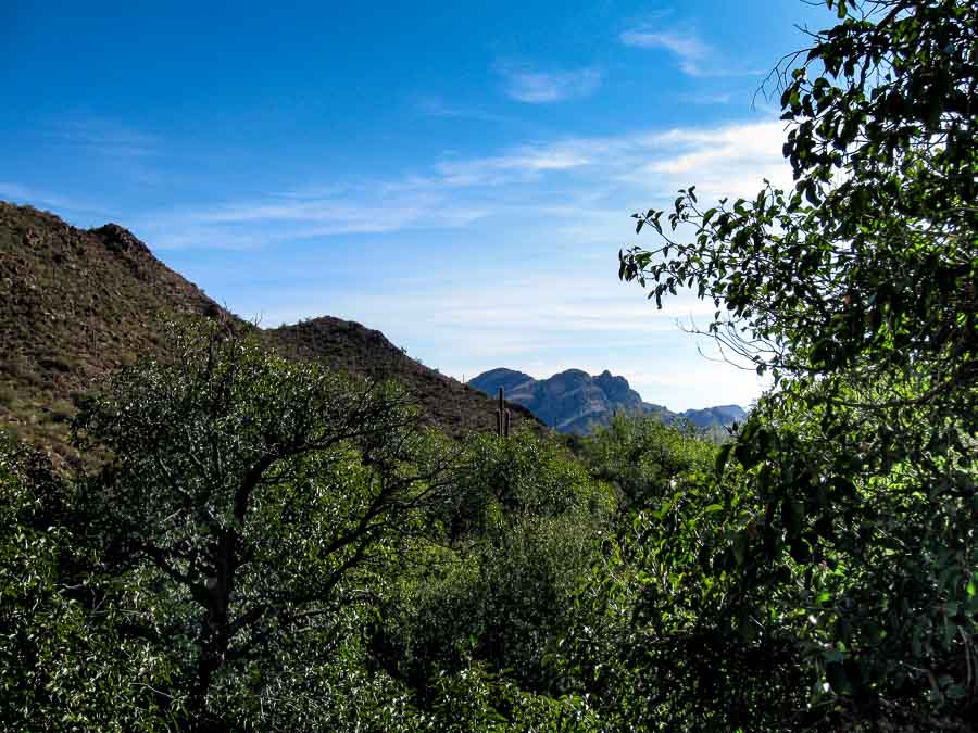

More mountains come into view

Hiking in the mountains is interesting because the hiker’s view is almost always partial. What I mean by that is that people cannot generally see all the mountains around them at the lower elevations. On the Peralta Trail, this is no different. As we hiked higher and higher, the more distant mountains began to come into view.

Read more about the Peralta Trail HERE.

Previous posts and photographs in the Peralta Trail series in chronological order:


**********


JBRish.com originally published this post
*All photographs Copyright by Jeffrey B. Ross with all rights reserved.
Hiking the Peralta Trail, Gold Canyon, AZ – 20160619

NOTE – Keep in mind that we took this hike and these pictures represent the trail as we saw it in December, 2009. The trail may have changed a bit since them and some of the flora may no longer be exactly where we are reporting, but this is a good representation of things you may find along the way. Perhaps you will find even more intriguing highlights.

Of course the large rock formations and mountains will remain largely unchanged.


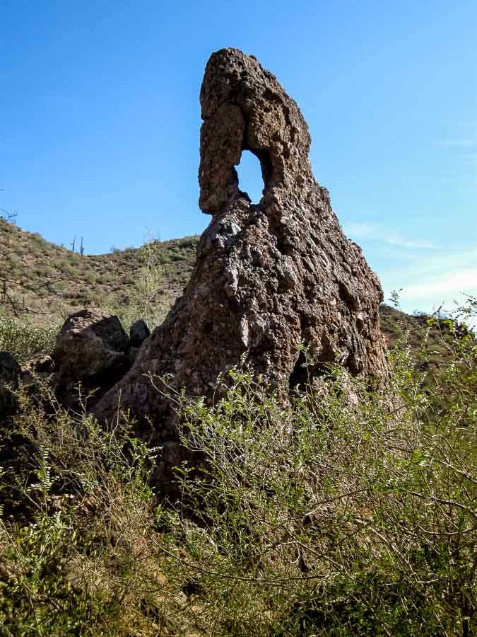
Windows in the rocks
Nature creates unusual and interesting formations

Whenever hiking a trail that is new to me, I enjoy seeing the various rock formations created by nature. Holes in the rock, such as the one pictured above, are often referred to as windows. Wind, sand or dust storms and rain create such holes by pounding away at the weak points in these structures. Over time, the rock, dirt and mud give way and create the interesting holes in the formations.

Read more about the Peralta Trail HERE.

Previous posts and photographs in the Peralta Trail series in chronological order:


**********


JBRish.com originally published this post
*All photographs Copyright by Jeffrey B. Ross with all rights reserved.
Hiking the Peralta Trail, Gold Canyon, AZ – 20160618

NOTE – Keep in mind that we took this hike and these pictures represent the trail as we saw it in December, 2009. The trail may have changed a bit since them and some of the flora may no longer be exactly where we are reporting, but this is a good representation of things you may find along the way. Perhaps you will find even more intriguing highlights.

Of course the large rock formations and mountains will remain largely unchanged.


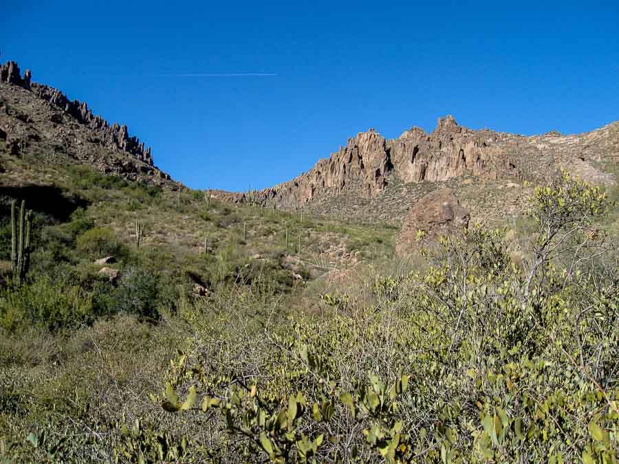
Soon the mountains loom
Mountains begin to appear all around

It wasn’t long after we left the trailhead and began our upward trek that the mountains began to rise up around us. The trail was easy to follow and the way was clear. As John Muir notably said: “The mountains are calling and I must go.”

Read more about the Peralta Trail HERE.

Previous posts and photographs in the Peralta Trail series in chronological order:


**********


JBRish.com originally published this post
*All photographs Copyright by Jeffrey B. Ross with all rights reserved.
Saguaro Along the Peralta Trail, Gold Canyon, AZ – 20160606

NOTE – Keep in mind that we took this hike (and these pictures represent the trail as we saw it) on December 2, 2009. The trail may have changed a bit since then and some of the flora may no longer be exactly where we are reporting, but this is a good representation of things you may find along the way. Perhaps you will find even more intriguing highlights.

Of course the large rock formations and mountains will remain largely unchanged.


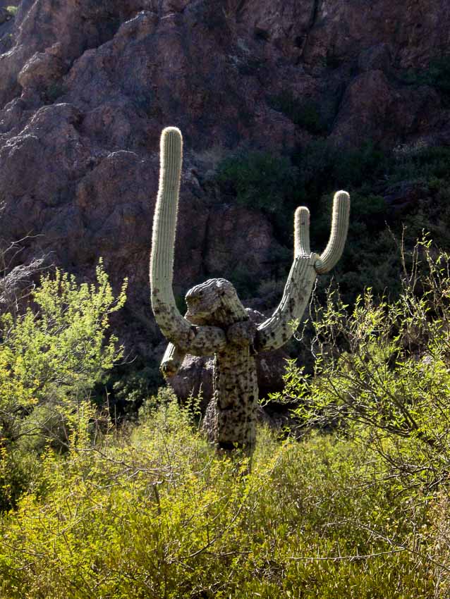
Hands up saguaro
Unusually shaped saguaro along the Peralta Trail

I often take photographs of plants, especially saguaros. that take on human shapes. This saguaro seems as though it is being held up in a robbery and has its hands held high. The fact that the very top of the saguaro is missing might mean that at one time it was hit by lightning.

Read more about the Peralta Trail HERE.

Previous posts and photographs in the Peralta Trail series in chronological order:


**********


JBRish.com originally published this post
*All photographs Copyright by Jeffrey B. Ross with all rights reserved.
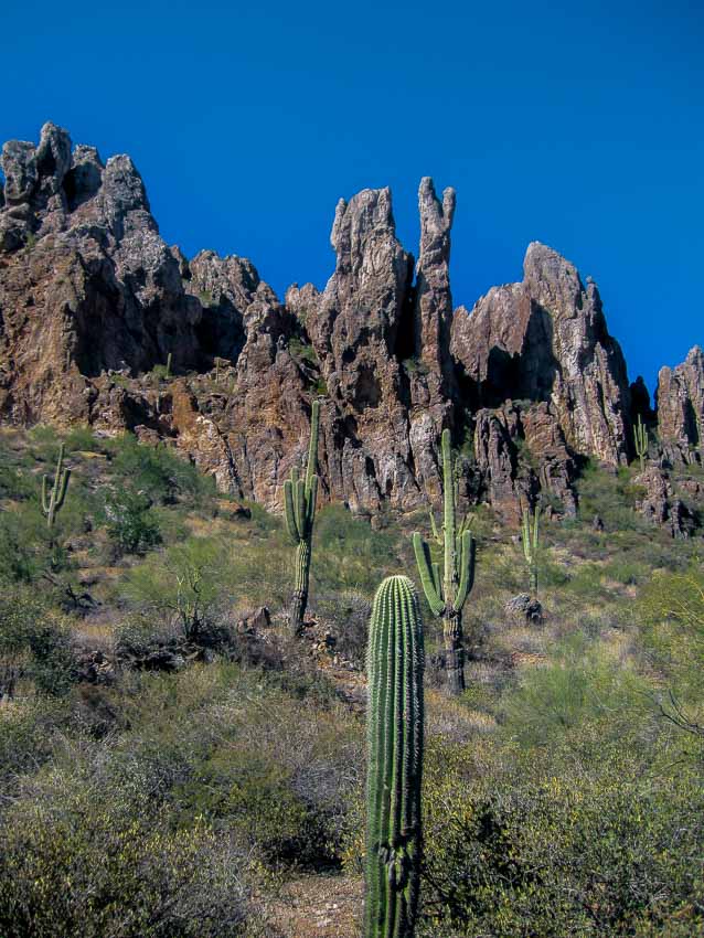
Part of a series of photographs and descriptions depicting the areas in and around the Peralta Trail located in Gold Canyon, Arizona.

hiking, Arizona, Gold Canyon, Peralta Trail, desert, photographs, rugged, scenery

Hiking the Peralta Trail, Gold Canyon, AZ – 20160605


A signpost along the trail
Soon after starting along the trail, a signpost appears

It isn’t long before the Peralta trail leads hikers upward and toward the rugged mountains and rock formations. The saguaros and native flora are plentiful and provide added interest.

Read more about the Peralta Trail HERE.

Previous posts and photographs in the Peralta Trail series in chronological order:


**********


JBRish.com originally published this post
*All photographs Copyright by Jeffrey B. Ross with all rights reserved.
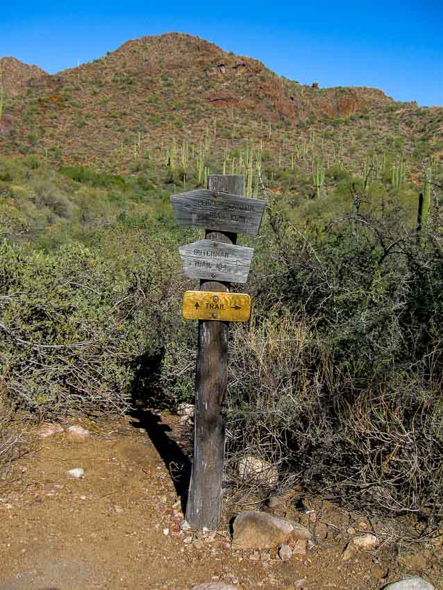
Hiking the Peralta Trail, Gold Canyon, AZ – 20160604


A signpost along the trail
Soon after starting along the trail, a signpost appears

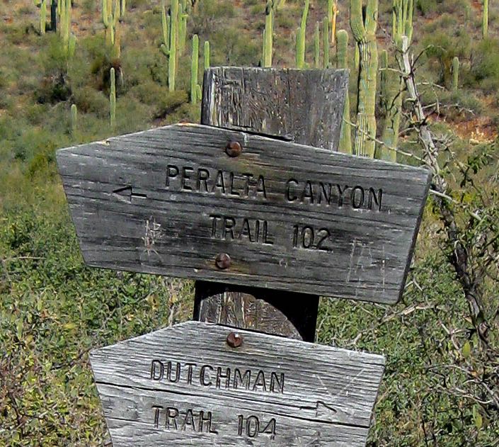
Not too far into the trail there is a sign post pointing in one of two directions; left leads to the Peralta Trail while right leads to the Dutchman Trail. We completed this hike in December of 2009 and the sign, as you can see, was fairly weathered then.

Here is a closeup below. Perhaps it has been replaced and is a bit more legible, but there was no problem when you were standing next to it. It doesn’t render well in the photograph.

A nice think about this trail is that it is obvious and easy to follow.


Signpost closeup

Read more about the Peralta Trail HERE.

Previous posts and photographs in the Peralta Trail series in chronological order:


**********


JBRish.com originally published this post
*All photographs Copyright by Jeffrey B. Ross with all rights reserved.
Hiking the Peralta Trail, Gold Canyon, AZ – 20160603

Now that I have completed the Year of Yosemite posts, I am going to provide photographs and short posts about other hikes we have enjoyed. Some will be from our adopted home of Arizona while others will be of more far-flung destinations.

The first of this new series is the Peralta Trail, Gold Canyon, AZ.

“Peralta Trail is a 4.9 mile moderately trafficked out and back trail located near Gold Canyon, Arizona that offers scenic views and is rated as moderate. The trail is primarily used for hiking and birding and is accessible year-round. Dogs are also able to use this trail but must be kept on leash.” [ Emphasis by JBRish.com ]

    DISTANCE – 4.9 miles
    ELEVATION GAIN – 1354 feet
    ROUTE TYPE – Out & Back

Above information gathered from the All Trails website. Visit the link for more detailed information – Peralta Trail.


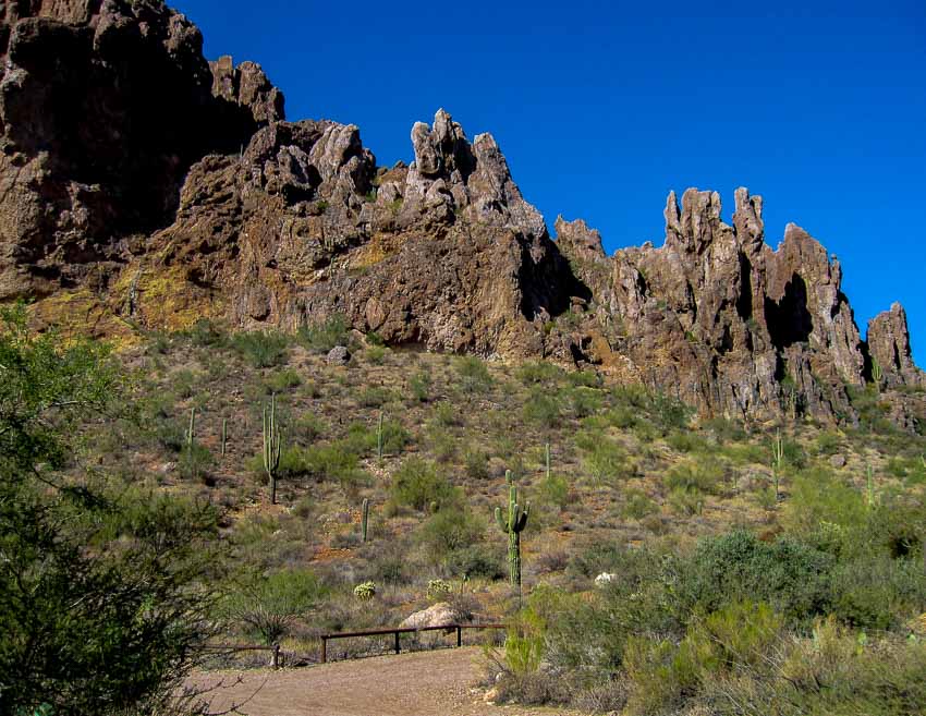
The Peralta Trail Trailhead

The terrain around the Peralta trail is rugged and there are areas which may required boulder scrambling.

Read more about the Peralta Trail HERE.


**********


JBRish.com originally published this post
*All photographs Copyright by Jeffrey B. Ross with all rights reserved.
The Final Post – Year of Yosemite (YOY) – Day 305

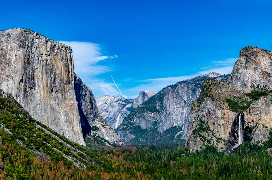
Half dome, El Capitan and Bridalveil Fall

Half dome, El Capitan and Bridalveil Fall


As we prepared to visit the park and hike many of the trails, we realized how overwhelming a visit to Yosemite might be. It is vast and can be daunting. When I first started this project nearly a year ago, I wanted to provide information for those planning to visit Yosemite National Park.

JBRish is a small, narrowly focused blog that I curate as a hobby and hopefully as a service to others who might want to share and discuss many of the same ideas about the skills and interests that I have.

I was hoping to have a dialogue with future and past Yosemite visitors to create a resource as a reference for those who might desire to visit the park. Unfortunately, my posts have generated only a small amount of interest.

I have shared photographs of most of the areas we visited and besides alternate views of places and things I have already posted, I didn’t think there was much new that would compel me to continue the series. Couple this with my recent computer troubles which set me back a bit, and I think it is time to end the project.
I am hopeful that at least a few people will find the information I shared helpful.

I don’t think I could have chosen a better photograph for the final post. The above scene captured from Tunnel View showing two of the major icons of Yosemite, El Capitan and Half Dome along with Bridalveil Falls, provides an example of the amazing natural beauty of this national park.

If you love nature or hiking, I can’t recommend a trip to Yosemite more highly! Just realize that it will be crowded and remote. Bring with you all of what you might need as supplies and food are expensive. If you do have questions, feel free to post them in the comment section of any JBRish post and I will try to respond promptly.

 
Do you have a question about our visit to Yosemite? Ask it in the comment section.


JBRish.com originally published this post
*All photographs Copyright by Jeffrey B. Ross with all rights reserved.
 
See previous Year of Yosemite (YOY) posts HERE. If you want to read the introduction to the YOY series, CLICK HERE.


Hetch Hetchy Reservoir Structurer – Year of Yosemite (YOY) – Day 304

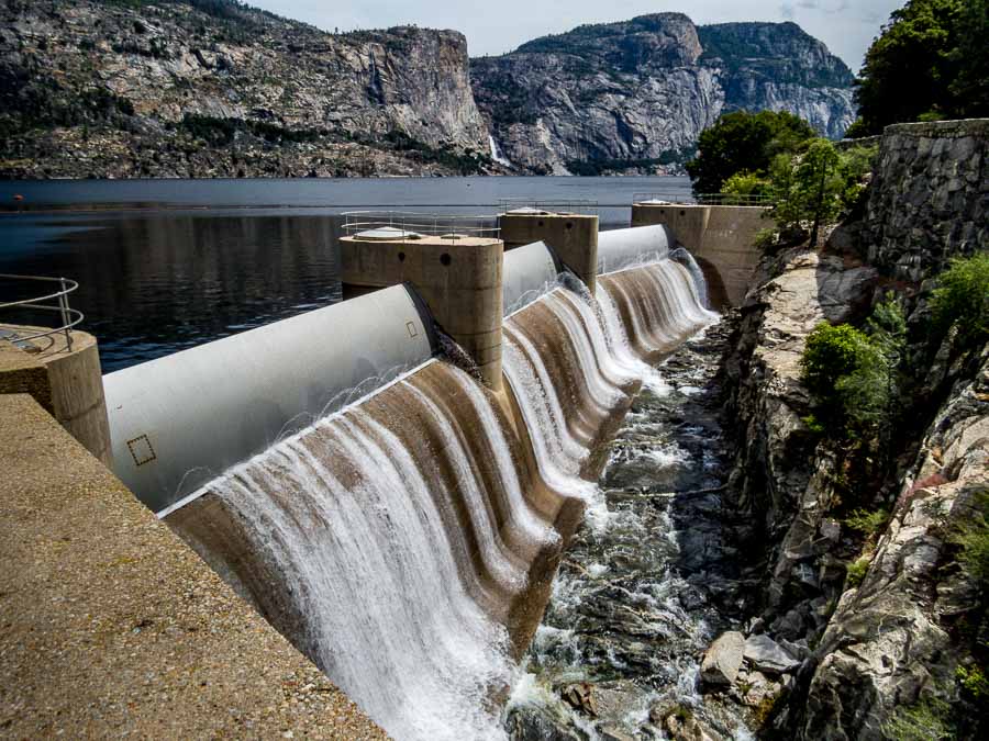
Hetch Hetchy Reservoir Structure

Hetch Hetchy Reservoir Dam Structure

Surrounded as it was by the beautiful mountains and aura of the national park, even the mundane structure of the Hetch Hetch Dam appeared attractive. As you can note, there was an abundant water release taking place this day to compensate for the full-flowing waterfalls and recent rains.

 
Do you have a question about our visit to Yosemite? Ask it in the comment section.


JBRish.com originally published this post
*All photographs Copyright by Jeffrey B. Ross with all rights reserved.
 
See previous Year of Yosemite (YOY) posts HERE. If you want to read the introduction to the YOY series, CLICK HERE.

***********************************

Meta Data – Day 304 YOY – Year of Yosemite

File Name: 0421.CR2
Capture time: 11:05:53 AM
Capture date: June 11, 2016
Exposure: 1/500 sec @ f/6.3
Focal Length: 4.3mm
ISO 100
Canon PowerShot SX50 HS


Hetch Hetchy Reservoir Bridge – Year of Yosemite (YOY) – Day 303

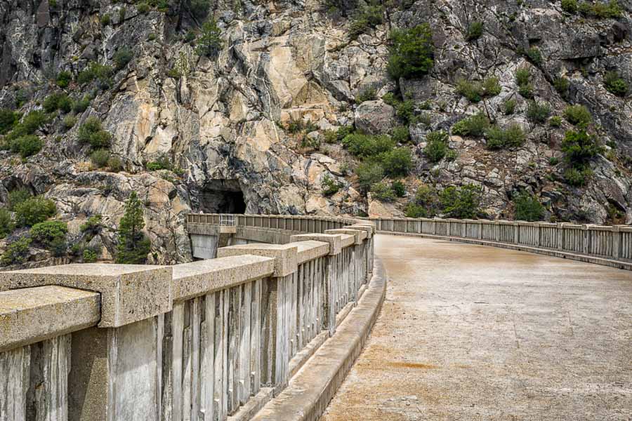
Hetch Hetchy Reservoir Bridge

Hetch Hetchy Reservoir Bridge

Getting to Hetch Hetchy is a bit of a trip if you are staying in Yosemite Valley, but I do highly recommend it. The area is unlike the other places we hiked and visited in and around the national park. Even before getting on to the main trail, we knew it was different because we had to walk through the mountain tunnel to come out on the other side where the major trails start.

The photograph above shows the tunnel at the end. It can be dark and we were glad to have our head lamps so we could avoid the puddles and potential wet feet. It was also fascinating to view the water release from the bridge and to see all the spillways funneling the water in various directions.

 
Do you have a question about our visit to Yosemite? Ask it in the comment section.


JBRish.com originally published this post
*All photographs Copyright by Jeffrey B. Ross with all rights reserved.
 
See previous Year of Yosemite (YOY) posts HERE. If you want to read the introduction to the YOY series, CLICK HERE.

***********************************

Meta Data – Day 303 YOY – Year of Yosemite

File Name: 0471.NEF
Capture time: 11:16:43 PM
Capture date: June 11, 2016
Exposure: 1/60 sec @ f/22
Focal Length: 38mm
ISO 200
Nikon D3300