Location, Location, Location – Year of Yosemite (YOY) – Day 289

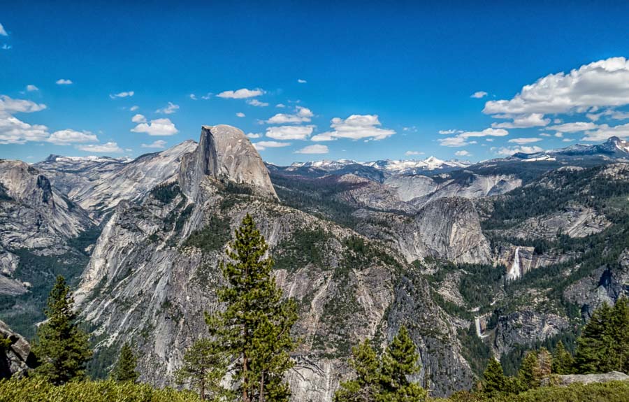
Vernal and Nevada Falls viewed from Glacier Point

Where things are located – Yosemite Valley

What is interesting about hiking among the mountains of any national park is the difference in orientation and perspective between ground level and the top of the peaks.

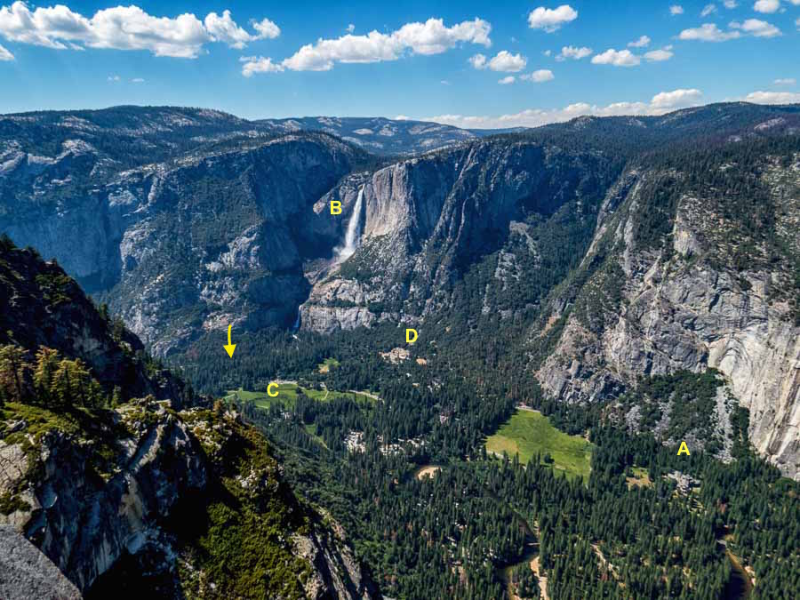
Above is a view of part of Yosemite Valley. Off to the right, almost in the bottom of the frame, is the Majestic Yosemite Hotel (A), Yosemite Falls (B) is easy to see and pick out near the top middle of the shot. The green area (C) is the meadow where I took several very good photographs of Half Dome during the early evening hours (a long lens will help).

Just below the falls and a bit to the right are the stores and some amenities (D).

In the approximate vicinity of the arrow is where we stayed and where the Yosemite Valley Lodge and amenities are located.

We walked it all and enjoyed every minute of it. The Valley Loop trail will take you to most of the places named above and I recommend it, but do purchase a good map as we found the signage somewhat confusing

 
Do you have a question about our visit to Yosemite? Ask it in the comment section.


JBRish.com originally published this post
*All photographs Copyright by Jeffrey B. Ross with all rights reserved.

 
See previous Year of Yosemite (YOY) posts HERE. If you want to read the introduction to the YOY series, CLICK HERE.

***********************************

Meta Data – Day 289 YOY – Year of Yosemite

File Name: 0292.CR2
Capture time: 3:23:31 PM
Capture date: June 6, 2016
Exposure: 1/250 sec @ f/7.1
Focal Length: 4.3mm
ISO 100
Canon PowerShot SX50 HS

 

Liberty Cap, Vernal and Nevada Falls– Year of Yosemite (YOY) – Day 288

Vernal and Nevada Falls viewed from Glacier Point

Liberty Cap, Vernal Fall and Nevada Falls viewed from Glacier Point

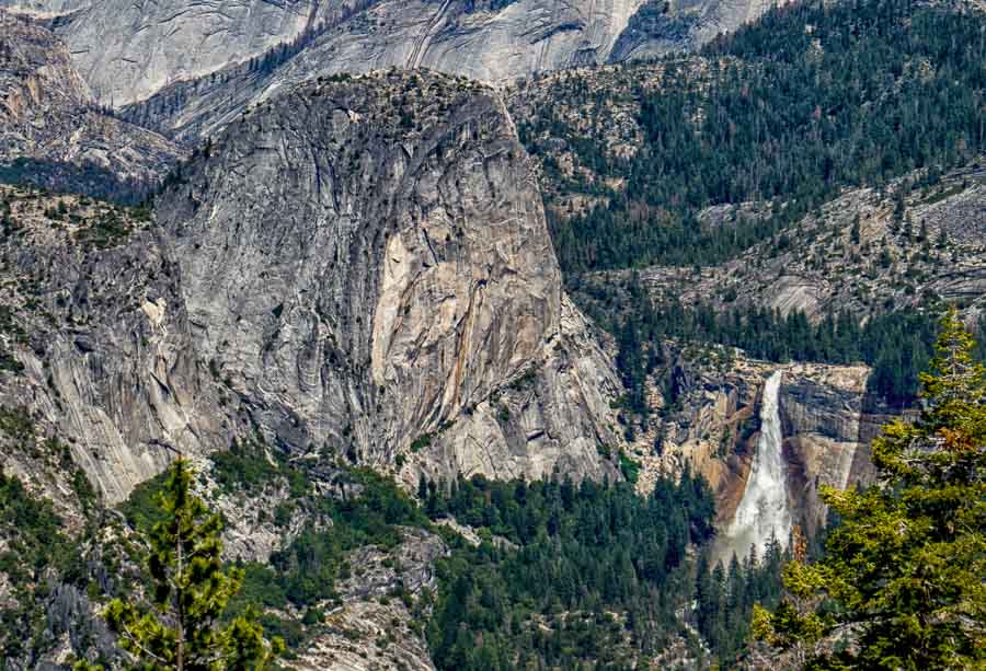
Half Dome is not the only intriguing feature to view from Glacier Point. Vernal and Nevada Falls offer a show of their own. The photograph above shows Vernal Fall (bottom, left) and Nevada Falls (upper, right). Also prominent is Liberty Cap mountain in the upper left portion of the picture.

 
Do you have a question about our visit to Yosemite? Ask it in the comment section.


JBRish.com originally published this post
*All photographs Copyright by Jeffrey B. Ross with all rights reserved.

 
See previous Year of Yosemite (YOY) posts HERE. If you want to read the introduction to the YOY series, CLICK HERE.

***********************************

Meta Data – Day 288 YOY – Year of Yosemite

File Name: 0282.CR2
Capture time: 3:02:31 PM
Capture date: June 6, 2016
Exposure: 1/400 sec @ f/6.3
Focal Length: 12.51mm
ISO 100
Canon PowerShot SX50 HS
 

Half Dome: Getting Close 3/3 – Year of Yosemite (YOY) – Day 287

Half Dome viewed from Glacier Point

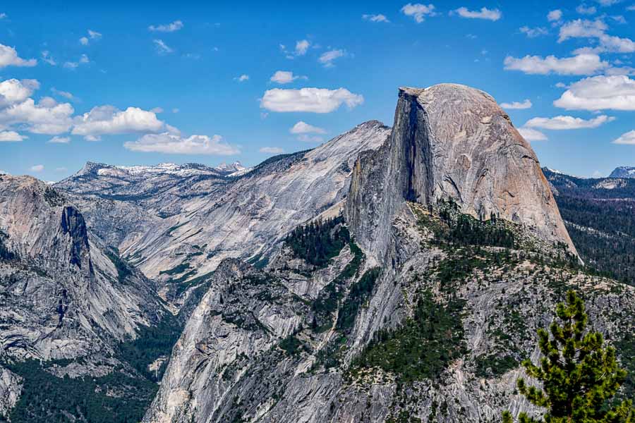
A closer view of Half Dome taken from Glacier Point

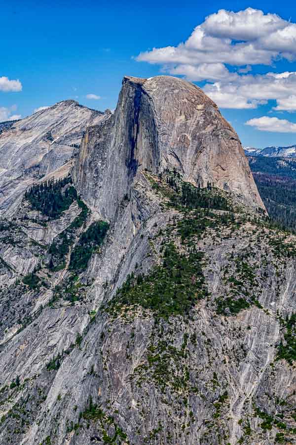
This is the last of three different photographs, in my most recent series, of Half Dome taken from Glacier point. I have tried to provide increasingly closer views to arrive at this particular scene. As you can see, it is quite majestic in size and form.

I am not sure the textures show as well in the photograph as they did in the actual vista, but there are many crevices and ridges of various colors which give this Yosemite big wig a lot of character.

 
Do you have a question about our visit to Yosemite? Ask it in the comment section.


JBRish.com originally published this post
*All photographs Copyright by Jeffrey B. Ross with all rights reserved.

 
See previous Year of Yosemite (YOY) posts HERE. If you want to read the introduction to the YOY series, CLICK HERE.

***********************************

Meta Data – Day 286 YOY – Year of Yosemite

File Name: 0172.NEF
Capture time: 3:00:50 PM
Capture date: June 6, 2016
Exposure: 1/160 sec @ f/13
Focal Length: 46mm
ISO 100
Nikon D3300


Half Dome: Getting Close 2/3 – Year of Yosemite (YOY) – Day 286

Half Dome viewed from Glacier Point

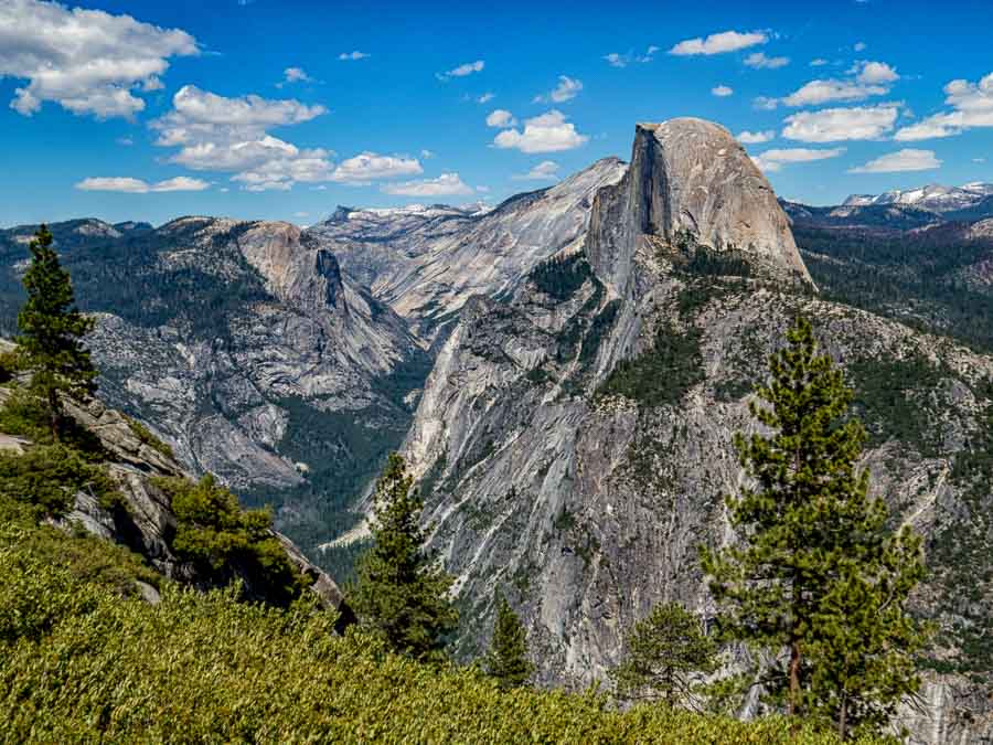
Half Dome dominates the views from Glacier Point

Naturally Half Dome is one of the major draws at Yosemite and one of the best places to catch a good view of the dome is at Glacier Point.

 
Do you have a question about our visit to Yosemite? Ask it in the comment section.


JBRish.com originally published this post
*All photographs Copyright by Jeffrey B. Ross with all rights reserved.

 
See previous Year of Yosemite (YOY) posts HERE. If you want to read the introduction to the YOY series, CLICK HERE.

***********************************

Meta Data – Day 286 YOY – Year of Yosemite

File Name: 0182.NEF
Capture time: 3:21:22 PM
Capture date: June 6, 2016
Exposure: 1/80 sec @ f/18
Focal Length: 50mm
ISO 100
Nikon D3300


Half Dome: Getting Close 1/3 – Year of Yosemite (YOY) – Day 285

Half Dome dominates the views from Glacier Point

Half Dome dominates the views from Glacier Point

Naturally Half Dome is one of the major draws at Yosemite and one of the best places to catch a good view of the dome is at Glacier Point.

 
Do you have a question about our visit to Yosemite? Ask it in the comment section.


JBRish.com originally published this post
*All photographs Copyright by Jeffrey B. Ross with all rights reserved.

 
See previous Year of Yosemite (YOY) posts HERE. If you want to read the introduction to the YOY series, CLICK HERE.

***********************************

Meta Data – Day 285 YOY – Year of Yosemite

File Name: 0280.CR2
Capture time: 3:02:50 PM
Capture date: June 6, 2016
Exposure: 1/400 sec @ f/6.3
Focal Length: 7mm
ISO 100
Canon PowerShot SX50 HS
 

Steal the Scene from Liberty Cap – Year of Yosemite (YOY) – Day 232

Liberty Cap

Liberty Cap seen from Glacier Point

Yesterday’s post discussed how some Yosemite features “suffer” from comparison to the more iconic and more easily recognizable sights of the national park. It is hard to be located adjacent Half Dome and try to draw attention to yourself.

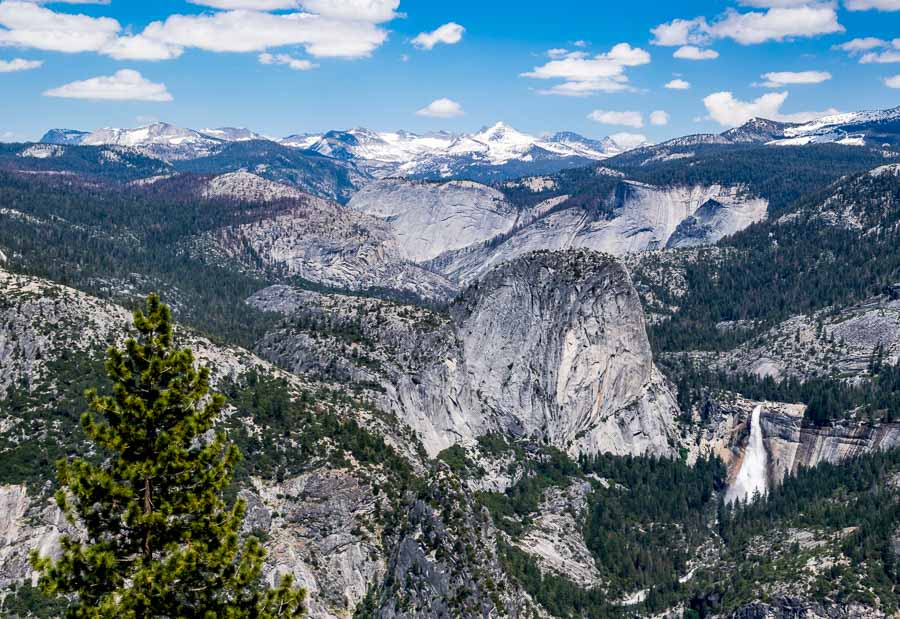
This photo demonstrates the “location conundrum.” While Liberty Cap is located near the center of the photograph, Half Dome pulls our attention to the left of the frame and perhaps another pull comes from the waterfalls on the right.

Liberty Cap is trying to make a statement and avoid “blending in.”

 
Do you have a question about our visit to Yosemite? Ask it in the comment section.


JBRish.com originally published this post
*All photographs Copyright by Jeffrey B. Ross with all rights reserved.

 
See previous Year of Yosemite (YOY) posts HERE. If you want to read the introduction to the YOY series, CLICK HERE.

***********************************

Meta Data – Day 232 YOY – Year of Yosemite

File Name: 0281.CR2
Capture time: 3:02:25 PM
Capture date: June 6, 2016
Exposure: 1/400 sec @ f/6.3
Focal Length: 4.3.5mm
ISO 100
Canon PowerShot SX50 HS
 

Liberty Cap – Year of Yosemite (YOY) – Day 231

Lizard on the Taft Point Trail

Liberty Cap Mountain and Nevada Falls

Let’s be honest. If I asked you to name the major attractions at Yosemite, would you refer to the mountain in the photo above? This is a massive granite mountain just north of Nevada Fall.

I am willing to wager that many visitors to Glacier Point, the overlook from where this photo was taken, skip over this feature because it tends to be overshadowed by Half Dome, even further to the north (not in the photo). When the water is flowing, Vernal and Nevada Falls also draw attention away from the surrounding mountains, hills, etc. and grab the spotlight. This large feature becomes an unknown co-star for most visitors.

I had never heard of Liberty Cap before out trip to Yosemite and I think most people would share that sentiment as well. A good number probably would not be able to recall it even after visiting Yosemite. That is one of the reasons I love photography. My record is saved for posterity and, if necessary, a Liberty Cap memory jog!

 
Do you have a question about our visit to Yosemite? Ask it in the comment section.


JBRish.com originally published this post
*All photographs Copyright by Jeffrey B. Ross with all rights reserved.

 
See previous Year of Yosemite (YOY) posts HERE. If you want to read the introduction to the YOY series, CLICK HERE.

***********************************

Meta Data – Day 231 YOY – Year of Yosemite

File Name: 0285.CR2
Capture time: 3:05:52 PM
Capture date: June 6, 2016
Exposure: 1/400 sec @ f/6.3
Focal Length: 17.5mm
ISO 100
Canon PowerShot SX50 HS
 

Year of Yosemite (YOY) – Day 151 (Four Mile Trail 1/5 – Yosemite Falls)

NOTE – This is the first photograph in a series of five that will be presented over the following days to give readers a sense of what it was like to hike the four Mile Trail. Previous Year of Yosemite photographs and descriptions were mostly individual presentations without providing a narrative to portray the essence of the hike.

Yosemite Falls from GP

Yosemite Falls from Glacier Point just before we begin our hike

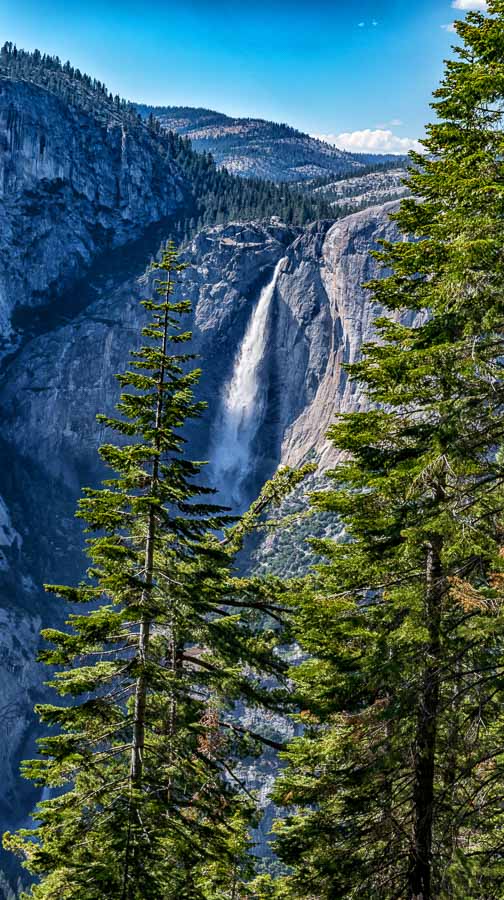
After spending some time at Glacier Point, we moved toward the Four Mile Trail trailhead. On the way, I stopped for one last picture of Yosemite Falls. We were far away, but the falls were so overwhelming that they made their presence felt.

We read about the Four Mile Trail and we were excited to begin our adventure. No matter how much one reads about certain trails, being there can still take your breath away. While we “heard” that Half Dome and El Cap could be seen from the trail, the reality of how much, how close and how amazing the views would be could not be anticipated.

Even though the Four Mile Trail from Glacier Point is downhill, there are numerous switchbacks and the footing can be slow in places so be prepared.

 
Do you have a question about our visit to Yosemite? Ask it in the comment section.


JBRish.com originally published this post
*All photographs Copyright by Jeffrey B. Ross with all rights reserved.

 
See previous Year of Yosemite (YOY) posts HERE. If you want to read the introduction to the YOY series, CLICK HERE.

***********************************

Meta Data – Day 151 YOY – Year of Yosemite

File Name: 0189.NEF
Capture time: 4:33:37 PM
Capture date: June 6, 2016
Exposure: 1/60 sec @ f/14
Focal Length: 48mm
ISO 100
Nikon D3300


Year of Yosemite (YOY) – Day 149 (Glacier Point – Liberty Cap)

Liberty Cap from Glacier Point

Liberty Cap mountain viewed from Glacier Point

When standing at Glacier Point and soaking in the panorama that lies before you, it is almost overwhelming. There are mountains on top of mountains.

Closer to the pedestrian viewpoints, however, there are some that loom large and add to the beauty of the foreground scene. There is one very recognizable landmark among the sea of hilltops and peaks. Just to the left of Vernal Fall in the picture is Liberty Cap mountain.

Apparently this is quite hikeable and draws a good number of adventurers. You can read more about the hike to Liberty Cap at the linkk below:

SummitPost.org – Liberty Cap Hike: Yosemite

 
Do you have a question about our visit to Yosemite? Ask it in the comment section.


JBRish.com originally published this post
*All photographs Copyright by Jeffrey B. Ross with all rights reserved.

 
See previous Year of Yosemite (YOY) posts HERE. If you want to read the introduction to the YOY series, CLICK HERE.

***********************************

Meta Data – Day 149 YOY – Year of Yosemite

File Name: 0168.NEF
Capture time: 2:59:09 PM
Capture date: June 6, 2016
Exposure: 1/125 sec @ f/13
Focal Length: 34mm
ISO 100
Nikon D3300

Day 149, Year of Yosemite, hiking,information,natural beauty,nature, wild places,Year of Yosemite,Yosemite,Yosemite National Park,YOY, Liberty Cap, Glacier Point


Year of Yosemite (YOY) – Day 109 (Nevada & Vernal Falls vs The Map)

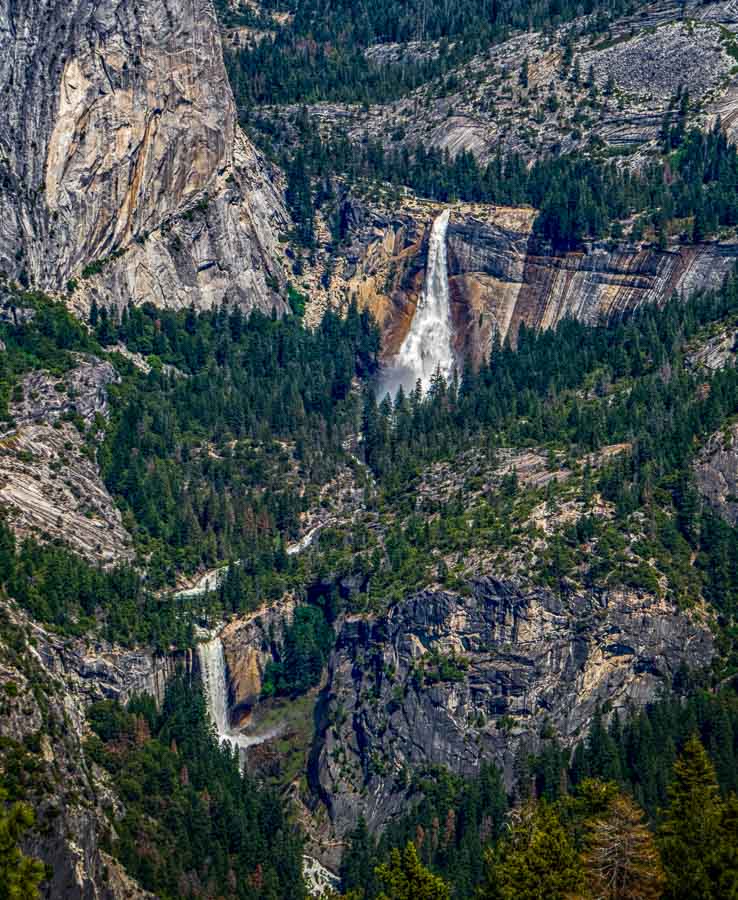
Nevada & Vernal FallsNevada & Vernal Falls with Big Cap off to the Left as seen from Glacier Point
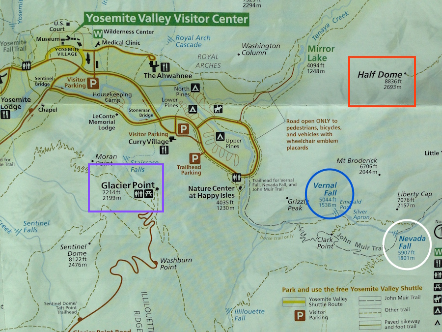
In preparation for visiting a national park for the first time, it is very hard to visualize the relationship of the major points of interest. Looking at a map is abstract. Of course it provides a “sense of place,” but it can not prepare one for the actual physical experience (IMHO).

Let’s take the photograph above for example. The map can pinpoint Nevada Falls (upper) and Vernal Fall (lower), but it cannot adequately convey the juxtaposition to each other and the overall physical relationship to their wider surroundings. (Half Dome is not in the picture, but is off to the left.)

See the partial map below with noted points outlined by ovals and rectangles:

 
Map of Glacier Point

I particularly like the zig-zaged relationship of the falls that flow in the Half Dome neighborhood, but this cannot be truly appreciated from looking at a map. The other half of the problem is that when looking at photographs, it is hard to get a sense of the total layout of the area because pictures are narrow in scope. Plan we must, but we also need to be prepared for “surprises” and to be flexible in our goals.


***** BTW *****

I didn’t see one person arrive at Glacier Point and leave within a few minutes. Everyone I watched lingered and walked around as though they couldn’t soak in enough of the views. I admit, I was one who lingered for a length of time.

I wish these photographs and my skills could depict the grandeur of the panorama that was cast before me, but they are only a lesser reproduction.

For another part of the panorama seen from Glacier Point incuding Half Dome, located just to the North (left) of the above photo check the link below:

Year of Yosemite (YOY) – Day 63 (Glacier Point-Half Dome)

 
Do you have a question about our visit to Yosemite? Ask it in the comment section.


JBRish.com originally published this post
*All photographs Copyright by Jeffrey B. Ross with all rights reserved.

 
See previous Year of Yosemite (YOY) posts HERE. If you want to read the introduction to the YOY series, CLICK HERE.

***********************************

Meta Data – Day 109 YOY – Year of Yosemite

File Name: 0279.CR2
Capture time: 3:01:40 PM
Capture date: June 6, 2016
Exposure: 1/400 sec @ f/6.3
Focal Length: 20mm
ISO 100
Canon PowerShot SX50 HS